How to get to Shurtape by bus?
Click on the bus route to see step by step directions with maps, line arrival times and updated time schedules.
From Parque Lambramani Centro Comercial, Miraflores
49 minFrom AV BRASIL 16, Lima
30 minFrom Hospital Nacional Cayetano Heredia, San Martin
43 minFrom Cafae-Se, San Isidro
44 minFrom Las Cucardas Night Club, Lima
44 minFrom Centro Comercial Real Plaza Salaverry, San Isidro
43 minFrom Av Faustino Sánchez Carrión 615 Jesús María, Jesus Mari
47 minFrom AV FAUSTINO SANCHEZ CARRION JESUS MARIA, Magdalena
46 minFrom OSCAR R BENAVIDES, Lima
43 min
Bus stops near Shurtape in Santa Anit
Metro station near Shurtape in Santa Anit
- Estación Colectora Industrial, 3 min walk,VIEW
Bus lines to Shurtape in Santa Anit
- 1221, Ramiro Priale (Ate) - Mexico (Lince) ,VIEW
- 1341, Santa Anita - Lurigancho ,VIEW
- 1177, Torre Blanca (Carabayllo) - Metropolitana (Ate),VIEW
- 1178, Tagore (Ate) - Km.22 (Carabayllo),VIEW
- 1235, Manchay (Pachacamac) - Santo Domingo (Carabayllo),VIEW
- 1194, Los Virreyes (Ate) - Chuquitanta (San Martin De Porres),VIEW
- 1214, Las Gardenias (Ate) - Canta Callao (San Martin De Porres),VIEW
- 1476, Ate - Los Olivos,VIEW
- 1488, Sumac Pacha (Lurín) - Ñaña (Lurigancho),VIEW
- 1281, Santa Clara (Ate) - Minka (Callao),VIEW
- 4205, Surge (Ate) - San Marcos (Lima),VIEW
- 1027, Rímac - Ate [60C],VIEW
- 1064, Lurigancho - San Juan de Lurigancho [49],VIEW
- 1066, Ate - Lima,VIEW
- 1068, Ate - Lima,VIEW
- 1069, Chosica - Lima,VIEW
- 1080, Ate - La Victoria,VIEW
- 1081, Ate - La Victoria,VIEW
- 1085, Lima - Chosica,VIEW
- 1112, Pachacamac - La Victoria,VIEW
What are the closest stations to Shurtape?
The closest stations to Shurtape are:
- Mall Santa Anita is 97 meters away, 2 min walk.
- Estación Colectora Industrial is 152 meters away, 3 min walk.
- Puente Santa Anita is 166 meters away, 3 min walk.
- Los Cipreses / Mall Santa Anita is 230 meters away, 4 min walk.
Which bus lines stop near Shurtape?
These bus lines stop near Shurtape: 1054, 1069, 1178, 1218, 1221, 1243, 1480.
What’s the nearest metro station to Shurtape in Santa Anit?
The nearest metro station to Shurtape in Santa Anit is Estación Colectora Industrial. It’s a 3 min walk away.
What’s the nearest bus station to Shurtape in Santa Anit?
The nearest bus station to Shurtape in Santa Anit is Mall Santa Anita. It’s a 2 min walk away.
What time is the first metro to Shurtape in Santa Anit?
The LINEA 2 is the first metro that goes to Shurtape in Santa Anit. It stops nearby at 6:00 AM.
What time is the last metro to Shurtape in Santa Anit?
The LINEA 2 is the last metro that goes to Shurtape in Santa Anit. It stops nearby at 11:02 PM.
What time is the first bus to Shurtape in Santa Anit?
The 1218 is the first bus that goes to Shurtape in Santa Anit. It stops nearby at 3:01 AM.
What time is the last bus to Shurtape in Santa Anit?
The 1479 is the last bus that goes to Shurtape in Santa Anit. It stops nearby at 4:09 AM.
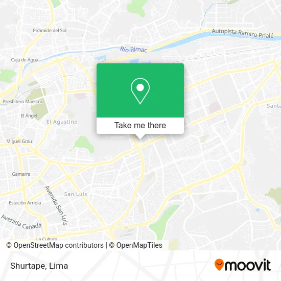
See Shurtape, Santa Anit, on the map
Public Transit to Shurtape in Santa Anit
Wondering how to get to Shurtape in Santa Anit? Moovit helps you find the best way to get to Shurtape with step-by-step directions from the nearest public transit station.
Moovit provides free maps and live directions to help you navigate through your city. View schedules, routes, timetables, and find out how long does it take to get to Shurtape in real time.
Looking for the nearest stop or station to Shurtape? Check out this list of stops closest to your destination: Mall Santa Anita; Estación Colectora Industrial; Puente Santa Anita; Los Cipreses / Mall Santa Anita.
Bus: 1054, 1069, 1178, 1218, 1221, 1243, 1480, 1341, 1177, 1235, 1194, 1214, 1476, 1488, 1281, 4205.Metro: LINEA 2.
Want to see if there’s another route that gets you there at an earlier time? Moovit helps you find alternative routes or times. Get directions from and directions to Shurtape easily from the Moovit App or Website.
We make riding to Shurtape easy, which is why over 1.5 million users, including users in Santa Anit, trust Moovit as the best app for public transit. You don’t need to download an individual bus app or train app, Moovit is your all-in-one transit app that helps you find the best bus time or train time available.
For information on prices of bus, costs and ride fares to Shurtape, please check the Moovit app.
Use the app to navigate to popular places including to the airport, hospital, stadium, grocery store, mall, coffee shop, school, college, and university.
Shurtape Address: Calle La Minería 141 Los Ficus, 15008 Santa Anita street in Santa Anit
- PLASTICOS DEL CENTRO .S.A.C,
- Inmobiliarias-Compañia de Inversiones Financieras E Inmobiliarias Andina,
- Laboratorio del Dr Look - Mall Aventura Plaza,
- Lolita,
- Centro PyP Euroshop,
- Cruz Del Sur Cargo,
- Ditersa Repuestos Diesel,
- Calimod,
- AV LOS CIPRESES CUADRA 1,
- Orbes Agrícola S.A.C,
- Runa Store,
- Saga Falabella,
- Clínica Internacional - Medicentro Santa Anita,
- Avenida Los Cipreses,
- Amatista-Mall Aventura Plaza-Sta. Anita,
- Av nicolas ayllon con via evitamiento,
- Centro de Salud Materno Infantil Santa Anita,
- Banco de Credito BCP (Mall Aventura),
- Calle Mineria 122,
- Mall Aventura Plaza Santa Anita
Places Near Shurtape (Santa Anit)
- Parque Kennedy, Miraflores,
- Plaza San Miguel, San Miguel,
- Centro Comercial Plaza Norte, Independen,
- Jockey Plaza, Santiago D,
- Barranco, Barranco,
- Larcomar, Miraflores,
- Mall Del Sur,
- av arequipa, Lima,
- Miraflores, Miraflores,
- Aeropuerto Internacional Jorge Chávez, Ventanilla,
- Parque de las Leyendas, San Miguel,
- Real Plaza Puruchuco, Ate,
- Av. La Marina, San Miguel,
- Paradero Av.Brasil,
- Circuito Mágico Del Agua, Lima,
- Av. Abancay, Lima,
- Real Plaza Salaverry, Jesus Mari,
- Gamarra,
- Av. Salaverry, Jesus Mari,
- Hospital Edgardo Rebagliati Martins, Jesus Mari
How to get to popular places in Lima with public transit
Get around Santa Anit by public transit!
Traveling around Santa Anit has never been so easy. See step by step directions as you travel to any attraction, street or major public transit station. View bus and train schedules, arrival times, service alerts and detailed routes on a map, so you know exactly how to get to anywhere in Santa Anit.
When traveling to any destination around Santa Anit use Moovit's Live Directions with Get Off Notifications to know exactly where and how far to walk, how long to wait for your line, and how many stops are left. Moovit will alert you when it's time to get off — no need to constantly re-check whether yours is the next stop.
Wondering how to use public transit in Santa Anit or how to pay for public transit in Santa Anit? Moovit public transit app can help you navigate your way with public transit easily, and at minimum cost. It includes public transit fees, ticket prices, and costs. Looking for a map of Santa Anit public transit lines? Moovit public transit app shows all public transit maps in Santa Anit with all Bus, Metro and Ferry routes and stops on an interactive map.
Lima has 3 transit type(s), including: Bus, Metro and Ferry, operated by several transit agencies, including Metro de Lima Línea 2 , Metro de Lima, Corredor Rojo, Metropolitano, Metropolitano - Alimentadores, Corredor Morado, Corredor Azul, Rutas Tradicionales, Transportes y Servicios La Esperanza S.A., Las Flores S.A., Virgen de la Asunción S.A., Consorcio HAM, Transportes y Service Canadá S.A., ETUL4SA and ETUCHISA