How to get to Si-Service by bus?
Click on the bus route to see step by step directions with maps, line arrival times and updated time schedules.
From Maria-von-Linden-Gymnasium, Verwaltungsgemeinschaft Calw
159 minFrom Hotel Palmenwald, Vereinbarte Verwaltungsgemeinschaft Freudenstadt
92 minFrom Panorama-Bad Freudenstadt, Vereinbarte Verwaltungsgemeinschaft Freudenstadt
82 minFrom Berghütte Lauterbad, Vereinbarte Verwaltungsgemeinschaft Freudenstadt
85 minFrom Campingplatz Schüttehof Horb, Gemarkung Horb am Neckar
70 minFrom Klinik Hohenfreudenstadt, Vereinbarte Verwaltungsgemeinschaft Freudenstadt
76 minFrom Krankenhaus Freudenstadt, Vereinbarte Verwaltungsgemeinschaft Freudenstadt
74 minFrom Beatparade, Verwaltungsgemeinschaft Horb am Neckar
115 min
Bus stop near Si-Service in Verwaltungsgemeinschaft Pfalzgrafenweiler
- Neu Nuifra Bstg 1, 1 min walk,VIEW
Bus lines to Si-Service in Verwaltungsgemeinschaft Pfalzgrafenweiler
- 42, Pfalzgrafenweiler Zob,VIEW
What are the closest stations to Si-Service?
The closest stations to Si-Service are:
- Neu Nuifra Bstg 1 is 20 meters away, 1 min walk.
Which bus lines stop near Si-Service?
These bus lines stop near Si-Service: 41, 7938.
What’s the nearest bus station to Si-Service in Verwaltungsgemeinschaft Pfalzgrafenweiler?
The nearest bus station to Si-Service in Verwaltungsgemeinschaft Pfalzgrafenweiler is Neu Nuifra Bstg 1. It’s a 1 min walk away.
What time is the first bus to Si-Service in Verwaltungsgemeinschaft Pfalzgrafenweiler?
The 42 is the first bus that goes to Si-Service in Verwaltungsgemeinschaft Pfalzgrafenweiler. It stops nearby at 6:46 AM.
What time is the last bus to Si-Service in Verwaltungsgemeinschaft Pfalzgrafenweiler?
The 42 is the last bus that goes to Si-Service in Verwaltungsgemeinschaft Pfalzgrafenweiler. It stops nearby at 5:43 PM.
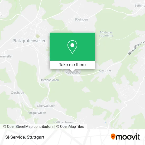
See Si-Service, Verwaltungsgemeinschaft Pfalzgrafenweiler, on the map
Public Transit to Si-Service in Verwaltungsgemeinschaft Pfalzgrafenweiler
Wondering how to get to Si-Service in Verwaltungsgemeinschaft Pfalzgrafenweiler? Moovit helps you find the best way to get to Si-Service with step-by-step directions from the nearest public transit station.
Moovit provides free maps and live directions to help you navigate through your city. View schedules, routes, timetables, and find out how long does it take to get to Si-Service in real time.
Looking for the nearest stop or station to Si-Service? Check out this list of stops closest to your destination: Neu Nuifra Bstg 1.
Bus: 41, 7938, 42.
Want to see if there’s another route that gets you there at an earlier time? Moovit helps you find alternative routes or times. Get directions from and directions to Si-Service easily from the Moovit App or Website.
We make riding to Si-Service easy, which is why over 1.7 million users, including users in Verwaltungsgemeinschaft Pfalzgrafenweiler, trust Moovit as the best app for public transit. You don’t need to download an individual bus app or train app, Moovit is your all-in-one transit app that helps you find the best bus time or train time available.
For information on prices of bus and train, costs and ride fares to Si-Service, please check the Moovit app.
Use the app to navigate to popular places including to the airport, hospital, stadium, grocery store, mall, coffee shop, school, college, and university.
Si-Service Address: Ortsstraße 10 Neunuifra, 72285 Pfalzgrafenweiler street in Verwaltungsgemeinschaft Pfalzgrafenweiler
- Adler Neu-Nuifra,
- Koch's Fahrradgarage,
- Kaupp, G.-Ulrich, Antonia, Versicherungsagentur für Pferde,
- Schwarzwaldblick,
- Hyla Handelsve,
- Black Forest Guest Stay,
- Anke Kreidler,
- Drk Landesschule,
- Joachim Gremmelspacher,
- Schuler Consulting,
- Homag Produktion,
- Vinzenz Schimpfle,
- Stephanie Buck Tierärztin,
- Beichel Labels,
- Waldachtal Oberwaldach Impressum,
- Transsibirische Eisenbahn,
- Apartment-Pension im Eichenweg,
- Interim24 Ug (Haftungsbeschränkt),
- Festlich-Kreativ,
- Gasthof Waldachtal
Places Near Si-Service (Verwaltungsgemeinschaft Pfalzgrafenweiler)
- Mercedes-Benz Museum (Mercedes Museum Stuttgart), Bad Cannstatt,
- Im Wizemann (Halle), Bad Cannstatt,
- Geilhaus Haus 33a, Reutlingen-Betzingen,
- Mettingen Eros-Center Puff Laufhaus, Esslingen Am Neckar,
- Porsche Museum, Zuffenhausen,
- SI-Centrum, Möhringen,
- Wilhelma (U-Bahn Wilhelma), Bad Cannstatt,
- Pariser Platz Stuttgart, Stuttgart-Mitte,
- Hanns-Martin-Schleyer-Halle (Stuttgart Hans-Martin-Schleyerhalle), Bad Cannstatt,
- Waldfriedhof, Degerloch,
- Hauptbahnhof Stuttgart, Stuttgart-Mitte,
- Porsche-Arena, Bad Cannstatt,
- Klinikum Stuttgart - Katharinenhospital, Stuttgart-Mitte,
- Marmorsaal Im Weissenburgpark, Stuttgart-Süd,
- Gleis 101/102 (tief), Stuttgart-Mitte,
- FlixBus Haltestelle, Stuttgart,
- Schleyerhalle, Bad Cannstatt,
- Gasometer Pforzheim, Pforzheim,
- Hanns-Martin-Schleyer-Halle, Bad Cannstatt,
- Mercedes-Benz Museum, Bad Cannstatt
How to get to popular places in Stuttgart with public transit
Get around Verwaltungsgemeinschaft Pfalzgrafenweiler by public transit!
Traveling around Verwaltungsgemeinschaft Pfalzgrafenweiler has never been so easy. See step by step directions as you travel to any attraction, street or major public transit station. View bus and train schedules, arrival times, service alerts and detailed routes on a map, so you know exactly how to get to anywhere in Verwaltungsgemeinschaft Pfalzgrafenweiler.
When traveling to any destination around Verwaltungsgemeinschaft Pfalzgrafenweiler use Moovit's Live Directions with Get Off Notifications to know exactly where and how far to walk, how long to wait for your line, and how many stops are left. Moovit will alert you when it's time to get off — no need to constantly re-check whether yours is the next stop.
Wondering how to use public transit in Verwaltungsgemeinschaft Pfalzgrafenweiler or how to pay for public transit in Verwaltungsgemeinschaft Pfalzgrafenweiler? Moovit public transit app can help you navigate your way with public transit easily, and at minimum cost. It includes public transit fees, ticket prices, and costs. Looking for a map of Verwaltungsgemeinschaft Pfalzgrafenweiler public transit lines? Moovit public transit app shows all public transit maps in Verwaltungsgemeinschaft Pfalzgrafenweiler with all Bus, Train, Subway, Light Rail, Ferry, S-Bahn and Funicular routes and stops on an interactive map.
Stuttgart has 7 transit type(s), including: Bus, Train, Subway, Light Rail, Ferry, S-Bahn and Funicular, operated by several transit agencies, including SSB - Stadtbahn, SSB, SSB - Seilbahn / Zacke, S-Bahn Stuttgart, Rhein-Neckar-Verkehr GmbH (rnv), Karlsruher Verkehrsverbund, DB AG, DB Regiobus BW, Arverio Baden-Württemberg GmbH, DB RegioNetz Verkehrs GmbH Westfrankenbahn, DB Regio AG Baden-Württemberg, Südwestdeutsche Verkehrs-AG, DB Regio AG Mitte Region Hessen, DB and Bodensee-Oberschwaben-Bahn