Sig St. stop - Tuesday schedule
| Line | Direction | Time |
|---|---|---|
| 030 | Skjern St. | 5:10 AM |
| 030 | Esbjerg St. | 5:41 AM |
| 030 | Skjern St. | 6:08 AM |
| 030 | Skjern St. | 7:01 AM |
| 030 | Esbjerg St. | 7:13 AM |
| 030 | Esbjerg St. | 8:09 AM |
| 030 | Skjern St. | 8:37 AM |
| 030 | Esbjerg St. | 9:09 AM |
| 030 | Skjern St. | 9:37 AM |
| 030 | Esbjerg St. | 10:09 AM |
| 030 | Skjern St. | 10:37 AM |
| 030 | Esbjerg St. | 11:09 AM |
| 030 | Skjern St. | 11:37 AM |
| 030 | Esbjerg St. | 12:09 PM |
| 030 | Skjern St. | 12:37 PM |
| 030 | Esbjerg St. | 1:09 PM |
| 030 | Skjern St. | 1:37 PM |
| 030 | Esbjerg St. | 2:09 PM |
| 030 | Skjern St. | 2:37 PM |
| 030 | Esbjerg St. | 3:09 PM |
| 030 | Skjern St. | 3:28 PM |
| 030 | Esbjerg St. | 4:09 PM |
| 030 | Skjern St. | 4:37 PM |
| 030 | Esbjerg St. | 5:09 PM |
| 030 | Skjern St. | 5:37 PM |
Directions to Sig St. stop (Varde) with public transit
The following transit lines have routes that pass near Sig St.
 Bus: 475, 2571.
- Train: 030.
How to get to Sig St. stop by train?
Click on the train route to see step by step directions with maps, line arrival times and updated time schedules.
Bus stops near Sig St. stop in Varde
- Sig Vardevej V Vesterbækvej (Varde), 1 min walk,
- Sig Thorstrup Skole (Varde), 9 min walk,
Bus lines to Sig St. stop in Varde
- 475, Sig Vardevej V Vesterbækvej (Varde),
- 2571, Varde Fritidscenter (Varde),
What are the closest stations to Sig St.?
The closest stations to Sig St. are:
- Sig Vardevej V Vesterbækvej (Varde) stop is 21 meters away, 1 min walk.
- Sig Thorstrup Skole (Varde) stop is 675 meters away, 9 min walk.
Which train line stops near Sig St.?
030 (Skjern St.)
What’s the nearest bus station to Sig St. in Varde?
The nearest bus station to Sig St. in Varde is Sig Vardevej V Vesterbækvej (Varde). It’s a 1 min walk away.
See Sig St. stop, Varde, on the map
Public transit to Sig St. stop in Varde
Looking for directions to Sig St. in Varde, Denmark?
Download the Moovit App to find the current schedule and step-by-step directions for Train or Bus routes that pass through Sig St..
Looking for the nearest stops closest to Sig St. ? Check out this list of closest stops to your destination: Sig Vardevej V Vesterbækvej (Varde); Sig Thorstrup Skole (Varde).
Bus: 475, 2571.Train: 030.
We make riding on public transit to Sig St. easy, which is why over 1.7 billion users, including users in Varde trust Moovit as the best app for public transit.
Use the app to navigate to popular places including to the airport, hospital, stadium, grocery store, mall, coffee shop, school, college, and university.
The stop has the following entrances: Vesterbækvej and Stationsvej
The first line to this stop is 030, at 5:10 AM, and the last line is 030 at 12:17 AM.
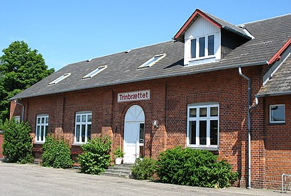
Stationsvej 21, Denmark
This stop serves GoCollective and GoCollective’s lines
Popular routes from Sig St. stop, Varde
- Sig Vardevej V Vesterbækvej (Varde),
- Sig Thorstrup Skole (Varde)
Bus stops near Sig St. stop
- Skodsborg St.,
- Raffinaderivej (Kløvermarksvej),
- Rævehøjvej Dtu (Lundtoftegårdsvej),
- Mellemvangen (Hareskovvej),
- Jesperhus Blomsterpark (Morsø Kommune),
- Bella Center St. (Metro),
- Færgelandsparken (Tornskadevej),
- Trylleskoven (Karlstrup Strandvej),
- Anker Jørgensens Plads (Borgbjergsvej),
- College 360/Kejlstrupvej (Silkeborg Kom),
- Rådhuspladsen St. (Metro),
- Fuglebakken St.,
- Nr. Nissum/Via University College (Lemvig Kom),
- Roskilde St. Sygehuset (Ny Østergade),
- Sølvtorvet (Sølvgade),
- Ryparken,
- Stormbroen Nationalmuseet (Vindebrogade),
- Frydenlunds Allé/Viborgvej (Aarhus Kom),
- Aalborg St. (Perron C9),
- Tømmerup Skole (Tømmerupvej)
Popular public transit stations in Varde
Get around Varde by public transit!
Traveling around Varde has never been so easy. See step by step directions as you travel to any attraction, street or major public transit station. View bus and train schedules, arrival times, service alerts and detailed routes on a map, so you know exactly how to get to anywhere in Varde.
When traveling to any destination around Varde use Moovit's Live Directions with Get Off Notifications to know exactly where and how far to walk, how long to wait for your line, and how many stops are left. Moovit will alert you when it's time to get off — no need to constantly re-check whether yours is the next stop.
Wondering how to use public transit in Varde or how to pay for public transit in Varde? Moovit public transit app can help you navigate your way with public transit easily, and at minimum cost. It includes public transit fees, ticket prices, and costs. Looking for a map of Varde public transit lines? Moovit public transit app shows all public transit maps in Varde with all Bus, Train, Metro, Light Rail and Ferry routes and stops on an interactive map.
Denmark has 5 transit type(s), including: Bus, Train, Metro, Light Rail and Ferry, operated by several transit agencies, including Metroselskabet, DSB S-tog, Lokaltog A/S, Midttrafik, Odense Letbane, DSB, NT, GoCollective, Skånetrafiken, Movia, FYNBUS, Sydtrafik, Bornholms Trafik, Samsø Bus and Citybus