How to get to Sign'Elec by bus?
Click on the bus route to see step by step directions with maps, line arrival times and updated time schedules.
From Rue du Temple, Paris
55 minFrom Mairie du 14e arrondissement, Paris
75 minFrom Rue Violet, Paris
95 minFrom La poste du louvre, Paris
59 minFrom Rue de Charenton, Paris
73 minFrom Leroy Merlin, Arrondissement de L'Haÿ-Les-Roses
110 minFrom Salons Hoche, Paris
79 minFrom Hôtel Mercure Paris La Défense 5, Courbevoie
89 minFrom La Butte aux Cailles, Paris
84 minFrom Rue de Bretagne, Paris
57 min
How to get to Sign'Elec by metro?
Click on the metro route to see step by step directions with maps, line arrival times and updated time schedules.
From Rue du Temple, Paris
42 minFrom Mairie du 14e arrondissement, Paris
52 minFrom Rue Violet, Paris
49 minFrom La poste du louvre, Paris
39 minFrom Rue de Charenton, Paris
49 minFrom Leroy Merlin, Arrondissement de L'Haÿ-Les-Roses
59 minFrom Salons Hoche, Paris
39 minFrom Hôtel Mercure Paris La Défense 5, Courbevoie
64 minFrom La Butte aux Cailles, Paris
56 minFrom Rue de Bretagne, Paris
44 min
Bus stops near Sign'Elec in Aubervilliers
Metro stations near Sign'Elec in Aubervilliers
RER station near Sign'Elec in Aubervilliers
- La Courneuve - Aubervilliers, 17 min walk,VIEW
Bus lines to Sign'Elec in Aubervilliers
What are the closest stations to Sign'Elec?
The closest stations to Sign'Elec are:
- Mairie D'Aubervilliers is 333 meters away, 5 min walk.
- Nouvelle France is 429 meters away, 6 min walk.
- André Karman is 486 meters away, 7 min walk.
- La Courneuve - Aubervilliers is 1310 meters away, 17 min walk.
- Aubervilliers-Pantin Quatre Chemins is 1381 meters away, 18 min walk.
Which metro line stops near Sign'Elec?
12 (Mairie D'Issy)
Which bus lines stop near Sign'Elec?
These bus lines stop near Sign'Elec: 170, 173, 35.
What’s the nearest metro station to Sign'Elec in Aubervilliers?
The nearest metro station to Sign'Elec in Aubervilliers is Mairie D'Aubervilliers. It’s a 6 min walk away.
What’s the nearest bus station to Sign'Elec in Aubervilliers?
The nearest bus station to Sign'Elec in Aubervilliers is Mairie D'Aubervilliers. It’s a 5 min walk away.
What’s the nearest RER station to Sign'Elec in Aubervilliers?
The nearest RER station to Sign'Elec in Aubervilliers is La Courneuve - Aubervilliers. It’s a 17 min walk away.
What time is the first metro to Sign'Elec in Aubervilliers?
The 12 is the first metro that goes to Sign'Elec in Aubervilliers. It stops nearby at 5:30 AM.
What time is the last metro to Sign'Elec in Aubervilliers?
The 12 is the last metro that goes to Sign'Elec in Aubervilliers. It stops nearby at 1:15 AM.
What time is the first bus to Sign'Elec in Aubervilliers?
The N43 is the first bus that goes to Sign'Elec in Aubervilliers. It stops nearby at 3:02 AM.
What time is the last bus to Sign'Elec in Aubervilliers?
The N43 is the last bus that goes to Sign'Elec in Aubervilliers. It stops nearby at 3:23 AM.
What time is the first RER to Sign'Elec in Aubervilliers?
The B is the first RER that goes to Sign'Elec in Aubervilliers. It stops nearby at 5:05 AM.
What time is the last RER to Sign'Elec in Aubervilliers?
The B is the last RER that goes to Sign'Elec in Aubervilliers. It stops nearby at 11:17 PM.
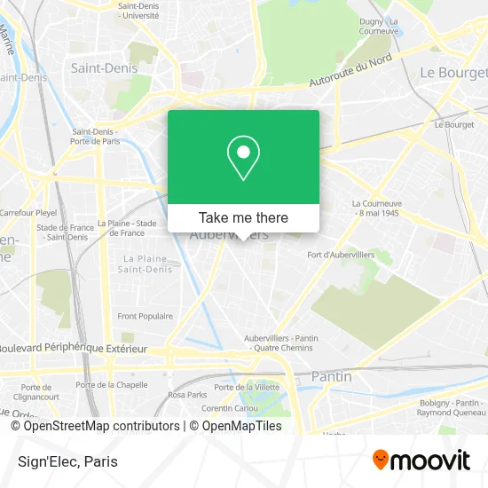
See Sign'Elec, Aubervilliers, on the map
Public Transit to Sign'Elec in Aubervilliers
Wondering how to get to Sign'Elec in Aubervilliers? Moovit helps you find the best way to get to Sign'Elec with step-by-step directions from the nearest public transit station.
Moovit provides free maps and live directions to help you navigate through your city. View schedules, routes, timetables, and find out how long does it take to get to Sign'Elec in real time.
Looking for the nearest stop or station to Sign'Elec? Check out this list of stops closest to your destination: Mairie D'Aubervilliers; Nouvelle France; André Karman; La Courneuve - Aubervilliers; Aubervilliers-Pantin Quatre Chemins.
RER: B.Metro: 12, 7.Bus: 170, 173, 35, 249.
Want to see if there’s another route that gets you there at an earlier time? Moovit helps you find alternative routes or times. Get directions from and directions to Sign'Elec easily from the Moovit App or Website.
We make riding to Sign'Elec easy, which is why over 1.5 million users, including users in Aubervilliers, trust Moovit as the best app for public transit. You don’t need to download an individual bus app or train app, Moovit is your all-in-one transit app that helps you find the best bus time or train time available.
For information on prices of metro, bus and train, costs and ride fares to Sign'Elec, please check the Moovit app.
Use the app to navigate to popular places including to the airport, hospital, stadium, grocery store, mall, coffee shop, school, college, and university.
Sign'Elec Address: Rue Charron street in Aubervilliers
- Lamia,
- Centre Municipal de Santé Docteur Pesqué,
- 6 Rue de la Courneuve,
- 15 Rue Chapon,
- Harmonie,
- Pyramide Batiment,
- Js Btp,
- 2 ter Rue du Moutier,
- 9 Rue de la Nouvelle France,
- Jyk Transport,
- 12 Rue Léopold Rechossière,
- 122 Rue André Karman,
- Commissariat De Police Aubervilliers,
- Square Lucien Brun,
- Église Notre-Dame-des-Vertus,
- Arrêt Mairie d'Aubervilliers [35],
- 2 Rue de la Commune de Paris,
- 5 Rue du Commandant l'Herminier,
- LIDL Aubervilliers,
- Navette Fluviale le Millénaire
Places Near Sign'Elec (Aubervilliers)
- Hôpital Beaujon, Clichy,
- Atelier Des Lumieres, Paris,
- Galeries Lafayette Haussmann, Paris,
- Créteil Soleil, Creteil,
- Hopital Lariboisière, Paris,
- Beaugrenelle, Paris,
- Gare Routière Flixbus, Paris,
- Hôpital Henri Mondor, Creteil,
- Fondation Louis Vuitton, Paris,
- Hôpital Saint-Joseph, Paris,
- Hôpital Cochin, Paris,
- Galeries Lafayette, Paris,
- 29 Rue Manin, Paris,
- Hôpital Pitié Salpêtrière, Paris,
- Centre Hospitalier des 15/20, Paris,
- Théâtre Mogador, Paris,
- Hopital Foch, Suresnes,
- Hôpital de la Pitié-Salpêtrière, Paris,
- Hôpital Necker, Paris,
- Marché Saint-Pierre, Paris
How to get to popular places in Paris with public transit
Get around Aubervilliers by public transit!
Traveling around Aubervilliers has never been so easy. See step by step directions as you travel to any attraction, street or major public transit station. View bus and train schedules, arrival times, service alerts and detailed routes on a map, so you know exactly how to get to anywhere in Aubervilliers.
When traveling to any destination around Aubervilliers use Moovit's Live Directions with Get Off Notifications to know exactly where and how far to walk, how long to wait for your line, and how many stops are left. Moovit will alert you when it's time to get off — no need to constantly re-check whether yours is the next stop.
Wondering how to use public transit in Aubervilliers or how to pay for public transit in Aubervilliers? Moovit public transit app can help you navigate your way with public transit easily, and at minimum cost. It includes public transit fees, ticket prices, and costs. Looking for a map of Aubervilliers public transit lines? Moovit public transit app shows all public transit maps in Aubervilliers with all Bus, Train, Metro, Light Rail, RER, Funicular and Gondola routes and stops on an interactive map.
Paris has 7 transit type(s), including: Bus, Train, Metro, Light Rail, RER, Funicular and Gondola, operated by several transit agencies, including RATP, RER, RER Bus de remplacement, Train, Train Bus de remplacement, Tramway Bus de remplacement, TER, ADP, Magical Shuttle, Argenteuil - Boucles de Seine, Autocars Dominique, Bièvre, Brie et 2 Morin, Le Bus - C.C. du Clermontois and Cœur d’Essonne