Directions to Signet Signs (Norfolk) with public transportation
The following transit lines have routes that pass near Signet Signs
 Bus: 003, 023, 018.
- Train: NORTHEAST REGIONAL.
How to get to Signet Signs by bus?
Click on the bus route to see step by step directions with maps, line arrival times and updated time schedules.
Bus stops near Signet Signs in Norfolk
Light Rail stations near Signet Signs in Norfolk
- Nsu Station, 44 min walk,VIEW
Train station near Signet Signs in Norfolk
- Norfolk Station, 55 min walk,VIEW
Bus lines to Signet Signs in Norfolk
What are the closest stations to Signet Signs?
The closest stations to Signet Signs are:
- Ballentine & Tait is 673 yards away, 9 min walk.
- Princess Anne & Arkansas is 1245 yards away, 15 min walk.
- Chesapeake & Robin Hood is 1421 yards away, 17 min walk.
- Nsu Station is 3688 yards away, 44 min walk.
- Norfolk Station is 4629 yards away, 55 min walk.
Which bus lines stop near Signet Signs?
These bus lines stop near Signet Signs: 003, 023.
What’s the nearest bus station to Signet Signs in Norfolk?
The nearest bus station to Signet Signs in Norfolk is Ballentine & Tait. It’s a 9 min walk away.
What time is the first light rail to Signet Signs in Norfolk?
The 800 is the first light rail that goes to Signet Signs in Norfolk. It stops nearby at 5:32 AM.
What time is the last light rail to Signet Signs in Norfolk?
The 800 is the last light rail that goes to Signet Signs in Norfolk. It stops nearby at 11:49 PM.
What time is the first train to Signet Signs in Norfolk?
The NORTHEAST REGIONAL is the first train that goes to Signet Signs in Norfolk. It stops nearby at 8:59 AM.
What time is the last train to Signet Signs in Norfolk?
The NORTHEAST REGIONAL is the last train that goes to Signet Signs in Norfolk. It stops nearby at 10:43 PM.
What time is the first bus to Signet Signs in Norfolk?
The 023 is the first bus that goes to Signet Signs in Norfolk. It stops nearby at 5:24 AM.
What time is the last bus to Signet Signs in Norfolk?
The 003 is the last bus that goes to Signet Signs in Norfolk. It stops nearby at 1:06 AM.
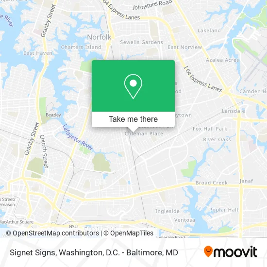
See Signet Signs, Norfolk, on the map
Public Transit to Signet Signs in Norfolk
Wondering how to get to Signet Signs in Norfolk? Moovit helps you find the best way to get to Signet Signs with step-by-step directions from the nearest public transit station.
Moovit provides free maps and live directions to help you navigate through your city. View schedules, routes, timetables, and find out how long does it take to get to Signet Signs in real time.
Looking for the nearest stop or station to Signet Signs? Check out this list of stops closest to your destination: Ballentine & Tait; Princess Anne & Arkansas; Chesapeake & Robin Hood; Nsu Station; Norfolk Station.
Bus: 003, 023, 018.Train: NORTHEAST REGIONAL.
Want to see if there’s another route that gets you there at an earlier time? Moovit helps you find alternative routes or times. Get directions from and directions to Signet Signs easily from the Moovit App or Website.
We make riding to Signet Signs easy, which is why over 1.5 million users, including users in Norfolk, trust Moovit as the best app for public transit. You don’t need to download an individual bus app or train app, Moovit is your all-in-one transit app that helps you find the best bus time or train time available.
For information on prices of bus, costs and ride fares to Signet Signs, please check the Moovit app.
Use the app to navigate to popular places including to the airport, hospital, stadium, grocery store, mall, coffee shop, school, college, and university.
Signet Signs Address: 2640 Arkansas Ave Norfolk, VA 23513 street in Norfolk
- Neon Nights,
- Kernodle Custom Company,
- Wayne's Custom Auto,
- Norfolk Tent,
- Camp Run-A Mut,
- Accent Signing Company,
- L B Huntington Co.,
- Pyramid Roofing,
- College Hunks Hauling Junk & Moving - Virginia Beach,
- Dominion Contract Carpet,
- CC Transmission & Auto Repair,
- Affordable Landscaping,
- RW Smith,
- CDS,
- RC Demolition,
- Boyd Automotive Center,
- Dogs of Justice Training Center,
- K-9 Special Services,
- Paul Walls Audio,
- East Coast Truck & Auto Body
Places Near Signet Signs (Norfolk)
- Marriott Marquis Washington, DC, Washington,
- Washington DC VA Medical Center, Washington,
- Sibley Memorial Hospital, Washington,
- Georgetown, Washington,
- Westfield Montgomery Mall, Montgomery County,
- Pennsylvania Ave NW (3rd st and pennsylvania), Washington,
- National Zoo, Washington,
- Rock Creek Tennis Center, Washington,
- Museum Of The Bible, Washington,
- Camden Yards, Baltimore,
- PG Mall, Prince George's County,
- National Mall, Washington,
- Basilica of the National Shrine, Washington,
- Warner Theatre, Washington,
- Washington National Cathedral, Washington,
- Amazon Hq2, Arlington County,
- Capital One Arena, Washington,
- M&T Bank Stadium, Baltimore,
- The Anthem, Washington,
- National Museum of African American History and Culture, Washington
How to get to popular places in Washington, D.C. - Baltimore, MD with public transit
Get around Norfolk by public transit!
Traveling around Norfolk has never been so easy. See step by step directions as you travel to any attraction, street or major public transit station. View bus and train schedules, arrival times, service alerts and detailed routes on a map, so you know exactly how to get to anywhere in Norfolk.
When traveling to any destination around Norfolk use Moovit's Live Directions with Get Off Notifications to know exactly where and how far to walk, how long to wait for your line, and how many stops are left. Moovit will alert you when it's time to get off — no need to constantly re-check whether yours is the next stop.
Wondering how to use public transit in Norfolk or how to pay for public transit in Norfolk? Moovit public transit app can help you navigate your way with public transit easily, and at minimum cost. It includes public transit fees, ticket prices, and costs. Looking for a map of Norfolk public transit lines? Moovit public transit app shows all public transit maps in Norfolk with all Bus, Train, Metro, Light Rail and Ferry routes and stops on an interactive map.
Washington, D.C. - Baltimore, MD has 5 transit type(s), including: Bus, Train, Metro, Light Rail and Ferry, operated by several transit agencies, including WMATA, Montgomery County Ride On, Fairfax Connector, TheBus, PRTC, DASH - Alexandria, Arlington Transit (ART), RTA of Central Maryland, MDOT MTA, MDOT MTA Light RailLink, MDOT MTA Commuter Bus, MDOT MTA Local Bus, FXBGO!, Virginia Railway Express (VRE) and MARC