Directions to Silly Sprouts Learning (Baltimore) with public transportation
The following transit lines have routes that pass near Silly Sprouts Learning
 Bus: CITYLINK PURPLE, 34.
How to get to Silly Sprouts Learning by bus?
Click on the bus route to see step by step directions with maps, line arrival times and updated time schedules.
From National Aquarium-Baltimore, Baltimore
50 minFrom Baltimore Museum Of Art, Baltimore
62 minFrom Mondawmin Mall, Baltimore
50 minFrom Patterson Park, Baltimore
58 minFrom Patterson Park, Baltimore
60 minFrom Johns Hopkins Mountcastle Auditorium, Baltimore
56 minFrom Pimlico Race Course, Baltimore
88 minFrom Loyola University Maryland, Baltimore
71 minFrom Walmart, Baltimore
41 minFrom Canton, Baltimore
65 min
Bus stop near Silly Sprouts Learning in Baltimore
- Frederick Ave & Atholwood Ln Opp Wb, 11 min walk,VIEW
What are the closest stations to Silly Sprouts Learning?
The closest stations to Silly Sprouts Learning are:
- Frederick Ave & Atholwood Ln Opp Wb is 845 yards away, 11 min walk.
Which bus line stops near Silly Sprouts Learning?
CITYLINK PURPLE (Paradise)
What’s the nearest bus station to Silly Sprouts Learning in Baltimore?
The nearest bus station to Silly Sprouts Learning in Baltimore is Frederick Ave & Atholwood Ln Opp Wb. It’s a 11 min walk away.
What time is the first bus to Silly Sprouts Learning in Baltimore?
The CITYLINK PURPLE is the first bus that goes to Silly Sprouts Learning in Baltimore. It stops nearby at 4:08 AM.
What time is the last bus to Silly Sprouts Learning in Baltimore?
The CITYLINK PURPLE is the last bus that goes to Silly Sprouts Learning in Baltimore. It stops nearby at 2:43 AM.
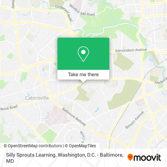
See Silly Sprouts Learning, Baltimore, on the map
Public Transit to Silly Sprouts Learning in Baltimore
Wondering how to get to Silly Sprouts Learning in Baltimore? Moovit helps you find the best way to get to Silly Sprouts Learning with step-by-step directions from the nearest public transit station.
Moovit provides free maps and live directions to help you navigate through your city. View schedules, routes, timetables, and find out how long does it take to get to Silly Sprouts Learning in real time.
Looking for the nearest stop or station to Silly Sprouts Learning? Check out this list of stops closest to your destination: Frederick Ave & Atholwood Ln Opp Wb.
Bus: CITYLINK PURPLE, 34.
Want to see if there’s another route that gets you there at an earlier time? Moovit helps you find alternative routes or times. Get directions from and directions to Silly Sprouts Learning easily from the Moovit App or Website.
We make riding to Silly Sprouts Learning easy, which is why over 1.5 million users, including users in Baltimore, trust Moovit as the best app for public transit. You don’t need to download an individual bus app or train app, Moovit is your all-in-one transit app that helps you find the best bus time or train time available.
For information on prices of bus, costs and ride fares to Silly Sprouts Learning, please check the Moovit app.
Use the app to navigate to popular places including to the airport, hospital, stadium, grocery store, mall, coffee shop, school, college, and university.
Silly Sprouts Learning Address: Wyndholme Cir Baltimore, MD 21229 street in Baltimore
- Frederick Ave & Stonecroft Rd Opp Eb,
- Impact for Christ Community Church,
- Frederick N Bend Rd,
- Frederick Ave and Bend Rd,
- Frederick Ave & North Bend Rd,
- MD-144,
- Sumner DRS,
- Dix MS Catherine LCPC,
- YMCA,
- USPS Collection Box - Blue Box,
- College Grads Give Back. Org,
- North Bend,
- Tara Hope Photography,
- Golden Arc Center,
- American Agencies,
- Blissesthetics,
- North Bend Playground,
- Blue Talon Technology Group,
- Sage Management,
- Atlantic Realty MGMT
Places Near Silly Sprouts Learning (Baltimore)
- Washington National Cathedral, Washington,
- National Zoo, Washington,
- Westfield Montgomery Mall, Montgomery County,
- National Mall, Washington,
- Warner Theatre, Washington,
- National Museum of African American History and Culture, Washington,
- Museum Of The Bible, Washington,
- Basilica of the National Shrine, Washington,
- M&T Bank Stadium, Baltimore,
- Capital One Arena, Washington,
- Georgetown, Washington,
- Rock Creek Tennis Center, Washington,
- Marriott Marquis Washington, DC, Washington,
- Washington DC VA Medical Center, Washington,
- Pennsylvania Ave NW (3rd st and pennsylvania), Washington,
- Amazon Hq2, Arlington County,
- The Anthem, Washington,
- PG Mall, Prince George's County,
- Camden Yards, Baltimore,
- Sibley Memorial Hospital, Washington
How to get to popular places in Washington, D.C. - Baltimore, MD with public transit
Get around Baltimore by public transit!
Traveling around Baltimore has never been so easy. See step by step directions as you travel to any attraction, street or major public transit station. View bus and train schedules, arrival times, service alerts and detailed routes on a map, so you know exactly how to get to anywhere in Baltimore.
When traveling to any destination around Baltimore use Moovit's Live Directions with Get Off Notifications to know exactly where and how far to walk, how long to wait for your line, and how many stops are left. Moovit will alert you when it's time to get off — no need to constantly re-check whether yours is the next stop.
Wondering how to use public transit in Baltimore or how to pay for public transit in Baltimore? Moovit public transit app can help you navigate your way with public transit easily, and at minimum cost. It includes public transit fees, ticket prices, and costs. Looking for a map of Baltimore public transit lines? Moovit public transit app shows all public transit maps in Baltimore with all Bus, Train, Metro, Light Rail and Ferry routes and stops on an interactive map.
Washington, D.C. - Baltimore, MD has 5 transit type(s), including: Bus, Train, Metro, Light Rail and Ferry, operated by several transit agencies, including WMATA, Montgomery County Ride On, Fairfax Connector, TheBus, PRTC, DASH - Alexandria, Arlington Transit (ART), RTA of Central Maryland, MDOT MTA, MDOT MTA Light RailLink, MDOT MTA Commuter Bus, MDOT MTA Local Bus, FXBGO!, Virginia Railway Express (VRE) and MARC