How to get to Silver Bells Chapel by bus?
Click on the bus route to see step by step directions with maps, line arrival times and updated time schedules.
From Cheyenne High School, North Las Vegas
50 minFrom O'Neill Outlet (Riders Outlet), Enterprise
71 minFrom E Sunset Rd / S Pecos Rd, Paradise
70 minFrom Ulta Beauty, Las Vegas
64 minFrom Mercado Las Vegas, North Las Vegas
72 minFrom Best in the West Shopping Center, Las Vegas
66 minFrom Tru by Hilton Las Vegas Airport, Enterprise
65 minFrom E Flamingo Rd / Pecos McLeod, Paradise
56 minFrom Smoke Ranch & Tenaya, Las Vegas
69 minFrom College of Southern NV-Cheyenne (CSN-North Las Vegas Campus), North Las Vegas
62 min
Bus stops near Silver Bells Chapel in Las Vegas
Monorail station near Silver Bells Chapel in Las Vegas
- Sls Station, 46 min walk,VIEW
Bus lines to Silver Bells Chapel in Las Vegas
What are the closest stations to Silver Bells Chapel?
The closest stations to Silver Bells Chapel are:
- Sb Rancho Before Sahara is 502 yards away, 7 min walk.
- Eb Sahara After South Bridge is 649 yards away, 8 min walk.
- Sls Station is 3836 yards away, 46 min walk.
Which bus lines stop near Silver Bells Chapel?
These bus lines stop near Silver Bells Chapel: 119, DEUCE, SX.
What’s the nearest bus station to Silver Bells Chapel in Las Vegas?
The nearest bus station to Silver Bells Chapel in Las Vegas is Sb Rancho Before Sahara. It’s a 7 min walk away.
What time is the first bus to Silver Bells Chapel in Las Vegas?
The SX is the first bus that goes to Silver Bells Chapel in Las Vegas. It stops nearby at 3:09 AM.
What time is the last bus to Silver Bells Chapel in Las Vegas?
The SX is the last bus that goes to Silver Bells Chapel in Las Vegas. It stops nearby at 3:20 AM.
What time is the first Monorail to Silver Bells Chapel in Las Vegas?
The LVM is the first Monorail that goes to Silver Bells Chapel in Las Vegas. It stops nearby at 7:00 AM.
What time is the last Monorail to Silver Bells Chapel in Las Vegas?
The LVM is the last Monorail that goes to Silver Bells Chapel in Las Vegas. It stops nearby at 12:02 AM.
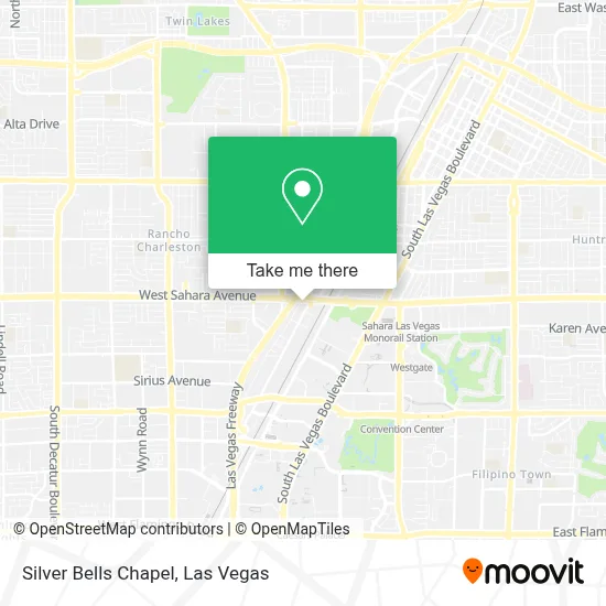
See Silver Bells Chapel, Las Vegas, on the map
Public Transit to Silver Bells Chapel in Las Vegas
Wondering how to get to Silver Bells Chapel in Las Vegas? Moovit helps you find the best way to get to Silver Bells Chapel with step-by-step directions from the nearest public transit station.
Moovit provides free maps and live directions to help you navigate through your city. View schedules, routes, timetables, and find out how long does it take to get to Silver Bells Chapel in real time.
Looking for the nearest stop or station to Silver Bells Chapel? Check out this list of stops closest to your destination: Sb Rancho Before Sahara; Eb Sahara After South Bridge; Sls Station.
Bus: 119, DEUCE, SX.Monorail: LVM.
Want to see if there’s another route that gets you there at an earlier time? Moovit helps you find alternative routes or times. Get directions from and directions to Silver Bells Chapel easily from the Moovit App or Website.
We make riding to Silver Bells Chapel easy, which is why over 1.7 million users, including users in Las Vegas, trust Moovit as the best app for public transit. You don’t need to download an individual bus app or train app, Moovit is your all-in-one transit app that helps you find the best bus time or train time available.
For information on prices of bus, costs and ride fares to Silver Bells Chapel, please check the Moovit app.
Use the app to navigate to popular places including to the airport, hospital, stadium, grocery store, mall, coffee shop, school, college, and university.
Silver Bells Chapel Address: 1501 W Sahara Ave street in Las Vegas
- Bus Stop In Front Of Palace Station,
- PeepLand,
- Sahara & I 15,
- Count's Kustoms,
- RTC Sahara Express - Palace Station Westbound,
- sahara express bus,
- Sahara @ Rancho (W),
- Grand Ballroom @ Palace Station,
- Palace Station Hotel & Casino,
- Palace Station Hotel and Casino (Palace Station Las Vegas),
- Sammy Davis Jr. Drive & Circus Circus Drive,
- Caesars Palace Palms Place Palms Casino Resort,
- Dolan Springs Arizona,
- Fitness Center @ Circus Circus,
- Karaoke X X X,
- Tarkanian Basketball Academy (Dann Tarkanian Basketball),
- Garden Grill (DQ Grill & Chill Restaurant),
- Starbucks Coffee Circus Circus,
- Circus Circus Hotel Casino Theme Park Las Vegas,
- West Tower Rooms at Circus Circus
Places Near Silver Bells Chapel (Las Vegas)
- Las Vegas South Premium Outlets, Enterprise,
- Las Vegas Premium Outlets-North, Enterprise,
- Arte Museum Las Vegas, Paradise,
- Welcome To Fabulous Las Vegas Sign, Paradise,
- Allegiant Stadium, Paradise,
- Meow Wolf - Las Vegas (Meow Wolf's Omega Mart), Las Vegas,
- Omega Mart, Las Vegas,
- The Deuce Bus Stop at Fremont St, Las Vegas,
- Town Square, Enterprise,
- Area15, Las Vegas,
- Las Vegas North Premium Outlets, Las Vegas,
- Walmart Supercenter, Las Vegas,
- Zak Bagans Haunted Museum, Las Vegas,
- Lee Canyon, Las Vegas,
- The Neon Museum, Las Vegas,
- Gold & Silver Pawn Shop, Las Vegas,
- Koolsville Tattoos, Las Vegas,
- The Palms Casino Resort, Paradise,
- Trump International Hotel Las Vegas, Paradise,
- Walmart, Las Vegas
How to get to popular places in Las Vegas with public transit
Get around Las Vegas by public transit!
Traveling around Las Vegas has never been so easy. See step by step directions as you travel to any attraction, street or major public transit station. View bus and train schedules, arrival times, service alerts and detailed routes on a map, so you know exactly how to get to anywhere in Las Vegas.
When traveling to any destination around Las Vegas use Moovit's Live Directions with Get Off Notifications to know exactly where and how far to walk, how long to wait for your line, and how many stops are left. Moovit will alert you when it's time to get off — no need to constantly re-check whether yours is the next stop.
Wondering how to use public transit in Las Vegas or how to pay for public transit in Las Vegas? Moovit public transit app can help you navigate your way with public transit easily, and at minimum cost. It includes public transit fees, ticket prices, and costs. Looking for a map of Las Vegas public transit lines? Moovit public transit app shows all public transit maps in Las Vegas with all Bus and Monorail routes and stops on an interactive map.
Las Vegas has 2 transit type(s), including: Bus and Monorail, operated by several transit agencies, including RTCSNV, City of Las Vegas, Alvand Transportation, Vegas Airporter, Las Vegas Monorail, FlixBus-us and Greyhound-us