Directions to Silver Model Management (Manhattan) with public transportation
The following transit lines have routes that pass near Silver Model Management
 Bus: BM2, BM3, BXM4, M2, M3.
- Train: 1, PORT JEFFERSON BRANCH, RONKONKOMA BRANCH, ACELA, ADIRONDACK.
- Subway: 1, B, F, M, N.
How to get to Silver Model Management by bus?
Click on the bus route to see step by step directions with maps, line arrival times and updated time schedules.
How to get to Silver Model Management by train?
Click on the train route to see step by step directions with maps, line arrival times and updated time schedules.
How to get to Silver Model Management by subway?
Click on the subway route to see step by step directions with maps, line arrival times and updated time schedules.
Subway stations near Silver Model Management in Manhattan
Bus stops near Silver Model Management in Manhattan
Train stations near Silver Model Management in Manhattan
Bus lines to Silver Model Management in Manhattan
- M7, Harlem 147 St Via 6 Av Via Amsterdam,VIEW
- M55, South Ferry,VIEW
- M5, Limited Washington Heights Gw Bridge,VIEW
- M1, Harlem - East Village,VIEW
- M2, Washington Heights - East Village,VIEW
- M3, Fort George - East Village,VIEW
- GREENWICH, Midtown / W 39th Street,VIEW
- BM1, Mill Basin - Downtown/Midtown,VIEW
- BM2, Canarsie/Spring Creek - Downtown/Midtown,VIEW
- BXM3, Yonkers - Midtown,VIEW
- BXM4, Woodlawn - Midtown,VIEW
- BXM11, Wakefield - Midtown,VIEW
- BXM18, Riverdale - Downtown,VIEW
- BM3, Sheepshead Bay Emmons Av Via Ocean Av,VIEW
- BM4, Gerritsen Bch Gerritsen Av,VIEW
- Q32, Jackson Heights,VIEW
- X27, Bay Ridge Shore Rd Via Broadway,VIEW
- X28, Coney Island Sea Gate Via Broadway,VIEW
- X37, Bay Ridge Shore Rd Via 23 St Via Fdr Dr,VIEW
- X38, Coney Isl Sea Gte Via 23 St-Fdr Via Crop,VIEW
What are the closest stations to Silver Model Management?
The closest stations to Silver Model Management are:
- 28 St is 96 yards away, 2 min walk.
- 6 Av/W 29 St is 140 yards away, 2 min walk.
- 34 St-Penn Station is 240 yards away, 3 min walk.
- W 31 St/6 Av is 273 yards away, 4 min walk.
- 5 Av/E 28 St is 273 yards away, 4 min walk.
- 33rd Street is 273 yards away, 4 min walk.
- 5th Ave & W 29th St is 314 yards away, 4 min walk.
- 5th Ave & W 27th St is 334 yards away, 4 min walk.
- 5 Av/W 26 St is 366 yards away, 5 min walk.
- 34 St-Herald Sq is 367 yards away, 5 min walk.
- W 32 St/Broadway is 398 yards away, 5 min walk.
- 5 Av/W 30 St is 398 yards away, 5 min walk.
Which bus lines stop near Silver Model Management?
These bus lines stop near Silver Model Management: BM2, BM3, BXM4, M2, M3, M5, QM12, QM18, QM24, X37.
Which train lines stop near Silver Model Management?
These train lines stop near Silver Model Management: 1, PORT JEFFERSON BRANCH, RONKONKOMA BRANCH.
Which subway lines stop near Silver Model Management?
These subway lines stop near Silver Model Management: 1, B, F, M, N, Q, R.
What’s the nearest subway station to Silver Model Management in Manhattan?
The nearest subway station to Silver Model Management in Manhattan is 28 St. It’s a 2 min walk away.
What’s the nearest train station to Silver Model Management in Manhattan?
The nearest train station to Silver Model Management in Manhattan is 34 St-Penn Station. It’s a 3 min walk away.
What’s the nearest bus station to Silver Model Management in Manhattan?
The nearest bus station to Silver Model Management in Manhattan is 6 Av/W 29 St. It’s a 2 min walk away.
What time is the first subway to Silver Model Management in Manhattan?
The Q is the first subway that goes to Silver Model Management in Manhattan. It stops nearby at 3:00 AM.
What time is the last subway to Silver Model Management in Manhattan?
The N is the last subway that goes to Silver Model Management in Manhattan. It stops nearby at 3:59 AM.
What time is the first train to Silver Model Management in Manhattan?
The PORT JEFFERSON BRANCH is the first train that goes to Silver Model Management in Manhattan. It stops nearby at 3:01 AM.
What time is the last train to Silver Model Management in Manhattan?
The ATW is the last train that goes to Silver Model Management in Manhattan. It stops nearby at 3:21 AM.
What time is the first bus to Silver Model Management in Manhattan?
The M7 is the first bus that goes to Silver Model Management in Manhattan. It stops nearby at 3:42 AM.
What time is the last bus to Silver Model Management in Manhattan?
The M2 is the last bus that goes to Silver Model Management in Manhattan. It stops nearby at 2:53 AM.
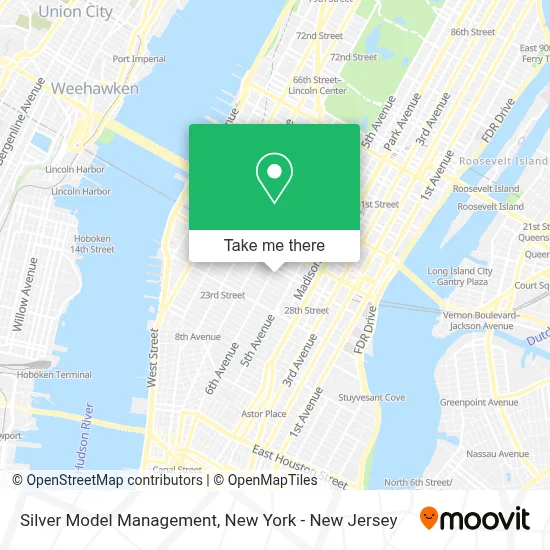
See Silver Model Management, Manhattan, on the map
Public Transit to Silver Model Management in Manhattan
Wondering how to get to Silver Model Management in Manhattan? Moovit helps you find the best way to get to Silver Model Management with step-by-step directions from the nearest public transit station.
Moovit provides free maps and live directions to help you navigate through your city. View schedules, routes, timetables, and find out how long does it take to get to Silver Model Management in real time.
Looking for the nearest stop or station to Silver Model Management? Check out this list of stops closest to your destination: 28 St; 6 Av/W 29 St; 34 St-Penn Station; W 31 St/6 Av; 5 Av/E 28 St; 33rd Street; 5th Ave & W 29th St; 5th Ave & W 27th St; 5 Av/W 26 St; 34 St-Herald Sq; W 32 St/Broadway; 5 Av/W 30 St.
Bus: BM2, BM3, BXM4, M2, M3, M5, QM12, QM18, QM24, X37, M7, M55, M1.Train: 1, PORT JEFFERSON BRANCH, RONKONKOMA BRANCH, ACELA, ADIRONDACK, BERKSHIRE FLYER, CARDINAL, CAROLINIAN, ATW, BLU, YEL.Subway: 1, B, F, M, N, Q, R, W, D, FX.
Want to see if there’s another route that gets you there at an earlier time? Moovit helps you find alternative routes or times. Get directions from and directions to Silver Model Management easily from the Moovit App or Website.
We make riding to Silver Model Management easy, which is why over 1.5 million users, including users in Manhattan, trust Moovit as the best app for public transit. You don’t need to download an individual bus app or train app, Moovit is your all-in-one transit app that helps you find the best bus time or train time available.
For information on prices of subway, bus and train, costs and ride fares to Silver Model Management, please check the Moovit app.
Use the app to navigate to popular places including to the airport, hospital, stadium, grocery store, mall, coffee shop, school, college, and university.
Silver Model Management Address: 45 W 29th St street in Manhattan
- Unlocal,
- Sterling King,
- Onhim Church,
- MADE Hotel,
- Paramount Calendar and Advertising,
- Sterling Stone,
- Han Feng Art and Design Space,
- Golden Star Sunglasses,
- Preston Bailey Entertainment & Set Design,
- Atomic,
- Rugs R Us Inc.,
- Taboonia,
- $1 Pizza,
- Webkyte | Automatic Content Recognition (Acr),
- Downtown Nyc Foot Care,
- Interstate Special Events,
- 838 Asian Kitchen,
- Myori,
- Littlefield & Co.,
- Spada Uniforms
Places Near Silver Model Management (Manhattan)
- 3 Stone St, Manhattan,
- SoHo, Manhattan,
- Pier 83, Manhattan,
- 911 Memorial, Manhattan,
- 376 Hudson Street, Manhattan,
- qqqq, Manhattan,
- Chinatown, Manhattan,
- 66 John Street, Manhattan,
- Rockefeller Center, Manhattan,
- 111 Centre New York City Supreme Court, Manhattan,
- Mountainside Hospital, Glen Ridge,
- San Gennaro Feast, Manhattan,
- Times Square, Manhattan,
- Queens Center Mall, Queens,
- 26 Federal Plaza, Manhattan,
- Wall Street, Manhattan,
- 1 Police Plaza, Manhattan,
- Bellevue Hospital, Manhattan,
- Hudson Yards, Manhattan,
- Katz's Deli, Manhattan
How to get to popular places in New York - New Jersey with public transit
Get around Manhattan by public transit!
Traveling around Manhattan has never been so easy. See step by step directions as you travel to any attraction, street or major public transit station. View bus and train schedules, arrival times, service alerts and detailed routes on a map, so you know exactly how to get to anywhere in Manhattan.
When traveling to any destination around Manhattan use Moovit's Live Directions with Get Off Notifications to know exactly where and how far to walk, how long to wait for your line, and how many stops are left. Moovit will alert you when it's time to get off — no need to constantly re-check whether yours is the next stop.
Wondering how to use public transit in Manhattan or how to pay for public transit in Manhattan? Moovit public transit app can help you navigate your way with public transit easily, and at minimum cost. It includes public transit fees, ticket prices, and costs. Looking for a map of Manhattan public transit lines? Moovit public transit app shows all public transit maps in Manhattan with all Bus, Train, Subway, Light Rail, Ferry and Cable Car routes and stops on an interactive map.
New York - New Jersey has 6 transit type(s), including: Bus, Train, Subway, Light Rail, Ferry and Cable Car, operated by several transit agencies, including MTA Subway, Metro-North Railroad, LIRR, PATH, MTA New York City Transit - Express routes, MTA Bus, NJ Transit, NYC Ferry, NICE bus, Bee-Line Bus, NJ Transit Rail, Norwalk Transit District, Hartford Line, River Valley Transit and HART