Directions to Simfol (Edmonton) with public transportation
The following transit lines have routes that pass near Simfol
 Bus: 121.
How to get to Simfol by bus?
Click on the bus route to see step by step directions with maps, line arrival times and updated time schedules.
From Rogers, Strathcona County
141 minFrom Orthopedic Surgery Centre - Royal Alexandra Hospital, Edmonton
64 minFrom Glenrose Rehabilitation Center, Edmonton
66 minFrom 92 Street & Jasper Avenue, Edmonton
66 minFrom Killarney Junior High School, Edmonton
41 minFrom Lucky 97 Supermarket, Edmonton
64 minFrom Highlands, Edmonton
48 minFrom St Brendan Catholic Elementary Sch, Edmonton
65 min
Bus stop near Simfol in Edmonton
- 21 Street & 147 Avenue, 1 min walk,VIEW
Light Rail stations near Simfol in Edmonton
- Clareview Station, 41 min walk,VIEW
Bus lines to Simfol in Edmonton
- 121, East Clareview Transit Centre,VIEW
What are the closest stations to Simfol?
The closest stations to Simfol are:
- 21 Street & 147 Avenue is 55 meters away, 1 min walk.
- Clareview Station is 3191 meters away, 41 min walk.
Which bus line stops near Simfol?
121 (East Clareview Transit Centre→Evergreen Mobile Park Loop)
What’s the nearest bus station to Simfol in Edmonton?
The nearest bus station to Simfol in Edmonton is 21 Street & 147 Avenue. It’s a 1 min walk away.
What time is the first bus to Simfol in Edmonton?
The 121 is the first bus that goes to Simfol in Edmonton. It stops nearby at 6:08 AM.
What time is the last bus to Simfol in Edmonton?
The 121 is the last bus that goes to Simfol in Edmonton. It stops nearby at 11:31 PM.
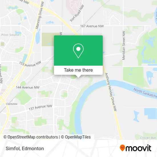
See Simfol, Edmonton, on the map
Public Transit to Simfol in Edmonton
Wondering how to get to Simfol in Edmonton? Moovit helps you find the best way to get to Simfol with step-by-step directions from the nearest public transit station.
Moovit provides free maps and live directions to help you navigate through your city. View schedules, routes, timetables, and find out how long does it take to get to Simfol in real time.
Looking for the nearest stop or station to Simfol? Check out this list of stops closest to your destination: 21 Street & 147 Avenue; Clareview Station.
Bus: 121.
Want to see if there’s another route that gets you there at an earlier time? Moovit helps you find alternative routes or times. Get directions from and directions to Simfol easily from the Moovit App or Website.
We make riding to Simfol easy, which is why over 1.5 million users, including users in Edmonton, trust Moovit as the best app for public transit. You don’t need to download an individual bus app or train app, Moovit is your all-in-one transit app that helps you find the best bus time or train time available.
For information on prices of bus, costs and ride fares to Simfol, please check the Moovit app.
Use the app to navigate to popular places including to the airport, hospital, stadium, grocery store, mall, coffee shop, school, college, and university.
Simfol Address: 147 Ave NW Edmonton, AB T5Y 2K3 street in Edmonton
- Fraser Park,
- Miks Media Inc.,
- Fraser Elementary School,
- Lara's Food,
- Bodevin's Maintenance Inc,
- DFK Canada,
- Alta 1 Mechanical Insulation,
- Hermitage Park,
- Berean Church of God,
- Funny Lawn Sign Rentals,
- Evangelical Free Church District Office,
- Heavenly Shine Cleaners,
- New Start Counselling,
- Grasshopper,
- Over the Fence,
- Karol's Master Painting,
- High Energy Junk Removal,
- Lone Star Limousine,
- Awan Beauty Clean,
- Sid's Barbershop
Places Near Simfol (Edmonton)
- Grey Nuns Community Hospital, Edmonton,
- Canada Place Service Canada Centre, Edmonton,
- Edmonton Commonwealth Stadium, Edmonton,
- MacEwan University, Edmonton,
- University of Alberta, Edmonton,
- Alberta Legislature Building, Edmonton,
- Fort Edmonton Park, Edmonton,
- Edmonton VIA Rail Station, Edmonton,
- Rogers Place, Edmonton,
- Royal Alexandra Hospital, Edmonton,
- Edmonton Valley Zoo, Edmonton,
- Cross Cancer Institute, Edmonton,
- Whyte Avenue, Edmonton,
- Edmonton EXPO Centre, Edmonton,
- West Edmonton Mall, Edmonton,
- Londonderry Mall, Edmonton,
- Borden Park, Edmonton,
- Northgate Centre, Edmonton,
- Kingsway Mall, Edmonton,
- Kaye Edmonton Clinic, Edmonton
How to get to popular places in Edmonton with public transit
Get around Edmonton by public transit!
Traveling around Edmonton has never been so easy. See step by step directions as you travel to any attraction, street or major public transit station. View bus and train schedules, arrival times, service alerts and detailed routes on a map, so you know exactly how to get to anywhere in Edmonton.
When traveling to any destination around Edmonton use Moovit's Live Directions with Get Off Notifications to know exactly where and how far to walk, how long to wait for your line, and how many stops are left. Moovit will alert you when it's time to get off — no need to constantly re-check whether yours is the next stop.
Wondering how to use public transit in Edmonton or how to pay for public transit in Edmonton? Moovit public transit app can help you navigate your way with public transit easily, and at minimum cost. It includes public transit fees, ticket prices, and costs. Looking for a map of Edmonton public transit lines? Moovit public transit app shows all public transit maps in Edmonton with all Bus and Light Rail routes and stops on an interactive map.
Edmonton has 2 transit type(s), including: Bus and Light Rail, operated by several transit agencies, including ETS LRT, ETS, Strathcona County Transit, St. Albert Transit, Spruce Grove Transit, Fort Saskatchewan Transit, Beaumont Transit and Leduc Transit