Directions to Simple Mobile (Queens) with public transportation
The following transit lines have routes that pass near Simple Mobile
 Bus: B38, Q39, Q55, Q58.
- Train: CITY TERMINAL ZONE, HEMPSTEAD BRANCH.
- Subway: L, M.
How to get to Simple Mobile by bus?
Click on the bus route to see step by step directions with maps, line arrival times and updated time schedules.
From East 93rd Street, Manhattan
82 minFrom Central Park Zoo, Manhattan
68 minFrom MTA Subway - 59th St/Columbus Circle (A/B/C/D/1), Manhattan
79 minFrom Memorial Sloan-Kettering Cancer Center, Manhattan
72 minFrom 300 E 66th street, Manhattan
62 minFrom Edge NYC, Manhattan
93 minFrom Gracie Mansion, Manhattan
93 minFrom E 87th St, Manhattan
82 minFrom E 66th St (2nd Ave & 66th), Manhattan
62 min
How to get to Simple Mobile by train?
Click on the train route to see step by step directions with maps, line arrival times and updated time schedules.
How to get to Simple Mobile by subway?
Click on the subway route to see step by step directions with maps, line arrival times and updated time schedules.
From East 93rd Street, Manhattan
58 minFrom Central Park Zoo, Manhattan
50 minFrom MTA Subway - 59th St/Columbus Circle (A/B/C/D/1), Manhattan
51 minFrom Memorial Sloan-Kettering Cancer Center, Manhattan
50 minFrom 300 E 66th street, Manhattan
60 minFrom Edge NYC, Manhattan
46 minFrom Gracie Mansion, Manhattan
64 minFrom E 87th St, Manhattan
48 minFrom E 66th St (2nd Ave & 66th), Manhattan
60 min
Bus stops near Simple Mobile in Queens
Subway stations near Simple Mobile in Queens
Bus lines to Simple Mobile in Queens
What are the closest stations to Simple Mobile?
The closest stations to Simple Mobile are:
- Myrtle Av/Seneca Av is 46 yards away, 1 min walk.
- Seneca Av/Cornelia St is 131 yards away, 2 min walk.
- Putnam Av/Onderdonk Av is 328 yards away, 4 min walk.
- Forest Av/Myrtle Av is 352 yards away, 5 min walk.
- Putnam Av/Myrtle Av is 358 yards away, 5 min walk.
- Fresh Pond Rd is 608 yards away, 8 min walk.
- Myrtle-Wyckoff Avs is 656 yards away, 8 min walk.
Which bus lines stop near Simple Mobile?
These bus lines stop near Simple Mobile: B38, Q39.
Which train lines stop near Simple Mobile?
These train lines stop near Simple Mobile: CITY TERMINAL ZONE, HEMPSTEAD BRANCH.
Which subway lines stop near Simple Mobile?
These subway lines stop near Simple Mobile: L, M.
What’s the nearest subway station to Simple Mobile in Queens?
The nearest subway stations to Simple Mobile in Queens are Fresh Pond Rd and Myrtle-Wyckoff Avs. The closest one is a 8 min walk away.
What’s the nearest bus station to Simple Mobile in Queens?
The nearest bus station to Simple Mobile in Queens is Myrtle Av/Seneca Av. It’s a 1 min walk away.
What time is the first subway to Simple Mobile in Queens?
The L is the first subway that goes to Simple Mobile in Queens. It stops nearby at 3:01 AM.
What time is the last subway to Simple Mobile in Queens?
The L is the last subway that goes to Simple Mobile in Queens. It stops nearby at 3:10 AM.
What time is the first bus to Simple Mobile in Queens?
The Q39 is the first bus that goes to Simple Mobile in Queens. It stops nearby at 3:03 AM.
What time is the last bus to Simple Mobile in Queens?
The B38 is the last bus that goes to Simple Mobile in Queens. It stops nearby at 3:29 AM.
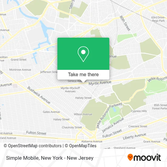
See Simple Mobile, Queens, on the map
Public Transit to Simple Mobile in Queens
Wondering how to get to Simple Mobile in Queens? Moovit helps you find the best way to get to Simple Mobile with step-by-step directions from the nearest public transit station.
Moovit provides free maps and live directions to help you navigate through your city. View schedules, routes, timetables, and find out how long does it take to get to Simple Mobile in real time.
Looking for the nearest stop or station to Simple Mobile? Check out this list of stops closest to your destination: Myrtle Av/Seneca Av; Seneca Av/Cornelia St; Putnam Av/Onderdonk Av; Forest Av/Myrtle Av; Putnam Av/Myrtle Av; Fresh Pond Rd; Myrtle-Wyckoff Avs.
Bus: B38, Q39, Q55, Q58.Train: CITY TERMINAL ZONE, HEMPSTEAD BRANCH.Subway: L, M.
Want to see if there’s another route that gets you there at an earlier time? Moovit helps you find alternative routes or times. Get directions from and directions to Simple Mobile easily from the Moovit App or Website.
We make riding to Simple Mobile easy, which is why over 1.5 million users, including users in Queens, trust Moovit as the best app for public transit. You don’t need to download an individual bus app or train app, Moovit is your all-in-one transit app that helps you find the best bus time or train time available.
For information on prices of subway, bus and train, costs and ride fares to Simple Mobile, please check the Moovit app.
Use the app to navigate to popular places including to the airport, hospital, stadium, grocery store, mall, coffee shop, school, college, and university.
Simple Mobile Address: 8-04 Woodward Ave street in Queens
- Spoiled Girl,
- Shorty Solutions Inc.,
- Myrtle Pub,
- Skechers Factory Outlet,
- Western Union,
- Dental Care Of Ridgewood,
- Mamkin Dentistry Aesthetic & Restorative Center,
- Myrtle Ave Ave intersection Seneca Ave,
- Popular Bank,
- 7-Eleven - Closed,
- Myrtle Avenue,
- Shop Fair Seneca,
- Food Nick Expo,
- Davita Ridge Care Dialysis,
- Superfresh,
- B's Hair Stylist,
- Dental Artes Llc,
- Catalpa Chemists Pharmacy and Optical,
- Ridgewood Avon Beauty Center,
- Water Damage Restoration and Repair
Places Near Simple Mobile (Queens)
- Times Square, Manhattan,
- San Gennaro Feast, Manhattan,
- Chinatown, Manhattan,
- Wall Street, Manhattan,
- 111 Centre New York City Supreme Court, Manhattan,
- Pier 83, Manhattan,
- Mountainside Hospital, Glen Ridge,
- 26 Federal Plaza, Manhattan,
- 3 Stone St, Manhattan,
- Queens Center Mall, Queens,
- Bellevue Hospital, Manhattan,
- 66 John Street, Manhattan,
- 376 Hudson Street, Manhattan,
- qqqq, Manhattan,
- Hudson Yards, Manhattan,
- 1 Police Plaza, Manhattan,
- Katz's Deli, Manhattan,
- Rockefeller Center, Manhattan,
- SoHo, Manhattan,
- 911 Memorial, Manhattan
How to get to popular places in New York - New Jersey with public transit
Get around Queens by public transit!
Traveling around Queens has never been so easy. See step by step directions as you travel to any attraction, street or major public transit station. View bus and train schedules, arrival times, service alerts and detailed routes on a map, so you know exactly how to get to anywhere in Queens.
When traveling to any destination around Queens use Moovit's Live Directions with Get Off Notifications to know exactly where and how far to walk, how long to wait for your line, and how many stops are left. Moovit will alert you when it's time to get off — no need to constantly re-check whether yours is the next stop.
Wondering how to use public transit in Queens or how to pay for public transit in Queens? Moovit public transit app can help you navigate your way with public transit easily, and at minimum cost. It includes public transit fees, ticket prices, and costs. Looking for a map of Queens public transit lines? Moovit public transit app shows all public transit maps in Queens with all Bus, Train, Subway, Light Rail, Ferry and Cable Car routes and stops on an interactive map.
New York - New Jersey has 6 transit type(s), including: Bus, Train, Subway, Light Rail, Ferry and Cable Car, operated by several transit agencies, including MTA Subway, Metro-North Railroad, LIRR, PATH, MTA New York City Transit - Express routes, MTA Bus, NJ Transit, NYC Ferry, NICE bus, Bee-Line Bus, NJ Transit Rail, Norwalk Transit District, Hartford Line, River Valley Transit and HART