How to get to SimplexGrinnell by bus?
Click on the bus route to see step by step directions with maps, line arrival times and updated time schedules.
From Superblue Miami, Miami
68 minFrom Versailles restaurant, Miami
70 minFrom UM Hospital, Miami
79 minFrom Goodwill, Miami
60 minFrom Terminal Aeropuerto Internacional del Miami, Miami
78 minFrom NW 3rd Ave, Miami
58 minFrom Santa Clara Metrorail Station, Miami
69 minFrom Flagler, Miami
70 minFrom Flagler & 57 Ave, Miami
57 minFrom Bruce W. Carter VA Medical Center, Miami
75 min
How to get to SimplexGrinnell by train?
Click on the train route to see step by step directions with maps, line arrival times and updated time schedules.
Bus stops near SimplexGrinnell in Hialeah
Train stations near SimplexGrinnell in Hialeah
Bus lines to SimplexGrinnell in Hialeah
What are the closest stations to SimplexGrinnell?
The closest stations to SimplexGrinnell are:
- W 8 Av & 29 St Hialeah is 87 yards away, 2 min walk.
- W 29 St & W 8 Av is 217 yards away, 3 min walk.
- Palmetto Station Rail Southbound is 4338 yards away, 51 min walk.
- Metrorail Transfer Station is 5320 yards away, 63 min walk.
Which bus lines stop near SimplexGrinnell?
These bus lines stop near SimplexGrinnell: 54, 73, HIAFLA.
Which train line stops near SimplexGrinnell?
GREEN (Dadeland South Stat.rail Northbound→Palmetto Station Rail Northbound)
What’s the nearest bus station to SimplexGrinnell in Hialeah?
The nearest bus station to SimplexGrinnell in Hialeah is W 8 Av & 29 St Hialeah. It’s a 2 min walk away.
What time is the first train to SimplexGrinnell in Hialeah?
The TRIRAIL is the first train that goes to SimplexGrinnell in Hialeah. It stops nearby at 3:56 AM.
What time is the last train to SimplexGrinnell in Hialeah?
The GREEN is the last train that goes to SimplexGrinnell in Hialeah. It stops nearby at 1:01 AM.
What time is the first bus to SimplexGrinnell in Hialeah?
The 54 is the first bus that goes to SimplexGrinnell in Hialeah. It stops nearby at 5:41 AM.
What time is the last bus to SimplexGrinnell in Hialeah?
The 54 is the last bus that goes to SimplexGrinnell in Hialeah. It stops nearby at 12:06 AM.
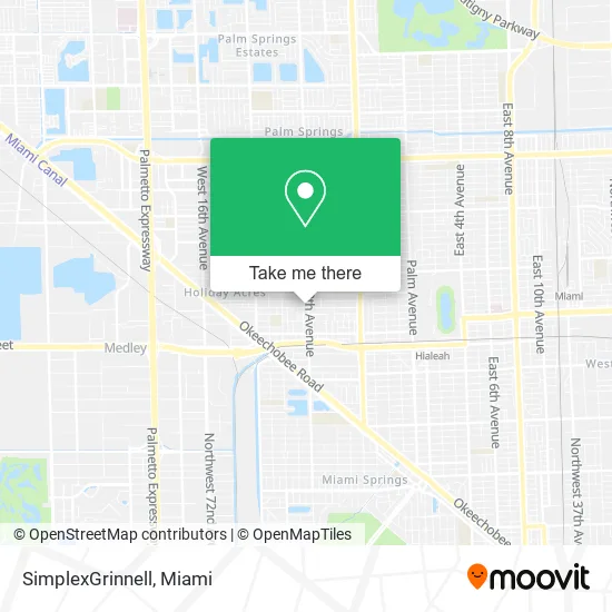
See SimplexGrinnell, Hialeah, on the map
Public Transit to SimplexGrinnell in Hialeah
Wondering how to get to SimplexGrinnell in Hialeah? Moovit helps you find the best way to get to SimplexGrinnell with step-by-step directions from the nearest public transit station.
Moovit provides free maps and live directions to help you navigate through your city. View schedules, routes, timetables, and find out how long does it take to get to SimplexGrinnell in real time.
Looking for the nearest stop or station to SimplexGrinnell? Check out this list of stops closest to your destination: W 8 Av & 29 St Hialeah; W 29 St & W 8 Av; Palmetto Station Rail Southbound; Metrorail Transfer Station.
Bus: 54, 73, HIAFLA.Train: GREEN, TRIRAIL, TRIRAIL.
Want to see if there’s another route that gets you there at an earlier time? Moovit helps you find alternative routes or times. Get directions from and directions to SimplexGrinnell easily from the Moovit App or Website.
We make riding to SimplexGrinnell easy, which is why over 1.5 million users, including users in Hialeah, trust Moovit as the best app for public transit. You don’t need to download an individual bus app or train app, Moovit is your all-in-one transit app that helps you find the best bus time or train time available.
For information on prices of bus, train and light rail, costs and ride fares to SimplexGrinnell, please check the Moovit app.
Use the app to navigate to popular places including to the airport, hospital, stadium, grocery store, mall, coffee shop, school, college, and university.
SimplexGrinnell Address: 2700 W 8th Ave Hialeah, FL 33010 street in Hialeah
- Department of Motor Vehicles,
- Maravana Cargo,
- Cook Commercial Realty,
- Hialeah Topaz Locksmith Inc,
- Ceramic Tiles by Pichs,
- Helados Dado,
- Santa Tipico Cafe,
- Home & Kitchen,
- UPS Access Point Location,
- Paraiso Cafe,
- Rodriguez Heriberto Jr,
- La Kasa Design Studio,
- L & M Custom Designs,
- Fleetway USA Heavy Duty Parts,
- Cafeteria Cubana,
- Partsw,
- Sierra Kitchen,
- Ministerio Apostolar la Cosecha Final,
- Carys Beauty Salon,
- Basic Accounting Bookkeeping Service
Places Near SimplexGrinnell (Hialeah)
- Marlins Park, Miami,
- Little Havana, Miami,
- Wynwood, Miami,
- Miami Freedom Park, Miami,
- Sawgrass mall ( FL ), Miami Beach,
- Dolphin Mall, Miami,
- Miami-Dade County Courthouse, Miami,
- Port of Miami Cruise Terminal, Miami,
- Bayside Marketplace, Miami,
- Aventura Mall, Miami,
- Zoo Miami, Miami,
- Miami Design District, Miami,
- Brickell City Centre, Miami,
- Aventura Mall, Miami Beach,
- Sawgrass Mall, Miami,
- Hard Rock Stadium, Miami Gardens,
- Richard E. Gerstein Justice Building, Miami,
- 1351 NW 12th St, Miami,
- Keiser University Flagship Campus, West Palm Beach,
- Dolphin Mall Bus, Miami
How to get to popular places in Miami with public transit
Get around Hialeah by public transit!
Traveling around Hialeah has never been so easy. See step by step directions as you travel to any attraction, street or major public transit station. View bus and train schedules, arrival times, service alerts and detailed routes on a map, so you know exactly how to get to anywhere in Hialeah.
When traveling to any destination around Hialeah use Moovit's Live Directions with Get Off Notifications to know exactly where and how far to walk, how long to wait for your line, and how many stops are left. Moovit will alert you when it's time to get off — no need to constantly re-check whether yours is the next stop.
Wondering how to use public transit in Hialeah or how to pay for public transit in Hialeah? Moovit public transit app can help you navigate your way with public transit easily, and at minimum cost. It includes public transit fees, ticket prices, and costs. Looking for a map of Hialeah public transit lines? Moovit public transit app shows all public transit maps in Hialeah with all Bus, Train, Light Rail and Ferry routes and stops on an interactive map.
Miami has 4 transit type(s), including: Bus, Train, Light Rail and Ferry, operated by several transit agencies, including Broward County Transit, Miami-Dade Transit, Metrorail, Palm Tran, Tri-Rail, Brightline, MARTY, City of Homestead Trolley, Key West Transit, Treasure Coast Connector, GoLine IRT, Amtrak, Greyhound-us, FlixBus-us and Aventura Express Shuttle Bus