How to get to Simplifai by bus?
Click on the bus route to see step by step directions with maps, line arrival times and updated time schedules.
From Prathamesh Go Crazy Resorts, Pune & Velhe
49 minFrom Synechron Technologies Pvt Ltd. STPI, Paud
50 minFrom Dr. D. Y. Patil Dental College and Hospital, Pune & Velhe
78 minFrom Lal Mahal, Pune & Velhe
52 minFrom Blades Of Glory Cricket Museum, Pune & Velhe
68 minFrom family Court pune, Pune & Velhe
48 minFrom Capgemini, Hinjawadi Phase III, Paud
50 minFrom Smt. Shakuntala Jagannath Shetty Auditorium - New Karnataka School, Pune & Velhe
42 minFrom Mamledar Kacheri, Pune & Velhe
66 minFrom Jagtap Dairy Chowk, Pune & Velhe
44 min
Bus stops near Simplifai in Pune & Velhe
Bus lines to Simplifai in Pune & Velhe
- 43, Nigdi Bhakti Shakti Terminal - Katraj,VIEW
- 44, Akurdi Railway Station - Katraj,VIEW
- 45, Radha Chowk (Mhalunge Phata) - Katraj,VIEW
- 77, Hinjawadi Maan Phase 3 - Ganpati Matha,VIEW
- 79, Hinjawadi Maan Phase 3 - Deccan Gymkhana,VIEW
- 228, Katraj - Vadgaon Mawal,VIEW
- 43A, Hinjawadi Maan Phase 3 - Katraj,VIEW
- 228B, Balewadi Depot - Katraj,VIEW
- 87E, Deccan Gymkhana To Radha Chowk (Mhalunge Phata),VIEW
- 50N, Nigdi Bhakti Shakti Terminal - Sinhgad Paytha,VIEW
- 258, Ma.Na.Pa Bhavan,VIEW
- 30, Marketyard,VIEW
- 142, Ghotawade Phata,VIEW
- 87A, Chande Gaon (ZP School),VIEW
- 142A, Ghotawade Gaon,VIEW
- 87D, Deccan Gymkhana,VIEW
- 344A, Susgaon Sunny World Resort,VIEW
- 344B, Bhosari Gaon,VIEW
What are the closest stations to Simplifai?
The closest stations to Simplifai are:
- Suskhind Phata is 62 meters away, 1 min walk.
- Nanavare Chowk / Girme Park is 559 meters away, 8 min walk.
- Bhande Nagar Sus Road is 561 meters away, 8 min walk.
- Girme Park is 562 meters away, 8 min walk.
Which bus lines stop near Simplifai?
These bus lines stop near Simplifai: 115, 124, 30, 43, 43A, 44, 45.
What’s the nearest bus station to Simplifai in Pune & Velhe?
The nearest bus station to Simplifai in Pune & Velhe is Suskhind Phata. It’s a 1 min walk away.
What time is the first bus to Simplifai in Pune & Velhe?
The 228B is the first bus that goes to Simplifai in Pune & Velhe. It stops nearby at 5:15 AM.
What time is the last bus to Simplifai in Pune & Velhe?
The 44 is the last bus that goes to Simplifai in Pune & Velhe. It stops nearby at 12:45 AM.
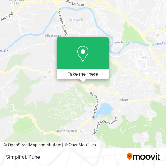
See Simplifai, Pune & Velhe, on the map
Public Transit to Simplifai in Pune & Velhe
Wondering how to get to Simplifai in Pune & Velhe? Moovit helps you find the best way to get to Simplifai with step-by-step directions from the nearest public transit station.
Moovit provides free maps and live directions to help you navigate through your city. View schedules, routes, timetables, and find out how long does it take to get to Simplifai in real time.
Looking for the nearest stop or station to Simplifai? Check out this list of stops closest to your destination: Suskhind Phata; Nanavare Chowk / Girme Park; Bhande Nagar Sus Road; Girme Park.
Bus: 115, 124, 30, 43, 43A, 44, 45, 77, 79, 258, 344A, 142, 87A, 142A, 87D, 344B.
Want to see if there’s another route that gets you there at an earlier time? Moovit helps you find alternative routes or times. Get directions from and directions to Simplifai easily from the Moovit App or Website.
We make riding to Simplifai easy, which is why over 1.5 million users, including users in Pune & Velhe, trust Moovit as the best app for public transit. You don’t need to download an individual bus app or train app, Moovit is your all-in-one transit app that helps you find the best bus time or train time available.
For information on prices of bus, costs and ride fares to Simplifai, please check the Moovit app.
Use the app to navigate to popular places including to the airport, hospital, stadium, grocery store, mall, coffee shop, school, college, and university.
Simplifai Address: पुणे 411045 MH street in Pune & Velhe
- Asec Engineers,
- Aioneers,
- Bank of Maharashtra,
- Valmet,
- Byjus,
- Global Port,
- Shrugo - the Design Studio,
- Divya Shanti Residency,
- Medicare Manage,
- Dr Varun Khandagale Gastroenterologist Clinic,
- Teerth Exchange,
- The Theka,
- Sunshine Pre-School,
- Geetank Multiwheels,
- Alfa Laval,
- Regal Spa,
- Sheesham Solid Wood Furniture,
- Mark Residency,
- Abhibus,
- National Institute of Virology
Places Near Simplifai (Pune & Velhe)
- Pvr Icon - Pavilion Mall, Pune & Velhe,
- Westend Mall, Pune & Velhe,
- ISKCON Pune, Pune & Velhe,
- Dagdusheth Halwai Ganpati Mandir, Pune & Velhe,
- Symbiosis Lavale Bus Stop, Pune & Velhe,
- Chaturshringi Temple, Pune & Velhe,
- Cognizant Deccan Campus (CDC), Paud,
- Fc Road, Pune & Velhe,
- Senapati Bapat Road, Pune & Velhe,
- ISKCON Nvcc Temple, Pune & Velhe,
- Swaminarayan Mandir, Pune & Velhe,
- Laxmi Road, Pune & Velhe,
- Ion Digital Zone, Pune & Velhe,
- BAPS Shri Swaminarayan Mandir, Pune & Velhe,
- Vishwakarma Institute Of Technology (Vit), Pune & Velhe,
- Sarasbaug, Pune & Velhe,
- Tulshibaug, Pune & Velhe,
- Pune Okayama Friendship Garden, Pune & Velhe,
- Dagadusheth Halwai Ganapati Temple, Pune & Velhe,
- M G Road, Pune & Velhe
How to get to popular places in Pune with public transit
Get around Pune & Velhe by public transit!
Traveling around Pune & Velhe has never been so easy. See step by step directions as you travel to any attraction, street or major public transit station. View bus and train schedules, arrival times, service alerts and detailed routes on a map, so you know exactly how to get to anywhere in Pune & Velhe.
When traveling to any destination around Pune & Velhe use Moovit's Live Directions with Get Off Notifications to know exactly where and how far to walk, how long to wait for your line, and how many stops are left. Moovit will alert you when it's time to get off — no need to constantly re-check whether yours is the next stop.
Wondering how to use public transit in Pune & Velhe or how to pay for public transit in Pune & Velhe? Moovit public transit app can help you navigate your way with public transit easily, and at minimum cost. It includes public transit fees, ticket prices, and costs. Looking for a map of Pune & Velhe public transit lines? Moovit public transit app shows all public transit maps in Pune & Velhe with all Bus, Train and Metro routes and stops on an interactive map.
Pune has 3 transit type(s), including: Bus, Train and Metro, operated by several transit agencies, including Pune Metro (Maha Metro), PMPML, PMPML Night Bus Service (Ratrani) and Central Railways (Indian Railways)