Directions to Simplified Solutions Insurance (Washington, D.C. - Baltimore, MD) with public transportation
The following transit lines have routes that pass near Simplified Solutions Insurance
 Bus: 1, 6, FLIXBUS N2601, 5.
- Train: NORTHEAST REGIONAL.
How to get to Simplified Solutions Insurance by bus?
Click on the bus route to see step by step directions with maps, line arrival times and updated time schedules.
From Busch Gardens Williamsburg (Employee Parking Lot), James City County
49 minFrom Lorton, VA, Fairfax County
593 minFrom Potomac Mills Mall, Prince William County
583 minFrom Hampton University, Hampton
230 minFrom Rose Gaming Resort, Prince William County
608 minFrom Woodbridge, VA, Prince William County
533 min
How to get to Simplified Solutions Insurance by train?
Click on the train route to see step by step directions with maps, line arrival times and updated time schedules.
Bus stop near Simplified Solutions Insurance in Washington, D.C. - Baltimore, MD
- Pilot Way at Taco Bell, 3 min walk,VIEW
Train station near Simplified Solutions Insurance in Washington, D.C. - Baltimore, MD
- Williamsburg Amtrak Station, 47 min walk,VIEW
Bus lines to Simplified Solutions Insurance in Washington, D.C. - Baltimore, MD
What are the closest stations to Simplified Solutions Insurance?
The closest stations to Simplified Solutions Insurance are:
- Pilot Way at Taco Bell is 231 yards away, 3 min walk.
- Williamsburg Amtrak Station is 4033 yards away, 47 min walk.
Which bus lines stop near Simplified Solutions Insurance?
These bus lines stop near Simplified Solutions Insurance: 1, 6, FLIXBUS N2601.
Which train line stops near Simplified Solutions Insurance?
NORTHEAST REGIONAL (Newport News)
What’s the nearest bus station to Simplified Solutions Insurance in Washington, D.C. - Baltimore, MD?
The nearest bus station to Simplified Solutions Insurance in Washington, D.C. - Baltimore, MD is Pilot Way at Taco Bell. It’s a 3 min walk away.
What time is the first train to Simplified Solutions Insurance in Washington, D.C. - Baltimore, MD?
The NORTHEAST REGIONAL is the first train that goes to Simplified Solutions Insurance in Washington, D.C. - Baltimore, MD. It stops nearby at 4:24 AM.
What time is the last train to Simplified Solutions Insurance in Washington, D.C. - Baltimore, MD?
The NORTHEAST REGIONAL is the last train that goes to Simplified Solutions Insurance in Washington, D.C. - Baltimore, MD. It stops nearby at 7:44 PM.
What time is the first bus to Simplified Solutions Insurance in Washington, D.C. - Baltimore, MD?
The 6 is the first bus that goes to Simplified Solutions Insurance in Washington, D.C. - Baltimore, MD. It stops nearby at 6:04 AM.
What time is the last bus to Simplified Solutions Insurance in Washington, D.C. - Baltimore, MD?
The 6 is the last bus that goes to Simplified Solutions Insurance in Washington, D.C. - Baltimore, MD. It stops nearby at 8:46 PM.
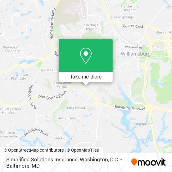
See Simplified Solutions Insurance, Washington, D.C. - Baltimore, MD, on the map
Public Transit to Simplified Solutions Insurance in Washington, D.C. - Baltimore, MD
Wondering how to get to Simplified Solutions Insurance in Washington, D.C. - Baltimore, MD? Moovit helps you find the best way to get to Simplified Solutions Insurance with step-by-step directions from the nearest public transit station.
Moovit provides free maps and live directions to help you navigate through your city. View schedules, routes, timetables, and find out how long does it take to get to Simplified Solutions Insurance in real time.
Looking for the nearest stop or station to Simplified Solutions Insurance? Check out this list of stops closest to your destination: Pilot Way at Taco Bell; Williamsburg Amtrak Station.
Bus: 1, 6, FLIXBUS N2601, 5.Train: NORTHEAST REGIONAL.
Want to see if there’s another route that gets you there at an earlier time? Moovit helps you find alternative routes or times. Get directions from and directions to Simplified Solutions Insurance easily from the Moovit App or Website.
We make riding to Simplified Solutions Insurance easy, which is why over 1.5 million users, including users in Washington, D.C. - Baltimore, MD, trust Moovit as the best app for public transit. You don’t need to download an individual bus app or train app, Moovit is your all-in-one transit app that helps you find the best bus time or train time available.
For information on prices of bus and train, costs and ride fares to Simplified Solutions Insurance, please check the Moovit app.
Use the app to navigate to popular places including to the airport, hospital, stadium, grocery store, mall, coffee shop, school, college, and university.
Simplified Solutions Insurance Address: 1101 Professional Dr Williamsburg, VA 23185 street in Washington, D.C. - Baltimore, MD
- Blossom Consulting and Engineers,
- Affordable Auto Insurance,
- Assessment & Counseling of Williamsburg,
- National Structural Steel,
- Cardinal Survey,
- Colby Cumber Colonial Realty,
- G Computer,
- State Farm,
- Rushby Chuck Pe Cxanalytics Williamsburg,
- 1st Class Real Estate,
- Dr Daniel G Jenkins Doctor of Medicine,
- Williamsburg Area Info,
- McNamara Karen E FNPC,
- Harmoney Hub,
- Emily F Roberson MD,
- Catalillies Play Cafe,
- Williamsburg Obstetrics & Gynecology PC,
- Kristy A Keller MD Facog,
- Roger W Jones MD,
- Swati S Adawadkar MD
Places Near Simplified Solutions Insurance (Washington, D.C. - Baltimore, MD)
- National Museum of African American History and Culture, Washington,
- Capital One Arena, Washington,
- National Mall, Washington,
- Washington DC VA Medical Center, Washington,
- Westfield Montgomery Mall, Montgomery County,
- Warner Theatre, Washington,
- Washington National Cathedral, Washington,
- Georgetown, Washington,
- Pennsylvania Ave NW (3rd st and pennsylvania), Washington,
- Amazon Hq2, Arlington County,
- Basilica of the National Shrine, Washington,
- M&T Bank Stadium, Baltimore,
- Camden Yards, Baltimore,
- Marriott Marquis Washington, DC, Washington,
- The Anthem, Washington,
- Rock Creek Tennis Center, Washington,
- Sibley Memorial Hospital, Washington,
- National Zoo, Washington,
- PG Mall, Prince George's County,
- Museum Of The Bible, Washington
How to get to popular places in Washington, D.C. - Baltimore, MD with public transit
Get around Washington, D.C. - Baltimore, MD by public transit!
Traveling around Washington, D.C. - Baltimore, MD has never been so easy. See step by step directions as you travel to any attraction, street or major public transit station. View bus and train schedules, arrival times, service alerts and detailed routes on a map, so you know exactly how to get to anywhere in Washington, D.C. - Baltimore, MD.
When traveling to any destination around Washington, D.C. - Baltimore, MD use Moovit's Live Directions with Get Off Notifications to know exactly where and how far to walk, how long to wait for your line, and how many stops are left. Moovit will alert you when it's time to get off — no need to constantly re-check whether yours is the next stop.
Wondering how to use public transit in Washington, D.C. - Baltimore, MD or how to pay for public transit in Washington, D.C. - Baltimore, MD? Moovit public transit app can help you navigate your way with public transit easily, and at minimum cost. It includes public transit fees, ticket prices, and costs. Looking for a map of Washington, D.C. - Baltimore, MD public transit lines? Moovit public transit app shows all public transit maps in Washington, D.C. - Baltimore, MD with all Bus, Train, Metro, Light Rail and Ferry routes and stops on an interactive map.
Washington, D.C. - Baltimore, MD has 5 transit type(s), including: Bus, Train, Metro, Light Rail and Ferry, operated by several transit agencies, including WMATA, Montgomery County Ride On, Fairfax Connector, TheBus, PRTC, DASH - Alexandria, Arlington Transit (ART), RTA of Central Maryland, MDOT MTA, MDOT MTA Light RailLink, MDOT MTA Commuter Bus, MDOT MTA Local Bus, FXBGO!, Virginia Railway Express (VRE) and MARC