How to get to Simulateur de Golf by bus?
Click on the bus route to see step by step directions with maps, line arrival times and updated time schedules.
From Nation, Paris
74 minFrom Rue Hélène et François Missoffe, Paris
86 minFrom Quartier Chinois, Paris
56 minFrom Hôpital Rothschild, Paris
80 minFrom Musée Guimet, Paris
46 minFrom Angelina, Paris
61 minFrom Edf Smartside, Saint-Ouen
88 minFrom 158 Boulevard Haussmann, Paris
54 minFrom Prison de la Santé, Paris
39 minFrom Conforama Nation, Paris
80 min
How to get to Simulateur de Golf by train?
Click on the train route to see step by step directions with maps, line arrival times and updated time schedules.
How to get to Simulateur de Golf by metro?
Click on the metro route to see step by step directions with maps, line arrival times and updated time schedules.
From Nation, Paris
55 minFrom Rue Hélène et François Missoffe, Paris
63 minFrom Quartier Chinois, Paris
65 minFrom Hôpital Rothschild, Paris
56 minFrom Musée Guimet, Paris
46 minFrom Angelina, Paris
49 minFrom Edf Smartside, Saint-Ouen
61 minFrom 158 Boulevard Haussmann, Paris
53 minFrom Prison de la Santé, Paris
45 minFrom Conforama Nation, Paris
65 min
Bus stops near Simulateur de Golf in Issy-Les-Moulineaux
Train station near Simulateur de Golf in Issy-Les-Moulineaux
- Clamart, 11 min walk,VIEW
Light Rail stations near Simulateur de Golf in Issy-Les-Moulineaux
- Jacques-Henri Lartigue, 11 min walk,VIEW
RER station near Simulateur de Golf in Issy-Les-Moulineaux
- Issy, 14 min walk,VIEW
Bus lines to Simulateur de Golf in Issy-Les-Moulineaux
What are the closest stations to Simulateur de Golf?
The closest stations to Simulateur de Golf are:
- Verdi is 164 meters away, 3 min walk.
- Général Guichard is 233 meters away, 4 min walk.
- Défense - Egalité is 365 meters away, 5 min walk.
- Clamart is 791 meters away, 11 min walk.
- Jacques-Henri Lartigue is 832 meters away, 11 min walk.
- Place John Fitzgerald Kennedy is 838 meters away, 11 min walk.
- Issy is 1100 meters away, 14 min walk.
Which train line stops near Simulateur de Golf?
N (Rambouillet/ Mantes-la-Jolie/ Dreux)
Which metro line stops near Simulateur de Golf?
12 (Front Populaire)
Which bus lines stop near Simulateur de Golf?
These bus lines stop near Simulateur de Golf: 169, 59.
What’s the nearest light rail station to Simulateur de Golf in Issy-Les-Moulineaux?
The nearest light rail station to Simulateur de Golf in Issy-Les-Moulineaux is Jacques-Henri Lartigue. It’s a 11 min walk away.
What’s the nearest train station to Simulateur de Golf in Issy-Les-Moulineaux?
The nearest train station to Simulateur de Golf in Issy-Les-Moulineaux is Clamart. It’s a 11 min walk away.
What’s the nearest bus station to Simulateur de Golf in Issy-Les-Moulineaux?
The nearest bus station to Simulateur de Golf in Issy-Les-Moulineaux is Verdi. It’s a 3 min walk away.
What’s the nearest RER station to Simulateur de Golf in Issy-Les-Moulineaux?
The nearest RER station to Simulateur de Golf in Issy-Les-Moulineaux is Issy. It’s a 14 min walk away.
What time is the first light rail to Simulateur de Golf in Issy-Les-Moulineaux?
The T2 is the first light rail that goes to Simulateur de Golf in Issy-Les-Moulineaux. It stops nearby at 6:02 AM.
What time is the last light rail to Simulateur de Golf in Issy-Les-Moulineaux?
The T2 is the last light rail that goes to Simulateur de Golf in Issy-Les-Moulineaux. It stops nearby at 1:34 AM.
What time is the first metro to Simulateur de Golf in Issy-Les-Moulineaux?
The 12 is the first metro that goes to Simulateur de Golf in Issy-Les-Moulineaux. It stops nearby at 5:30 AM.
What time is the last metro to Simulateur de Golf in Issy-Les-Moulineaux?
The 12 is the last metro that goes to Simulateur de Golf in Issy-Les-Moulineaux. It stops nearby at 10:41 PM.
What time is the first train to Simulateur de Golf in Issy-Les-Moulineaux?
The N is the first train that goes to Simulateur de Golf in Issy-Les-Moulineaux. It stops nearby at 5:27 AM.
What time is the last train to Simulateur de Golf in Issy-Les-Moulineaux?
The N is the last train that goes to Simulateur de Golf in Issy-Les-Moulineaux. It stops nearby at 1:12 AM.
What time is the first bus to Simulateur de Golf in Issy-Les-Moulineaux?
The 190 is the first bus that goes to Simulateur de Golf in Issy-Les-Moulineaux. It stops nearby at 6:32 AM.
What time is the last bus to Simulateur de Golf in Issy-Les-Moulineaux?
The 190 is the last bus that goes to Simulateur de Golf in Issy-Les-Moulineaux. It stops nearby at 12:08 AM.
What time is the first RER to Simulateur de Golf in Issy-Les-Moulineaux?
The C is the first RER that goes to Simulateur de Golf in Issy-Les-Moulineaux. It stops nearby at 5:12 AM.
What time is the last RER to Simulateur de Golf in Issy-Les-Moulineaux?
The C is the last RER that goes to Simulateur de Golf in Issy-Les-Moulineaux. It stops nearby at 12:20 AM.
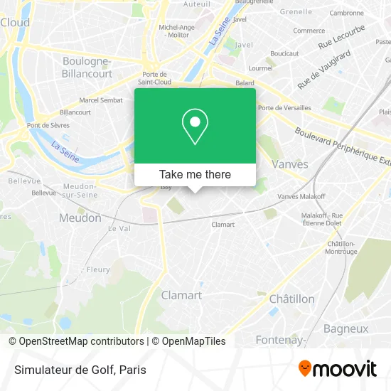
See Simulateur de Golf, Issy-Les-Moulineaux, on the map
Public Transit to Simulateur de Golf in Issy-Les-Moulineaux
Wondering how to get to Simulateur de Golf in Issy-Les-Moulineaux? Moovit helps you find the best way to get to Simulateur de Golf with step-by-step directions from the nearest public transit station.
Moovit provides free maps and live directions to help you navigate through your city. View schedules, routes, timetables, and find out how long does it take to get to Simulateur de Golf in real time.
Looking for the nearest stop or station to Simulateur de Golf? Check out this list of stops closest to your destination: Verdi; Général Guichard; Défense - Egalité; Clamart; Jacques-Henri Lartigue; Place John Fitzgerald Kennedy; Issy.
Train: N.RER: C.Metro: 12.Bus: 169, 59, TUVIM EP, 290, 190.
Want to see if there’s another route that gets you there at an earlier time? Moovit helps you find alternative routes or times. Get directions from and directions to Simulateur de Golf easily from the Moovit App or Website.
We make riding to Simulateur de Golf easy, which is why over 1.5 million users, including users in Issy-Les-Moulineaux, trust Moovit as the best app for public transit. You don’t need to download an individual bus app or train app, Moovit is your all-in-one transit app that helps you find the best bus time or train time available.
For information on prices of metro, bus, train and light rail, costs and ride fares to Simulateur de Golf, please check the Moovit app.
Use the app to navigate to popular places including to the airport, hospital, stadium, grocery store, mall, coffee shop, school, college, and university.
Simulateur de Golf Address: 60 Promenade du Verger 92130 Issy-les-Moulineaux street in Issy-Les-Moulineaux
- Escampette - Bistrot à Vins,
- Les Casemates,
- Wagy,
- Stade Alain Mimoun,
- Issy Volley,
- Gymnase Manouk Artinian,
- Passage Paul Assens,
- Bendjebbour Laurent,
- Maxime Ollivier,
- Juste Pour Son Sourire,
- Esplanade du Belvédère,
- 6 Rue Verdi,
- Manège Lady Pénélope,
- Gymnase Alain Mimoun,
- General Guichard,
- Miroir D'Eau,
- 54 bis Rue Rabelais,
- Yespark,
- 4 Allee du Puits,
- Rue Émile Duployé
Places Near Simulateur de Golf (Issy-Les-Moulineaux)
- Galeries Lafayette Haussmann, Paris,
- Hopital Lariboisière, Paris,
- Hôpital Necker, Paris,
- Hôpital Saint-Joseph, Paris,
- Hôpital Henri Mondor, Creteil,
- Hôpital de la Pitié-Salpêtrière, Paris,
- Théâtre Mogador, Paris,
- Atelier Des Lumieres, Paris,
- Beaugrenelle, Paris,
- Hôpital Cochin, Paris,
- Hôpital Beaujon, Clichy,
- Hopital Foch, Suresnes,
- 29 Rue Manin, Paris,
- Fondation Louis Vuitton, Paris,
- Gare Routière Flixbus, Paris,
- Créteil Soleil, Creteil,
- Hôpital Pitié Salpêtrière, Paris,
- Marché Saint-Pierre, Paris,
- Centre Hospitalier des 15/20, Paris,
- Galeries Lafayette, Paris
How to get to popular places in Paris with public transit
Get around Issy-Les-Moulineaux by public transit!
Traveling around Issy-Les-Moulineaux has never been so easy. See step by step directions as you travel to any attraction, street or major public transit station. View bus and train schedules, arrival times, service alerts and detailed routes on a map, so you know exactly how to get to anywhere in Issy-Les-Moulineaux.
When traveling to any destination around Issy-Les-Moulineaux use Moovit's Live Directions with Get Off Notifications to know exactly where and how far to walk, how long to wait for your line, and how many stops are left. Moovit will alert you when it's time to get off — no need to constantly re-check whether yours is the next stop.
Wondering how to use public transit in Issy-Les-Moulineaux or how to pay for public transit in Issy-Les-Moulineaux? Moovit public transit app can help you navigate your way with public transit easily, and at minimum cost. It includes public transit fees, ticket prices, and costs. Looking for a map of Issy-Les-Moulineaux public transit lines? Moovit public transit app shows all public transit maps in Issy-Les-Moulineaux with all Bus, Train, Metro, Light Rail, RER, Funicular and Gondola routes and stops on an interactive map.
Paris has 7 transit type(s), including: Bus, Train, Metro, Light Rail, RER, Funicular and Gondola, operated by several transit agencies, including RATP, RER, RER Bus de remplacement, Train, Train Bus de remplacement, Tramway Bus de remplacement, TER, ADP, Magical Shuttle, Argenteuil - Boucles de Seine, Autocars Dominique, Bièvre, Brie et 2 Morin, Le Bus - C.C. du Clermontois and Cœur d’Essonne