How to get to Sinclair & Erdman by bus?
Click on the bus route to see step by step directions with maps, line arrival times and updated time schedules.
From Port of Baltimore - Cruise Maryland Terminal, Baltimore
57 minFrom Saint Agnes Hospital, Baltimore
63 minFrom Towson, MD, Baltimore County
56 minFrom M&T Bank Stadium, Baltimore
47 minFrom Mondawmin Mall, Baltimore
44 minFrom Baltimore Polytechnic Institute, Baltimore
47 minFrom White Marsh Mall, Baltimore County
55 minFrom Federal Hill, Baltimore
36 minFrom Towson Town Center, Baltimore County
59 minFrom Pimlico Race Course, Baltimore
64 min
How to get to Sinclair & Erdman by metro?
Click on the metro route to see step by step directions with maps, line arrival times and updated time schedules.
Bus stops near Sinclair & Erdman in Baltimore
Metro station near Sinclair & Erdman in Baltimore
- Johns Hopkins Metro, 20 min walk,VIEW
Train stations near Sinclair & Erdman in Baltimore
Ferry station near Sinclair & Erdman in Baltimore
- Canton Waterfront Park, 30 min walk,VIEW
Bus lines to Sinclair & Erdman in Baltimore
What are the closest stations to Sinclair & Erdman?
The closest stations to Sinclair & Erdman are:
- Sinclair Ln & Erdman Ave FS Eb is 45 yards away, 1 min walk.
- Erdman Ave & Sinclair Lane Nb is 106 yards away, 2 min walk.
- Erdman Ave & Enoch Pratt Library Center is 232 yards away, 3 min walk.
- Edison Hwy & Sinclair Ln FS Nb is 641 yards away, 8 min walk.
- Johns Hopkins Metro is 1679 yards away, 20 min walk.
- Penn Station Marc Sb is 2007 yards away, 24 min walk.
- Canton Waterfront Park is 2524 yards away, 30 min walk.
- Baltimore Penn Station is 5172 yards away, 61 min walk.
Which bus lines stop near Sinclair & Erdman?
These bus lines stop near Sinclair & Erdman: 22, 63, CITYLINK PINK.
Which metro line stops near Sinclair & Erdman?
METRO (Towards John Hopkins)
What’s the nearest metro station to Sinclair & Erdman in Baltimore?
The nearest metro station to Sinclair & Erdman in Baltimore is Johns Hopkins Metro. It’s a 20 min walk away.
What’s the nearest train station to Sinclair & Erdman in Baltimore?
The nearest train station to Sinclair & Erdman in Baltimore is Penn Station Marc Sb. It’s a 24 min walk away.
What’s the nearest bus station to Sinclair & Erdman in Baltimore?
The nearest bus station to Sinclair & Erdman in Baltimore is Sinclair Ln & Erdman Ave FS Eb. It’s a 1 min walk away.
What’s the nearest ferry station to Sinclair & Erdman in Baltimore?
The nearest ferry station to Sinclair & Erdman in Baltimore is Canton Waterfront Park. It’s a 30 min walk away.
What time is the first metro to Sinclair & Erdman in Baltimore?
The METRO is the first metro that goes to Sinclair & Erdman in Baltimore. It stops nearby at 4:21 AM.
What time is the last metro to Sinclair & Erdman in Baltimore?
The METRO is the last metro that goes to Sinclair & Erdman in Baltimore. It stops nearby at 12:29 AM.
What time is the first train to Sinclair & Erdman in Baltimore?
The MARC is the first train that goes to Sinclair & Erdman in Baltimore. It stops nearby at 4:30 AM.
What time is the last train to Sinclair & Erdman in Baltimore?
The SILVER METEOR is the last train that goes to Sinclair & Erdman in Baltimore. It stops nearby at 7:57 AM.
What time is the first bus to Sinclair & Erdman in Baltimore?
The CITYLINK PINK is the first bus that goes to Sinclair & Erdman in Baltimore. It stops nearby at 3:04 AM.
What time is the last bus to Sinclair & Erdman in Baltimore?
The CITYLINK PINK is the last bus that goes to Sinclair & Erdman in Baltimore. It stops nearby at 3:16 AM.
What time is the first ferry to Sinclair & Erdman in Baltimore?
The HC2 is the first ferry that goes to Sinclair & Erdman in Baltimore. It stops nearby at 6:00 AM.
What time is the last ferry to Sinclair & Erdman in Baltimore?
The HC2 is the last ferry that goes to Sinclair & Erdman in Baltimore. It stops nearby at 8:00 PM.
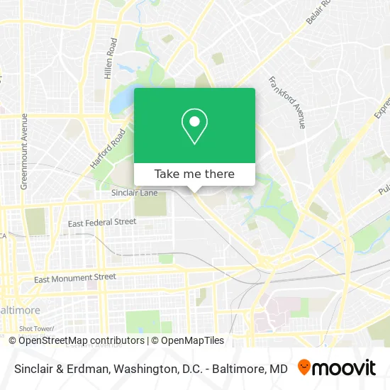
See Sinclair & Erdman, Baltimore, on the map
Public Transit to Sinclair & Erdman in Baltimore
Wondering how to get to Sinclair & Erdman in Baltimore? Moovit helps you find the best way to get to Sinclair & Erdman with step-by-step directions from the nearest public transit station.
Moovit provides free maps and live directions to help you navigate through your city. View schedules, routes, timetables, and find out how long does it take to get to Sinclair & Erdman in real time.
Looking for the nearest stop or station to Sinclair & Erdman? Check out this list of stops closest to your destination: Sinclair Ln & Erdman Ave FS Eb; Erdman Ave & Sinclair Lane Nb; Erdman Ave & Enoch Pratt Library Center; Edison Hwy & Sinclair Ln FS Nb; Johns Hopkins Metro; Penn Station Marc Sb; Canton Waterfront Park; Baltimore Penn Station.
Bus: 22, 63, CITYLINK PINK, 105, 59.Train: MARC, ACELA, CARDINAL, CAROLINIAN, CRESCENT, NORTHEAST REGIONAL.Metro: METRO.Ferry: HC2.
Want to see if there’s another route that gets you there at an earlier time? Moovit helps you find alternative routes or times. Get directions from and directions to Sinclair & Erdman easily from the Moovit App or Website.
We make riding to Sinclair & Erdman easy, which is why over 1.5 million users, including users in Baltimore, trust Moovit as the best app for public transit. You don’t need to download an individual bus app or train app, Moovit is your all-in-one transit app that helps you find the best bus time or train time available.
For information on prices of bus, metro and light rail, costs and ride fares to Sinclair & Erdman, please check the Moovit app.
Use the app to navigate to popular places including to the airport, hospital, stadium, grocery store, mall, coffee shop, school, college, and university.
Location: Baltimore, Washington, D.C. - Baltimore, MD
- SHOE CITY,
- Archbishop Curley High School (High School Admissions),
- Gerald's Family Daycare,
- Wine & Spirits,
- S-Star Car Wash - Auto,
- Hope Academy,
- Blue Star Home & Design,
- Catholic High School (The Catholic HS of Baltimore),
- Brothers,
- Mi Rinconcito Latino,
- Upholstery Cleaning Near Me Carpet Cleaning,
- Edison Hwy (edison highway and federal street),
- Edison E Federal St,
- Amazon Locker-Miriana,
- Raven Process Service,
- Wild Leaf,
- National Western Life,
- Wildpack Beverage,
- Forman Mills,
- Cliftmont Avenue Wesleyan Church
Places Near Sinclair & Erdman (Baltimore)
- National Mall, Washington,
- Warner Theatre, Washington,
- Pennsylvania Ave NW (3rd st and pennsylvania), Washington,
- National Museum of African American History and Culture, Washington,
- Museum Of The Bible, Washington,
- Basilica of the National Shrine, Washington,
- Sibley Memorial Hospital, Washington,
- M&T Bank Stadium, Baltimore,
- PG Mall, Prince George's County,
- Georgetown, Washington,
- Washington DC VA Medical Center, Washington,
- The Anthem, Washington,
- Marriott Marquis Washington, DC, Washington,
- Capital One Arena, Washington,
- Westfield Montgomery Mall, Montgomery County,
- Washington National Cathedral, Washington,
- National Zoo, Washington,
- Rock Creek Tennis Center, Washington,
- Camden Yards, Baltimore,
- Amazon Hq2, Arlington County
How to get to popular places in Washington, D.C. - Baltimore, MD with public transit
Get around Baltimore by public transit!
Traveling around Baltimore has never been so easy. See step by step directions as you travel to any attraction, street or major public transit station. View bus and train schedules, arrival times, service alerts and detailed routes on a map, so you know exactly how to get to anywhere in Baltimore.
When traveling to any destination around Baltimore use Moovit's Live Directions with Get Off Notifications to know exactly where and how far to walk, how long to wait for your line, and how many stops are left. Moovit will alert you when it's time to get off — no need to constantly re-check whether yours is the next stop.
Wondering how to use public transit in Baltimore or how to pay for public transit in Baltimore? Moovit public transit app can help you navigate your way with public transit easily, and at minimum cost. It includes public transit fees, ticket prices, and costs. Looking for a map of Baltimore public transit lines? Moovit public transit app shows all public transit maps in Baltimore with all Bus, Train, Metro, Light Rail and Ferry routes and stops on an interactive map.
Washington, D.C. - Baltimore, MD has 5 transit type(s), including: Bus, Train, Metro, Light Rail and Ferry, operated by several transit agencies, including WMATA, Montgomery County Ride On, Fairfax Connector, TheBus, PRTC, DASH - Alexandria, Arlington Transit (ART), RTA of Central Maryland, MDOT MTA, MDOT MTA Light RailLink, MDOT MTA Commuter Bus, MDOT MTA Local Bus, FXBGO!, Virginia Railway Express (VRE) and MARC