Directions to Single Black (Baltimore) with public transportation
The following transit lines have routes that pass near Single Black
 Bus: CITYLINK PURPLE, 34.
- Train: MARC.
How to get to Single Black by bus?
Click on the bus route to see step by step directions with maps, line arrival times and updated time schedules.
From MVA Glen Burnie, Anne Arundel County
60 minFrom Western High School, Baltimore
67 minFrom Canton, Baltimore
54 minFrom Baltimore Poly Tech High School, Baltimore
68 minFrom Social Security Administration, Baltimore
29 minFrom Morgan State University, Baltimore
65 minFrom Walmart, Baltimore County
26 minFrom Harford Road, Baltimore
48 minFrom The Johns Hopkins Hospital, Baltimore
47 minFrom Loyola University Maryland, Baltimore
60 min
Bus stop near Single Black in Baltimore
- Frederick Ave & Tremont Rd Wb, 2 min walk,VIEW
Train station near Single Black in Baltimore
- Halethorpe Marc Sb, 26 min walk,VIEW
What are the closest stations to Single Black?
The closest stations to Single Black are:
- Frederick Ave & Tremont Rd Wb is 117 yards away, 2 min walk.
- Halethorpe Marc Sb is 2181 yards away, 26 min walk.
Which bus line stops near Single Black?
CITYLINK PURPLE (Catonsville)
What’s the nearest train station to Single Black in Baltimore?
The nearest train station to Single Black in Baltimore is Halethorpe Marc Sb. It’s a 26 min walk away.
What’s the nearest bus station to Single Black in Baltimore?
The nearest bus station to Single Black in Baltimore is Frederick Ave & Tremont Rd Wb. It’s a 2 min walk away.
What time is the first train to Single Black in Baltimore?
The MARC is the first train that goes to Single Black in Baltimore. It stops nearby at 4:46 AM.
What time is the last train to Single Black in Baltimore?
The MARC is the last train that goes to Single Black in Baltimore. It stops nearby at 10:46 PM.
What time is the first bus to Single Black in Baltimore?
The CITYLINK PURPLE is the first bus that goes to Single Black in Baltimore. It stops nearby at 4:13 AM.
What time is the last bus to Single Black in Baltimore?
The CITYLINK PURPLE is the last bus that goes to Single Black in Baltimore. It stops nearby at 2:40 AM.
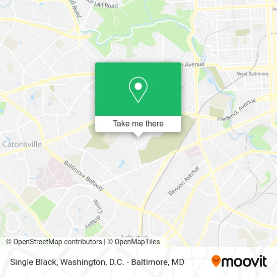
See Single Black, Baltimore, on the map
Public Transit to Single Black in Baltimore
Wondering how to get to Single Black in Baltimore? Moovit helps you find the best way to get to Single Black with step-by-step directions from the nearest public transit station.
Moovit provides free maps and live directions to help you navigate through your city. View schedules, routes, timetables, and find out how long does it take to get to Single Black in real time.
Looking for the nearest stop or station to Single Black? Check out this list of stops closest to your destination: Frederick Ave & Tremont Rd Wb; Halethorpe Marc Sb.
Bus: CITYLINK PURPLE, 34.Train: MARC.
Want to see if there’s another route that gets you there at an earlier time? Moovit helps you find alternative routes or times. Get directions from and directions to Single Black easily from the Moovit App or Website.
We make riding to Single Black easy, which is why over 1.7 million users, including users in Baltimore, trust Moovit as the best app for public transit. You don’t need to download an individual bus app or train app, Moovit is your all-in-one transit app that helps you find the best bus time or train time available.
For information on prices of bus, light rail and metro, costs and ride fares to Single Black, please check the Moovit app.
Use the app to navigate to popular places including to the airport, hospital, stadium, grocery store, mall, coffee shop, school, college, and university.
Single Black Address: 547 Lucia Ave Baltimore, MD 21229 street in Baltimore
- Norwood Heights,
- Norwood Heights, Maryland,
- Rol-Ros Professional Group,
- Green City Landscaping,
- Metro Delta Yubi Head Start,
- CH Home Health Services,
- Shans Christian Child Care,
- Yale Heights,
- The Apostolic Network of International Churches and Ministries,
- Christian Life Bible College,
- Life Changing Ministries,
- Myspeedyx,
- Brisbane Rd & Melbourne Rd,
- Regional Management,
- Mulu Tax & Accounting Solutions,
- Beechfield,
- Peculiar Treazures,
- Roadrunner Roadside,
- MR. Mervilus Speedy Lawn Service,
- Shipley David Rev & Delores
Places Near Single Black (Baltimore)
- PG Mall, Prince George's County,
- Washington DC VA Medical Center, Washington,
- Capital One Arena, Washington,
- Warner Theatre, Washington,
- National Theatre, Washington,
- The Anthem, Washington,
- Westfield Montgomery Mall, Montgomery County,
- Camden Yards, Baltimore,
- Marriott Marquis Washington, DC, Washington,
- Sibley Memorial Hospital, Washington,
- Washington National Cathedral, Washington,
- Georgetown, Washington,
- M&T Bank Stadium, Baltimore,
- Rock Creek Tennis Center, Washington,
- Pennsylvania Ave NW (3rd st and pennsylvania), Washington,
- National Museum of African American History and Culture, Washington,
- Basilica of the National Shrine, Washington,
- Amazon Hq2, Arlington County,
- National Zoo, Washington,
- Museum Of The Bible, Washington
How to get to popular places in Washington, D.C. - Baltimore, MD with public transit
Get around Baltimore by public transit!
Traveling around Baltimore has never been so easy. See step by step directions as you travel to any attraction, street or major public transit station. View bus and train schedules, arrival times, service alerts and detailed routes on a map, so you know exactly how to get to anywhere in Baltimore.
When traveling to any destination around Baltimore use Moovit's Live Directions with Get Off Notifications to know exactly where and how far to walk, how long to wait for your line, and how many stops are left. Moovit will alert you when it's time to get off — no need to constantly re-check whether yours is the next stop.
Wondering how to use public transit in Baltimore or how to pay for public transit in Baltimore? Moovit public transit app can help you navigate your way with public transit easily, and at minimum cost. It includes public transit fees, ticket prices, and costs. Looking for a map of Baltimore public transit lines? Moovit public transit app shows all public transit maps in Baltimore with all Bus, Train, Metro, Light Rail and Ferry routes and stops on an interactive map.
Washington, D.C. - Baltimore, MD has 5 transit type(s), including: Bus, Train, Metro, Light Rail and Ferry, operated by several transit agencies, including WMATA, Montgomery County Ride On, Fairfax Connector, TheBus, PRTC, DASH - Alexandria, Arlington Transit (ART), RTA of Central Maryland, MDOT MTA, MDOT MTA Light RailLink, MDOT MTA Commuter Bus, MDOT MTA Local Bus, FXBGO!, Virginia Railway Express (VRE) and MARC