How to get to Sinner (Durmersh. Str.) by bus?
Click on the bus route to see step by step directions with maps, line arrival times and updated time schedules.
How to get to Sinner (Durmersh. Str.) by train?
Click on the train route to see step by step directions with maps, line arrival times and updated time schedules.
From Karlsruher Straße, Pforzheim
95 minFrom Rkh Kliniken, Verwaltungsgemeinschaft Bretten
72 minFrom Schloss Neuenbürg, Verwaltungsgemeinschaft Neuenbürg
94 minFrom POCO Einrichtungsmärkte, Pforzheim
96 minFrom Hopfenschlingel, Vereinbarte Verwaltungsgemeinschaft Rastatt
60 minFrom Arcus Klinik, Pforzheim
92 minFrom Waldbronn Eistreff, Waldbronn
89 minFrom Kaufland Pforzheim Wilhelm-Becker-Str., Pforzheim
90 min
Train stations near Sinner (Durmersh. Str.) in Stuttgart
Bus stops near Sinner (Durmersh. Str.) in Stuttgart
Light Rail stations near Sinner (Durmersh. Str.) in Stuttgart
- Karlsruhe Eckenerstraße, 9 min walk,VIEW
Bus lines to Sinner (Durmersh. Str.) in Stuttgart
- 60, Karlsruhe Entenfang - Karlsruhe Staufenbergweg,VIEW
- 62, Karlsruhe Entenfang - KA Hauptbahnhof (Vorplatz),VIEW
- NL15, Karlsruhe Entenfang - Karlsruhe Entenfang,VIEW
- 60, Karlsruhe Entenfang,VIEW
- 62, Karlsruhe Hauptbahnhof (Vorplatz) Bstg B - Karlsruhe Entenfang Bstg E,VIEW
- ALT62, Karlsruhe Hardecksiedlung Bstg A - Karlsruhe Entenfang Bstg E,VIEW
- ALT62, Karlsruhe Entenfang,VIEW
- NL15, Karlsruhe Entenfang,VIEW
What are the closest stations to Sinner (Durmersh. Str.)?
The closest stations to Sinner (Durmersh. Str.) are:
- Karlsruhe West Gleis 1 is 298 meters away, 4 min walk.
- Karlsruhe West is 298 meters away, 4 min walk.
- Grünwinkel Friedhof is 309 meters away, 5 min walk.
- Karlsruhe Andreas-Hofer-Straße Bstg A is 329 meters away, 5 min walk.
- Karlsruhe Durmersheimer Straße Bstg A is 333 meters away, 5 min walk.
- Karlsruhe Durmersheimer Straße is 347 meters away, 5 min walk.
- Karlsruhe Durmersheimer Straße Bstg B is 377 meters away, 5 min walk.
- Karlsruhe Eckenerstraße is 640 meters away, 9 min walk.
Which train lines stop near Sinner (Durmersh. Str.)?
These train lines stop near Sinner (Durmersh. Str.): RB51, S2, S53.
Which bus lines stop near Sinner (Durmersh. Str.)?
These bus lines stop near Sinner (Durmersh. Str.): 106, 62.
What’s the nearest light rail station to Sinner (Durmersh. Str.) in Stuttgart?
The nearest light rail station to Sinner (Durmersh. Str.) in Stuttgart is Karlsruhe Eckenerstraße. It’s a 9 min walk away.
What’s the nearest train station to Sinner (Durmersh. Str.) in Stuttgart?
The nearest train stations to Sinner (Durmersh. Str.) in Stuttgart are Karlsruhe West Gleis 1 and Karlsruhe West. The closest one is a 4 min walk away.
What’s the nearest bus station to Sinner (Durmersh. Str.) in Stuttgart?
The nearest bus stations to Sinner (Durmersh. Str.) in Stuttgart are Grünwinkel Friedhof, Karlsruhe Andreas-Hofer-Straße Bstg A, Karlsruhe Durmersheimer Straße Bstg A, Karlsruhe Durmersheimer Straße and Karlsruhe Durmersheimer Straße Bstg B. The closest one is a 5 min walk away.
What time is the first light rail to Sinner (Durmersh. Str.) in Stuttgart?
The E is the first light rail that goes to Sinner (Durmersh. Str.) in Stuttgart. It stops nearby at 3:52 AM.
What time is the last light rail to Sinner (Durmersh. Str.) in Stuttgart?
The E is the last light rail that goes to Sinner (Durmersh. Str.) in Stuttgart. It stops nearby at 1:58 AM.
What time is the first train to Sinner (Durmersh. Str.) in Stuttgart?
The S2 is the first train that goes to Sinner (Durmersh. Str.) in Stuttgart. It stops nearby at 4:12 AM.
What time is the last train to Sinner (Durmersh. Str.) in Stuttgart?
The S2 is the last train that goes to Sinner (Durmersh. Str.) in Stuttgart. It stops nearby at 1:15 AM.
What time is the first bus to Sinner (Durmersh. Str.) in Stuttgart?
The ALT62 is the first bus that goes to Sinner (Durmersh. Str.) in Stuttgart. It stops nearby at 4:09 AM.
What time is the last bus to Sinner (Durmersh. Str.) in Stuttgart?
The 62 is the last bus that goes to Sinner (Durmersh. Str.) in Stuttgart. It stops nearby at 12:57 AM.
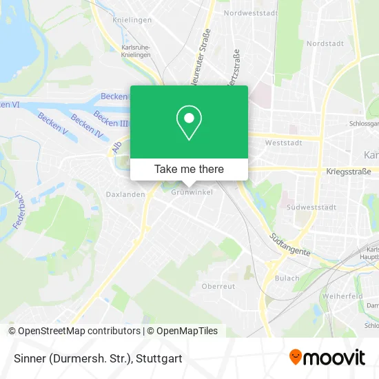
See Sinner (Durmersh. Str.), Stuttgart, on the map
Public Transit to Sinner (Durmersh. Str.) in Stuttgart
Wondering how to get to Sinner (Durmersh. Str.) in Stuttgart? Moovit helps you find the best way to get to Sinner (Durmersh. Str.) with step-by-step directions from the nearest public transit station.
Moovit provides free maps and live directions to help you navigate through your city. View schedules, routes, timetables, and find out how long does it take to get to Sinner (Durmersh. Str.) in real time.
Looking for the nearest stop or station to Sinner (Durmersh. Str.)? Check out this list of stops closest to your destination: Karlsruhe West Gleis 1; Karlsruhe West; Grünwinkel Friedhof; Karlsruhe Andreas-Hofer-Straße Bstg A; Karlsruhe Durmersheimer Straße Bstg A; Karlsruhe Durmersheimer Straße; Karlsruhe Durmersheimer Straße Bstg B; Karlsruhe Eckenerstraße.
Train: RB51, S2, S53, RE6, S52, RB54, S52, 3, E.Bus: 106, 62, 60, NL15, 60, ALT62.
Want to see if there’s another route that gets you there at an earlier time? Moovit helps you find alternative routes or times. Get directions from and directions to Sinner (Durmersh. Str.) easily from the Moovit App or Website.
We make riding to Sinner (Durmersh. Str.) easy, which is why over 1.7 million users, including users in Stuttgart, trust Moovit as the best app for public transit. You don’t need to download an individual bus app or train app, Moovit is your all-in-one transit app that helps you find the best bus time or train time available.
For information on prices of bus, train and light rail, costs and ride fares to Sinner (Durmersh. Str.), please check the Moovit app.
Use the app to navigate to popular places including to the airport, hospital, stadium, grocery store, mall, coffee shop, school, college, and university.
Sinner (Durmersh. Str.) Address: Durmersheimer Straße 55 Grünwinkel, 76185 Karlsruhe street in Stuttgart
- Futureoffice. Wir Gestalten Zukunftsräume.,
- De,
- Lexcon,
- Loreical,
- Wurstersteuerrecht,
- Eyeworkers Interactive,
- Wurster Dr. und Partner Wirtschaftsprüfer und Steuerberater,
- Polizeiposten Grünwinkel-Daxlanden,
- Wurster Hausverwaltung,
- Softec,
- Ergo Versicherung Mustafa Altun,
- Ferchau,
- Mawuka Steuerberatungs,
- AVG,
- Zusage König & Oesterle,
- Bankai Architekten,
- Fkp Architekten,
- Katharina Anna Huber,
- Impressum Datenschutz,
- Gaming2
Places Near Sinner (Durmersh. Str.) (Stuttgart)
- Porsche-Arena, Bad Cannstatt,
- Pariser Platz Stuttgart, Stuttgart-Mitte,
- Gleis 101/102 (tief), Stuttgart-Mitte,
- Geilhaus Haus 33a, Reutlingen-Betzingen,
- Gasometer Pforzheim, Pforzheim,
- Klinikum Stuttgart - Katharinenhospital, Stuttgart-Mitte,
- SI-Centrum, Möhringen,
- Mettingen Eros-Center Puff Laufhaus, Esslingen Am Neckar,
- Wilhelma (U-Bahn Wilhelma), Bad Cannstatt,
- Porsche Museum, Zuffenhausen,
- Marmorsaal Im Weissenburgpark, Stuttgart-Süd,
- FlixBus Haltestelle, Stuttgart,
- Im Wizemann (Halle), Bad Cannstatt,
- Mercedes-Benz Museum (Mercedes Museum Stuttgart), Bad Cannstatt,
- Waldfriedhof, Degerloch,
- Schleyerhalle, Bad Cannstatt,
- Hanns-Martin-Schleyer-Halle (Stuttgart Hans-Martin-Schleyerhalle), Bad Cannstatt,
- Hauptbahnhof Stuttgart, Stuttgart-Mitte,
- Hanns-Martin-Schleyer-Halle, Bad Cannstatt,
- Mercedes-Benz Museum, Bad Cannstatt
How to get to popular places in Stuttgart with public transit
Get around Stuttgart by public transit!
Traveling around Stuttgart has never been so easy. See step by step directions as you travel to any attraction, street or major public transit station. View bus and train schedules, arrival times, service alerts and detailed routes on a map, so you know exactly how to get to anywhere in Stuttgart.
When traveling to any destination around Stuttgart use Moovit's Live Directions with Get Off Notifications to know exactly where and how far to walk, how long to wait for your line, and how many stops are left. Moovit will alert you when it's time to get off — no need to constantly re-check whether yours is the next stop.
Wondering how to use public transit in Stuttgart or how to pay for public transit in Stuttgart? Moovit public transit app can help you navigate your way with public transit easily, and at minimum cost. It includes public transit fees, ticket prices, and costs. Looking for a map of Stuttgart public transit lines? Moovit public transit app shows all public transit maps in Stuttgart with all Bus, Train, Subway, Light Rail, Ferry, S-Bahn and Funicular routes and stops on an interactive map.
Stuttgart has 7 transit type(s), including: Bus, Train, Subway, Light Rail, Ferry, S-Bahn and Funicular, operated by several transit agencies, including SSB - Stadtbahn, SSB, SSB - Seilbahn / Zacke, S-Bahn Stuttgart, Rhein-Neckar-Verkehr GmbH (rnv), Karlsruher Verkehrsverbund, DB AG, DB Regiobus BW, Arverio Baden-Württemberg GmbH, DB RegioNetz Verkehrs GmbH Westfrankenbahn, DB Regio AG Baden-Württemberg, Südwestdeutsche Verkehrs-AG, DB Regio AG Mitte Region Hessen, DB and Bodensee-Oberschwaben-Bahn