Directions to Six Flags - New England (Boston) with public transportation
The following transit lines have routes that pass near Six Flags - New England
 Bus: G73E, GREYHOUND US0171, PETER PAN, B17, B6.
- Train: LAKE SHORE LIMITED, VERMONTER, AMTRAK HARTFORD LINE, NORTHEAST REGIONAL, VALLEY FLYER.
How to get to Six Flags - New England by bus?
Click on the bus route to see step by step directions with maps, line arrival times and updated time schedules.
From Foxwoods, Worcester
111 minFrom Worcester, MA, Worcester
81 minFrom Dcu Center, Worcester
83 minFrom Palladium, Worcester
86 minFrom Walmart Supercenter, Worcester
140 minFrom South High Community School, Worcester
178 minFrom Polar Park, Worcester
83 minFrom Registry Of Motor Vehicles (Rmv) Branch Office, Worcester
85 min
How to get to Six Flags - New England by train?
Click on the train route to see step by step directions with maps, line arrival times and updated time schedules.
Bus stops near Six Flags - New England in Boston
Train station near Six Flags - New England in Boston
- Springfield, 63 min walk,VIEW
Bus lines to Six Flags - New England in Boston
- B17, 16 Acres Via Wilbraham Rd / Worthington St,VIEW
- B6, Ludlow via Bay St,VIEW
- B7, Wilbraham Big Y-State St-Boston Rd,VIEW
- G1, Chicopee / Sumner-Allen-Canon Circle,VIEW
- G2, Carew-East Springfield / Belmont-Dwight Rd,VIEW
- G3, Spfld Plaza via Liberty / King-Westford,VIEW
- G5, Dickinson-Jewish Home-Longmeadow,VIEW
- R10, Westfield/West Springfield via Route 20,VIEW
- R14, Feeding Hills-Springfield,VIEW
- T1, Tripper 1 Helper Service,VIEW
- T2, Tripper 2 Helper Service,VIEW
- T3, Tripper 3 Helper Service,VIEW
- T4, Tripper 4 Helper Service,VIEW
- T5, Tripper 5 Helper Service,VIEW
- T6, Tripper 6 Helper Service,VIEW
- T92, Tripper 92 Helper Service,VIEW
- X90, Inner Crosstown,VIEW
- X92, Mid City Crosstown,VIEW
- T21, State Street Blunt Park Rd. To Bay Street,VIEW
- PETER PAN, AMHERST - NORTHAMPTON - SPRINGFIELD - HARTFORD - NEW YORK Express Service,VIEW
What are the closest stations to Six Flags - New England?
The closest stations to Six Flags - New England are:
- Worthington / Stearns is 40 yards away, 1 min walk.
- Main / Worthington is 152 yards away, 2 min walk.
- Main / Bridge is 224 yards away, 3 min walk.
- Union Station Springfield is 429 yards away, 6 min walk.
- Springfield Union Station is 443 yards away, 6 min walk.
- Springfield is 5357 yards away, 63 min walk.
Which bus lines stop near Six Flags - New England?
These bus lines stop near Six Flags - New England: G73E, GREYHOUND US0171, PETER PAN.
Which train lines stop near Six Flags - New England?
These train lines stop near Six Flags - New England: LAKE SHORE LIMITED, VERMONTER.
What’s the nearest bus station to Six Flags - New England in Boston?
The nearest bus station to Six Flags - New England in Boston is Worthington / Stearns. It’s a 1 min walk away.
What time is the first train to Six Flags - New England in Boston?
The NORTHEAST REGIONAL is the first train that goes to Six Flags - New England in Boston. It stops nearby at 4:10 AM.
What time is the last train to Six Flags - New England in Boston?
The LAKE SHORE LIMITED is the last train that goes to Six Flags - New England in Boston. It stops nearby at 6:04 PM.
What time is the first bus to Six Flags - New England in Boston?
The FLIXBUS N2615 is the first bus that goes to Six Flags - New England in Boston. It stops nearby at 3:00 AM.
What time is the last bus to Six Flags - New England in Boston?
The FLIXBUS N2605 is the last bus that goes to Six Flags - New England in Boston. It stops nearby at 5:40 AM.
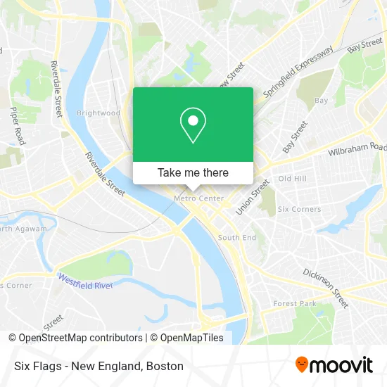
See Six Flags - New England, Boston, on the map
Public Transit to Six Flags - New England in Boston
Wondering how to get to Six Flags - New England in Boston? Moovit helps you find the best way to get to Six Flags - New England with step-by-step directions from the nearest public transit station.
Moovit provides free maps and live directions to help you navigate through your city. View schedules, routes, timetables, and find out how long does it take to get to Six Flags - New England in real time.
Looking for the nearest stop or station to Six Flags - New England? Check out this list of stops closest to your destination: Worthington / Stearns; Main / Worthington; Main / Bridge; Union Station Springfield; Springfield Union Station; Springfield.
Bus: G73E, GREYHOUND US0171, PETER PAN, B17, B6, B7, G1, G2, G3, T21, B4, B12, P20, P21.Train: LAKE SHORE LIMITED, VERMONTER, AMTRAK HARTFORD LINE, NORTHEAST REGIONAL, VALLEY FLYER.
Want to see if there’s another route that gets you there at an earlier time? Moovit helps you find alternative routes or times. Get directions from and directions to Six Flags - New England easily from the Moovit App or Website.
We make riding to Six Flags - New England easy, which is why over 1.7 million users, including users in Boston, trust Moovit as the best app for public transit. You don’t need to download an individual bus app or train app, Moovit is your all-in-one transit app that helps you find the best bus time or train time available.
For information on prices of bus and train, costs and ride fares to Six Flags - New England, please check the Moovit app.
Use the app to navigate to popular places including to the airport, hospital, stadium, grocery store, mall, coffee shop, school, college, and university.
Six Flags - New England Address: 1623 Main St street in Boston
- Vinny's Clothing Store,
- 15 Taylor Fashion Jewelry,
- Rockstar Nutrition,
- Cafe Dior,
- Cohen Philip J,
- WESTERN UNION,
- Rad Bike,
- Wells Fargo,
- Vox Church Springfield Ma,
- Taylor Street Garage,
- Executive Parking,
- Legends Barber Shop,
- Community Groom Room,
- Worthington Apartments,
- Olmsted-Hixon-Albion Block,
- Nefwc Wia Youth Roots Mentoring Program Springfield / Holyoke,
- Theodore's Booze Blues And Bbq,
- Hampden Building,
- Precise Cuts,
- Smith's Billiards
Places Near Six Flags - New England (Boston)
- House Of Blues, Boston,
- Wang Theater, Boston,
- Quincy Market, Boston,
- Massachusetts General Hospital, Boston,
- Seaport District, Boston,
- Boston Convention & Exhibition Center, Boston,
- Wilbur Theatre, Boston,
- Leader Bank Pavilion (Leader Bank Pavillion), Boston,
- Boston Medical Center, Boston,
- North End, Boston,
- Mgm Music Hall, Boston,
- Museum Of Science, Boston,
- Prudential Center, Boston,
- Boston Children's Hospital, Boston,
- Boston Common, Boston,
- Isabella Stewart Gardner Museum, Boston,
- Td Garden, Boston,
- Cheers, Boston,
- Castle Island, Boston,
- Faneuil Hall, Boston
How to get to popular places in Boston with public transit
Get around Boston by public transit!
Traveling around Boston has never been so easy. See step by step directions as you travel to any attraction, street or major public transit station. View bus and train schedules, arrival times, service alerts and detailed routes on a map, so you know exactly how to get to anywhere in Boston.
When traveling to any destination around Boston use Moovit's Live Directions with Get Off Notifications to know exactly where and how far to walk, how long to wait for your line, and how many stops are left. Moovit will alert you when it's time to get off — no need to constantly re-check whether yours is the next stop.
Wondering how to use public transit in Boston or how to pay for public transit in Boston? Moovit public transit app can help you navigate your way with public transit easily, and at minimum cost. It includes public transit fees, ticket prices, and costs. Looking for a map of Boston public transit lines? Moovit public transit app shows all public transit maps in Boston with all Bus, Train, Subway and Ferry routes and stops on an interactive map.
Boston has 4 transit type(s), including: Bus, Train, Subway and Ferry, operated by several transit agencies, including MBTA, Southeastern Regional Transit Authority, MetroWest Regional Transit Authority, Rhode Island Public Transit Authority, WRTA, Lowell Regional Transit Authority, Merrimack Valley Transit, Montachusett Regional Transit Authority, Cape Cod Regional Transit Authority, Brockton Area Transit Authority, Martha's Vineyard Transit Authority, the WAVE - Nantucket Regional Transit Authority, GATRA, Cape Ann Transportation Authority and Massport
Public transit lines with stations closest to Six Flags - New England in Boston
Train lines with stations closest to Six Flags - New England in Boston
Bus lines with stations closest to Six Flags - New England in Boston
Union Station Springfield
- PETER PANAMHERST - NORTHAMPTON - SPRINGFIELD - HARTFORD - NEW YORK Express Service
- PETER PANBOSTON - WORCESTER - SPRINGFIELD - NORTHAMPTON - AMHERST
- PETER PANNEW YORK - HARTFORD - SPRINGFIELD - NORTHAMPTON - AMHERST Express Service
- PETER PANAMHERST - NORTHAMPTON - SPRINGFIELD - WORCESTER - BOSTON
- PETER PANPROVIDENCE - SPRINGFIELD - ALBANY