Directions to Skipwith Farms (Washington, D.C. - Baltimore, MD) with public transportation
The following transit lines have routes that pass near Skipwith Farms
 Bus: 12A, 2, 4, 7.
- Train: NORTHEAST REGIONAL.
How to get to Skipwith Farms by bus?
Click on the bus route to see step by step directions with maps, line arrival times and updated time schedules.
Bus stops near Skipwith Farms in Washington, D.C. - Baltimore, MD
Train station near Skipwith Farms in Washington, D.C. - Baltimore, MD
- Williamsburg Amtrak Station, 24 min walk,VIEW
Bus lines to Skipwith Farms in Washington, D.C. - Baltimore, MD
What are the closest stations to Skipwith Farms?
The closest stations to Skipwith Farms are:
- Richmond Rd at Fireside is 13 yards away, 1 min walk.
- Longhill Rd at Rolling Meadows is 288 yards away, 4 min walk.
- Mooretown Rd at Anvil Campground is 1402 yards away, 17 min walk.
- Williamsburg Amtrak Station is 2002 yards away, 24 min walk.
Which bus lines stop near Skipwith Farms?
These bus lines stop near Skipwith Farms: 12A, 2.
What’s the nearest train station to Skipwith Farms in Washington, D.C. - Baltimore, MD?
The nearest train station to Skipwith Farms in Washington, D.C. - Baltimore, MD is Williamsburg Amtrak Station. It’s a 24 min walk away.
What’s the nearest bus station to Skipwith Farms in Washington, D.C. - Baltimore, MD?
The nearest bus station to Skipwith Farms in Washington, D.C. - Baltimore, MD is Richmond Rd at Fireside. It’s a 1 min walk away.
What time is the first train to Skipwith Farms in Washington, D.C. - Baltimore, MD?
The NORTHEAST REGIONAL is the first train that goes to Skipwith Farms in Washington, D.C. - Baltimore, MD. It stops nearby at 4:24 AM.
What time is the last train to Skipwith Farms in Washington, D.C. - Baltimore, MD?
The NORTHEAST REGIONAL is the last train that goes to Skipwith Farms in Washington, D.C. - Baltimore, MD. It stops nearby at 7:47 PM.
What time is the first bus to Skipwith Farms in Washington, D.C. - Baltimore, MD?
The 4 is the first bus that goes to Skipwith Farms in Washington, D.C. - Baltimore, MD. It stops nearby at 6:00 AM.
What time is the last bus to Skipwith Farms in Washington, D.C. - Baltimore, MD?
The 4 is the last bus that goes to Skipwith Farms in Washington, D.C. - Baltimore, MD. It stops nearby at 8:48 PM.
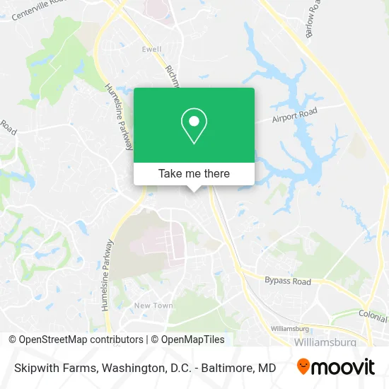
See Skipwith Farms, Washington, D.C. - Baltimore, MD, on the map
Public Transit to Skipwith Farms in Washington, D.C. - Baltimore, MD
Wondering how to get to Skipwith Farms in Washington, D.C. - Baltimore, MD? Moovit helps you find the best way to get to Skipwith Farms with step-by-step directions from the nearest public transit station.
Moovit provides free maps and live directions to help you navigate through your city. View schedules, routes, timetables, and find out how long does it take to get to Skipwith Farms in real time.
Looking for the nearest stop or station to Skipwith Farms? Check out this list of stops closest to your destination: Richmond Rd at Fireside; Longhill Rd at Rolling Meadows; Mooretown Rd at Anvil Campground; Williamsburg Amtrak Station.
Bus: 12A, 2, 4, 7.Train: NORTHEAST REGIONAL.
Want to see if there’s another route that gets you there at an earlier time? Moovit helps you find alternative routes or times. Get directions from and directions to Skipwith Farms easily from the Moovit App or Website.
We make riding to Skipwith Farms easy, which is why over 1.7 million users, including users in Washington, D.C. - Baltimore, MD, trust Moovit as the best app for public transit. You don’t need to download an individual bus app or train app, Moovit is your all-in-one transit app that helps you find the best bus time or train time available.
For information on prices of bus and train, costs and ride fares to Skipwith Farms, please check the Moovit app.
Use the app to navigate to popular places including to the airport, hospital, stadium, grocery store, mall, coffee shop, school, college, and university.
Location: Washington, D.C. - Baltimore, MD
- Yankee Candle,
- Pump Station,
- Skipwith Farms,
- Red Lobster,
- Wmbg Chrysler Dodge Jeep Ram Kia,
- Gizmoes/Sno-To-Go/J&M Jewlers,
- Buggy Bathe Auto Wash,
- Captain John Smith Inn Williamsburg,
- Richmond Rd & Park Inn,
- Anna's Brick Oven Pizza,
- Hampton Inn & Suites Williamsburg-Richmond Rd.,
- Church Of the Nazarene,
- Sandy's Pancake And Waffle House,
- Motel 6,
- Fireside Steakhouse,
- Wmsbg Storage Llc,
- La Terraza,
- James City County Recreation Center,
- The Christmas Mouse,
- Clarion Hotel Williamsburg I-64
Places Near Skipwith Farms (Washington, D.C. - Baltimore, MD)
- Westfield Montgomery Mall, Montgomery County,
- Washington DC VA Medical Center, Washington,
- Museum Of The Bible, Washington,
- Basilica of the National Shrine, Washington,
- The Anthem, Washington,
- Pennsylvania Ave NW (3rd st and pennsylvania), Washington,
- National Museum of African American History and Culture, Washington,
- Capital One Arena, Washington,
- Sibley Memorial Hospital, Washington,
- M&T Bank Stadium, Baltimore,
- Camden Yards, Baltimore,
- Washington National Cathedral, Washington,
- PG Mall, Prince George's County,
- Rock Creek Tennis Center, Washington,
- National Zoo, Washington,
- Georgetown, Washington,
- National Theatre, Washington,
- Marriott Marquis Washington, DC, Washington,
- Amazon Hq2, Arlington County,
- Warner Theatre, Washington
How to get to popular places in Washington, D.C. - Baltimore, MD with public transit
Get around Washington, D.C. - Baltimore, MD by public transit!
Traveling around Washington, D.C. - Baltimore, MD has never been so easy. See step by step directions as you travel to any attraction, street or major public transit station. View bus and train schedules, arrival times, service alerts and detailed routes on a map, so you know exactly how to get to anywhere in Washington, D.C. - Baltimore, MD.
When traveling to any destination around Washington, D.C. - Baltimore, MD use Moovit's Live Directions with Get Off Notifications to know exactly where and how far to walk, how long to wait for your line, and how many stops are left. Moovit will alert you when it's time to get off — no need to constantly re-check whether yours is the next stop.
Wondering how to use public transit in Washington, D.C. - Baltimore, MD or how to pay for public transit in Washington, D.C. - Baltimore, MD? Moovit public transit app can help you navigate your way with public transit easily, and at minimum cost. It includes public transit fees, ticket prices, and costs. Looking for a map of Washington, D.C. - Baltimore, MD public transit lines? Moovit public transit app shows all public transit maps in Washington, D.C. - Baltimore, MD with all Bus, Train, Metro, Light Rail and Ferry routes and stops on an interactive map.
Washington, D.C. - Baltimore, MD has 5 transit type(s), including: Bus, Train, Metro, Light Rail and Ferry, operated by several transit agencies, including WMATA, Montgomery County Ride On, Fairfax Connector, TheBus, PRTC, DASH - Alexandria, Arlington Transit (ART), RTA of Central Maryland, MDOT MTA, MDOT MTA Light RailLink, MDOT MTA Commuter Bus, MDOT MTA Local Bus, FXBGO!, Virginia Railway Express (VRE) and MARC