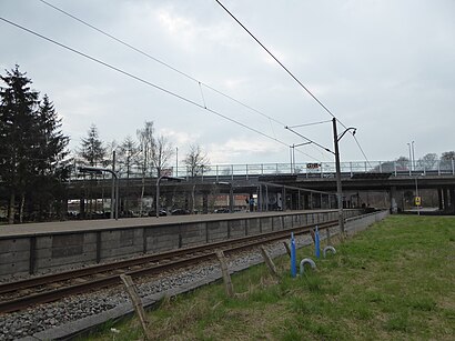
Skovbrynet St. station - Thursday schedule
| Line | Direction | Time |
|---|---|---|
| B | Høje Taastrup St. | 5:11 AM |
| B | Høje Taastrup St. | 5:31 AM |
| B | Farum St. | 5:34 AM |
| B | Høje Taastrup St. | 5:51 AM |
| B | Farum St. | 5:54 AM |
| B | Høje Taastrup St. | 6:01 AM |
| B | Høje Taastrup St. | 6:11 AM |
| B | Farum St. | 6:14 AM |
| B | Høje Taastrup St. | 6:21 AM |
| B | Høje Taastrup St. | 6:31 AM |
| B | Farum St. | 6:34 AM |
| B | Høje Taastrup St. | 6:41 AM |
| B | Farum St. | 6:44 AM |
| B | Høje Taastrup St. | 6:51 AM |
| B | Farum St. | 6:54 AM |
| B | Høje Taastrup St. | 7:01 AM |
| B | Farum St. | 7:04 AM |
| B | Høje Taastrup St. | 7:11 AM |
| B | Farum St. | 7:14 AM |
| B | Høje Taastrup St. | 7:21 AM |
| B | Farum St. | 7:24 AM |
| B | Høje Taastrup St. | 7:31 AM |
| B | Farum St. | 7:34 AM |
| B | Høje Taastrup St. | 7:41 AM |
| B | Farum St. | 7:44 AM |
Directions to Skovbrynet St. station (Gladsaxe) with public transit
The following transit lines have routes that pass near Skovbrynet St.
 Bus: 165, 166, 250S, 40E, 400S.
- Train: B, BX, A, E.
How to get to Skovbrynet St. station by bus?
Click on the bus route to see step by step directions with maps, line arrival times and updated time schedules.
How to get to Skovbrynet St. station by train?
Click on the train route to see step by step directions with maps, line arrival times and updated time schedules.
Bus stops near Skovbrynet St. stop in Gladsaxe
- Værebroparken (Hillerødmotorvejen), 9 min walk,
- Værebroparken, 10 min walk,
- Værebroparken (Værebrovej), 10 min walk,
Train stations near Skovbrynet St. station in Gladsaxe
- Buddinge St., 49 min walk,
- Lyngby St., 53 min walk,
Bus lines to Skovbrynet St. station in Gladsaxe
- 40E, Skodsborg St.,
- 400S, Lyngby St.,
- 165, Herlev St.,
- 166, Glostrup Ejby St.,
What are the closest stations to Skovbrynet St.?
The closest stations to Skovbrynet St. are:
- Værebroparken (Hillerødmotorvejen) stop is 654 meters away, 9 min walk.
- Værebroparken stop is 728 meters away, 10 min walk.
- Værebroparken (Værebrovej) stop is 738 meters away, 10 min walk.
- Buddinge St. station is 3873 meters away, 49 min walk.
- Lyngby St. station is 4184 meters away, 53 min walk.
Which bus lines stop near Skovbrynet St.?
These bus lines stop near Skovbrynet St.: 165, 166, 250S.
Which train line stops near Skovbrynet St.?
B (Farum St.)
What’s the nearest bus station to Skovbrynet St. in Gladsaxe?
The nearest bus station to Skovbrynet St. in Gladsaxe is Værebroparken (Hillerødmotorvejen). It’s a 9 min walk away.
What time is the first train to Skovbrynet St. in Gladsaxe?
The A is the first train that goes to Skovbrynet St. in Gladsaxe. It stops nearby at 3:02 AM.
What time is the last train to Skovbrynet St. in Gladsaxe?
The B is the last train that goes to Skovbrynet St. in Gladsaxe. It stops nearby at 12:55 AM.
What time is the first bus to Skovbrynet St. in Gladsaxe?
The 400S is the first bus that goes to Skovbrynet St. in Gladsaxe. It stops nearby at 3:10 AM.
What time is the last bus to Skovbrynet St. in Gladsaxe?
The 166 is the last bus that goes to Skovbrynet St. in Gladsaxe. It stops nearby at 12:51 AM.
See Skovbrynet St. station, Gladsaxe, on the map
Public transit to Skovbrynet St. station in Gladsaxe
Looking for directions to Skovbrynet St. in Gladsaxe, Denmark?
Download the Moovit App to find the current schedule and step-by-step directions for Train or Bus routes that pass through Skovbrynet St..
Looking for the nearest stops closest to Skovbrynet St. ? Check out this list of closest stops to your destination: Værebroparken (Hillerødmotorvejen); Værebroparken; Værebroparken (Værebrovej); Buddinge St.; Lyngby St..
Bus: 165, 166, 250S, 40E, 400S.Train: B, BX, A, E.
We make riding on public transit to Skovbrynet St. easy, which is why over 1.7 billion users, including users in Gladsaxe trust Moovit as the best app for public transit.
Use the app to navigate to popular places including to the airport, hospital, stadium, grocery store, mall, coffee shop, school, college, and university.
The station has the following entrances: Frederiksborgvej and Skovdiget
The first line to this station is B, at 5:11 AM, and the last line is B at 12:54 AM.
Skovdiget 6A, Copenhagen, Denmark
This station serves DSB S-tog’s lines
Popular routes from Skovbrynet St. station, Gladsaxe
- Værebroparken (Hillerødmotorvejen),
- Værebroparken,
- Værebroparken (Værebrovej)
Bus stops near Skovbrynet St. stop
- Buddinge St.,
- Lyngby St.
Train stations near Skovbrynet St. station
- Kalkærparken/Bjødstrupvej (Aarhus Kom),
- Nordhøj Netto Centrallager (Nordhøj),
- Rønnebæksholm (Bystævnet),
- Louisiana (Humlebæk Strandvej),
- Lindenborgvej (Sofiendalsvej / Aalborg),
- De Små Haver (Roskildevej),
- Marselisborgcentret/Skanderborgvej (Aarhus Kom),
- Strandgården (Strandby / Frederikshavn),
- Midtfyns Gymnasium (Faaborg Midtfyn),
- Parkering Odense Syd (Odense Letbane),
- Tingstedet (Valby Langgade),
- Cikorievej (Odense Kommune),
- Vejlevej/Sundhedshuset (Herning Kom),
- Ishøj St.,
- P.P. Ørums Gade/Jyllands Allé (Aarhus Kom),
- Tømmerby-Lild Skole (Tømmerbyvej / Frøstrup),
- Fgu Frederikshavn (Tuenvej / Elling),
- Obc Syd Plads C (Odense Kommune),
- Dalumcentret (Odense Kommune),
- Lerumbakken (Østergade / Nørresundby)
Popular public transit stations in Gladsaxe
Get around Gladsaxe by public transit!
Traveling around Gladsaxe has never been so easy. See step by step directions as you travel to any attraction, street or major public transit station. View bus and train schedules, arrival times, service alerts and detailed routes on a map, so you know exactly how to get to anywhere in Gladsaxe.
When traveling to any destination around Gladsaxe use Moovit's Live Directions with Get Off Notifications to know exactly where and how far to walk, how long to wait for your line, and how many stops are left. Moovit will alert you when it's time to get off — no need to constantly re-check whether yours is the next stop.
Wondering how to use public transit in Gladsaxe or how to pay for public transit in Gladsaxe? Moovit public transit app can help you navigate your way with public transit easily, and at minimum cost. It includes public transit fees, ticket prices, and costs. Looking for a map of Gladsaxe public transit lines? Moovit public transit app shows all public transit maps in Gladsaxe with all Bus, Train, Metro, Light Rail and Ferry routes and stops on an interactive map.
Denmark has 5 transit type(s), including: Bus, Train, Metro, Light Rail and Ferry, operated by several transit agencies, including Metroselskabet, DSB S-tog, Lokaltog A/S, Midttrafik, Odense Letbane, DSB, NT, GoCollective, Skånetrafiken, Movia, FYNBUS, Sydtrafik, Bornholms Trafik, Samsø Bus and Citybus