Directions to Sky Modas (Cic) with public transportation
The following transit lines have routes that pass near Sky Modas
How to get to Sky Modas by bus?
Click on the bus route to see step by step directions with maps, line arrival times and updated time schedules.
From Hospital De Clínicas Da Ufpr, Centro
50 minFrom Estação Tubo Museu Oscar Niemeyer, Centro Cívico
49 minFrom Rua Cyro Correia Pereira, Cic
50 minFrom Rua Paulo Setúbal, Boqueirão
58 minFrom Museu Oscar Niemeyer (MON), Centro Cívico
50 minFrom Rua Professor Brandão, Alto Da Rua XV
55 minFrom Rua Anne Frank, Boqueirão
66 minFrom Rua Itupava, Alto Da Rua XV
53 minFrom Hospital Sugisawa, Rebouças
33 minFrom Rua Bartolomeu Lourenço de Gusmão, Boqueirão
63 min
Bus stops near Sky Modas in Cic
Bus lines to Sky Modas in Cic
- 040 INTERBAIRROS IV, INTERBAIRROS IV,VIEW
- 703 CAIUÁ, CAIUÁ,VIEW
- 706 CAIUÁ - FAZENDINHA / CENTRO, CAIUÁ - FAZENDINHA / CENTRO,VIEW
- 711 ITATIAIA, ITATIAIA,VIEW
- 724 FAZENDINHA / CAIUÁ - BELA VISTA, FAZENDINHA - CAIUÁ / BELA VISTA,VIEW
- 789 MAD. CAIUÁ, MAD. CAIUÁ,VIEW
- 720 FAZENDINHA / CAMPO COMPRIDO, Terminal Campo Comprido → Terminal Fazendinha,VIEW
- 778 COTOLENGO, Terminal Fazendinha → Praça Rui Barbosa,VIEW
- 828 CAMPO COMPRIDO / CAPÃO RASO, Terminal Capão Raso → Terminal Campo Comprido,VIEW
- 710 SANTA AMÉLIA / PORTO BELO, Terminal Fazendinha ↺ Porto Belo (Circular),VIEW
- 718 PORTO BELO, Terminal Fazendinha → Porto Belo (Circular),VIEW
- 788 MAD. VILA VELHA, Praça Rui Barbosa ↺ Vila Velha (Circular),VIEW
What are the closest stations to Sky Modas?
The closest stations to Sky Modas are:
- R. Raul Pompéia, 114 is 62 meters away, 1 min walk.
- R. Raul Pompéia, 113 is 81 meters away, 2 min walk.
- R. Waldemar Cavanha, 817 is 332 meters away, 5 min walk.
- R. Raul Pompéia, 649 is 396 meters away, 6 min walk.
Which bus lines stop near Sky Modas?
These bus lines stop near Sky Modas: 040 INTERBAIRROS IV, 702 CAIUÁ / CACHOEIRA, 703 CAIUÁ, 828 CAMPO COMPRIDO / CAPÃO RASO.
What’s the nearest bus station to Sky Modas in Cic?
The nearest bus station to Sky Modas in Cic is R. Raul Pompéia, 114. It’s a 1 min walk away.
What time is the first bus to Sky Modas in Cic?
The 788 MAD. VILA VELHA is the first bus that goes to Sky Modas in Cic. It stops nearby at 3:26 AM.
What time is the last bus to Sky Modas in Cic?
The 789 MAD. CAIUÁ is the last bus that goes to Sky Modas in Cic. It stops nearby at 2:56 AM.
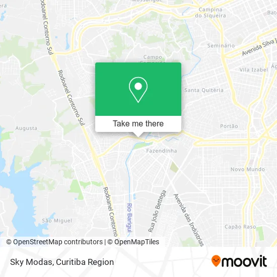
See Sky Modas, Cic, on the map
Public Transit to Sky Modas in Cic
Wondering how to get to Sky Modas in Cic? Moovit helps you find the best way to get to Sky Modas with step-by-step directions from the nearest public transit station.
Moovit provides free maps and live directions to help you navigate through your city. View schedules, routes, timetables, and find out how long does it take to get to Sky Modas in real time.
Looking for the nearest stop or station to Sky Modas? Check out this list of stops closest to your destination: R. Raul Pompéia; R. Raul Pompéia; R. Waldemar Cavanha; R. Raul Pompéia.
Bus: 040 INTERBAIRROS IV, 702 CAIUÁ / CACHOEIRA, 703 CAIUÁ, 828 CAMPO COMPRIDO / CAPÃO RASO, 706 CAIUÁ - FAZENDINHA / CENTRO, 711 ITATIAIA, 724 FAZENDINHA / CAIUÁ - BELA VISTA, 720 FAZENDINHA / CAMPO COMPRIDO, 778 COTOLENGO, 710 SANTA AMÉLIA / PORTO BELO, 718 PORTO BELO, 788 MAD. VILA VELHA.
Want to see if there’s another route that gets you there at an earlier time? Moovit helps you find alternative routes or times. Get directions from and directions to Sky Modas easily from the Moovit App or Website.
We make riding to Sky Modas easy, which is why over 1.5 million users, including users in Cic, trust Moovit as the best app for public transit. You don’t need to download an individual bus app or train app, Moovit is your all-in-one transit app that helps you find the best bus time or train time available.
For information on prices of bus, costs and ride fares to Sky Modas, please check the Moovit app.
Use the app to navigate to popular places including to the airport, hospital, stadium, grocery store, mall, coffee shop, school, college, and university.
Sky Modas Address: Rua Raul Pompéia, 247 Cidade Industrial de Curitiba Curitiba-PR 81240-000 street in Cic
- S3 Serviços Administrativos,
- Conexao I Assistencia Tecnica Especiali,
- Servopa Motos,
- Material De Construção Mafrei,
- Lrsinfo,
- Kamila Presentes,
- D. S. Hofmann Domingues Comercial e Transportes,
- Restaurante Popular Fazendinha,
- Balaroti,
- Farmacias Morifarma,
- Rogerio Boschini,
- Aloha Prime Store,
- Phanton Som Automotivo,
- Rua Raul Pompeia,
- Jean Santana Cabeleireiros,
- Policlínica Veterinária Mazzarouo,
- Jga Consultoria e Desenvolvimento,
- Boss Pinturas e Revestimentos,
- Condomínio do Conjunto Residencial Vale Verde III - Cidade Industrial,
- Alceu Luís Mazzarollo
Places Near Sky Modas (Cic)
- Shopping Palladium, Portão,
- Parque Barigui, Mercês,
- Hospital Universitário Evangélico de Curitiba, Bigorrilho,
- Rua Martim Afonso 558, Mercês,
- Pontifícia Universidade Católica do Paraná (PUCPR), Prado Velho,
- Hospital Nossa Senhora Das Graças, Mercês,
- Jockey Plaza Shopping Center, Tarumã,
- Rua General Mário Tourinho, Campina Do Siqueira,
- Campo Largo, Campo,
- Arena Da Baixada - Curitiba,
- Park Shopping Barigüi, Mossunguê,
- Hospital Madalena Sofia, Bairro Alto,
- Hospital Da Cruz Vermelha, Batel,
- Shopping Estação, Rebouças,
- Hospital de Clínicas (HC - UFPR), Centro,
- Hospital Angelina Caron, Campina Grande Do Sul,
- Jardim Botânico de Curitiba PR, Centro,
- Hospital Erasto Gaertner, Jardim Das Américas,
- Hospital do Rocio, Campo,
- Hhhhh, Fazendinha
How to get to popular places in Curitiba Region with public transit
Get around Cic by public transit!
Traveling around Cic has never been so easy. See step by step directions as you travel to any attraction, street or major public transit station. View bus and train schedules, arrival times, service alerts and detailed routes on a map, so you know exactly how to get to anywhere in Cic.
When traveling to any destination around Cic use Moovit's Live Directions with Get Off Notifications to know exactly where and how far to walk, how long to wait for your line, and how many stops are left. Moovit will alert you when it's time to get off — no need to constantly re-check whether yours is the next stop.
Wondering how to use public transit in Cic or how to pay for public transit in Cic? Moovit public transit app can help you navigate your way with public transit easily, and at minimum cost. It includes public transit fees, ticket prices, and costs. Looking for a map of Cic public transit lines? Moovit public transit app shows all public transit maps in Cic with all Bus and Cable Car routes and stops on an interactive map.
Curitiba Region has 2 transit type(s), including: Bus and Cable Car, operated by several transit agencies, including Sistema Integrado de Mobilidade (URBS), Sistema Integrado de Mobilidade (AMEP), URBS (Cartões bancários e Dinheiro), URBS (Cartões bancários / Cartão URBS), AMEP (Cartões bancários / Cartão MetroCard), AMEP (Cartões bancários / Cartão MetroCard / Dinheiro), Viação Colombo (Dinheiro), TRIAR (Cartão TRIAR / Dinheiro), Empresa Curitiba Cerro Azul (Dinheiro), Expresso Nossa Senhora da Penha (Dinheiro), Empresa Campo Alto Tijucas (Dinheiro), Auto Viação São José (Cartão VEM / Dinheiro), BRT S/A (Cartão VEM / Dinheiro), TransPiedade (Cartão Cidadão / Dinheiro) and Oceânica Sul (Cartão Transporte / Dinheiro)