How to get to Sl-Tech2 by bus?
Click on the bus route to see step by step directions with maps, line arrival times and updated time schedules.
From Fahrrad XXL Walcher, Gemeindeverwaltungsverband Plochingen
74 minFrom Hölderlin-Gymasium, Vereinbarte Verwaltungsgemeinschaft Der Stadt Nürtingen
78 minFrom Epplesee, Vereinbarte Verwaltungsgemeinschaft Der Stadt Uhingen
69 minFrom Eckwälden, Gemeindeverwaltungsverband Raum Bad Boll
57 minFrom Panorama Therme Beuren, Vereinbarte Verwaltungsgemeinschaft Der Stadt Neuffen
108 minFrom Olgastraße 94, Gemeindeverwaltungsverband Plochingen
112 minFrom Decathlon, Gemeindeverwaltungsverband Plochingen
104 minFrom Robert Bosch Gymnasium, Gemeindeverwaltungsverband Wendlingen am Neckar
52 minFrom Decathlon (Decathlon Plochingen), Gemeindeverwaltungsverband Plochingen
104 min
Bus stops near Sl-Tech2 in Vereinbarte Verwaltungsgemeinschaft Der Stadt Kirchheim Unter Teck
Train stations near Sl-Tech2 in Vereinbarte Verwaltungsgemeinschaft Der Stadt Kirchheim Unter Teck
Bus lines to Sl-Tech2 in Vereinbarte Verwaltungsgemeinschaft Der Stadt Kirchheim Unter Teck
- 173, Kirchheim (T) - Holzmaden - Weilheim (T) - Bissingen (T) - Kirchheim (T),VIEW
- 173A, Kirchheim (T) - Weilheim (T) - Bissingen (T) - Kirchheim (T),VIEW
- 176, Kirchheim (T) - Dettingen (T) - Bissingen (T) - Oberlenningen,VIEW
- 175, Kirchheim (T) Bahnhof/ZOB Bstg 3 - Kirchheim (T) Bahnhof/ZOB Bstg 3,VIEW
- 175A, Bissingen (T) See - Weilh.(T) Limb.sch./Biss. Str.,VIEW
- 176, Bissingen (T) See - Kirchheim (T) Bahnhof/ZOB Bstg 3,VIEW
- 173, Kirchheim (T) Bahnhof/ZOB Bstg 2 - Kirchheim (T) Bahnhof/ZOB Bstg 2,VIEW
- 173A, Weilh.(T) Limb.sch./Biss. Str. - Bissingen (T) See,VIEW
- 175, Weilh.(T) Egelsberg Hochhaus,VIEW
- 175A, Weilheim (T) Bildungszentrum,VIEW
- X92, Kirchheim (T) Bahnhof/Zob,VIEW
What are the closest stations to Sl-Tech2?
The closest stations to Sl-Tech2 are:
- Nabern Industriegebiet is 218 meters away, 3 min walk.
- Nabern Gartenstraße is 521 meters away, 7 min walk.
- Dettingen (T) Gleis 1 is 2359 meters away, 31 min walk.
- Dettingen (T) is 2359 meters away, 31 min walk.
- Dettingen(Teck) is 2359 meters away, 31 min walk.
Which bus lines stop near Sl-Tech2?
These bus lines stop near Sl-Tech2: 175, 176.
What’s the nearest bus station to Sl-Tech2 in Vereinbarte Verwaltungsgemeinschaft Der Stadt Kirchheim Unter Teck?
The nearest bus station to Sl-Tech2 in Vereinbarte Verwaltungsgemeinschaft Der Stadt Kirchheim Unter Teck is Nabern Industriegebiet. It’s a 3 min walk away.
What time is the first train to Sl-Tech2 in Vereinbarte Verwaltungsgemeinschaft Der Stadt Kirchheim Unter Teck?
The RB 64 is the first train that goes to Sl-Tech2 in Vereinbarte Verwaltungsgemeinschaft Der Stadt Kirchheim Unter Teck. It stops nearby at 5:20 AM.
What time is the last train to Sl-Tech2 in Vereinbarte Verwaltungsgemeinschaft Der Stadt Kirchheim Unter Teck?
The RB 64 is the last train that goes to Sl-Tech2 in Vereinbarte Verwaltungsgemeinschaft Der Stadt Kirchheim Unter Teck. It stops nearby at 8:10 PM.
What time is the first bus to Sl-Tech2 in Vereinbarte Verwaltungsgemeinschaft Der Stadt Kirchheim Unter Teck?
The 176 is the first bus that goes to Sl-Tech2 in Vereinbarte Verwaltungsgemeinschaft Der Stadt Kirchheim Unter Teck. It stops nearby at 4:53 AM.
What time is the last bus to Sl-Tech2 in Vereinbarte Verwaltungsgemeinschaft Der Stadt Kirchheim Unter Teck?
The 175 is the last bus that goes to Sl-Tech2 in Vereinbarte Verwaltungsgemeinschaft Der Stadt Kirchheim Unter Teck. It stops nearby at 1:30 AM.
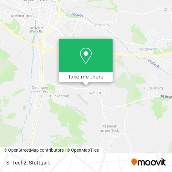
See Sl-Tech2, Vereinbarte Verwaltungsgemeinschaft Der Stadt Kirchheim Unter Teck, on the map
Public Transit to Sl-Tech2 in Vereinbarte Verwaltungsgemeinschaft Der Stadt Kirchheim Unter Teck
Wondering how to get to Sl-Tech2 in Vereinbarte Verwaltungsgemeinschaft Der Stadt Kirchheim Unter Teck? Moovit helps you find the best way to get to Sl-Tech2 with step-by-step directions from the nearest public transit station.
Moovit provides free maps and live directions to help you navigate through your city. View schedules, routes, timetables, and find out how long does it take to get to Sl-Tech2 in real time.
Looking for the nearest stop or station to Sl-Tech2? Check out this list of stops closest to your destination: Nabern Industriegebiet; Nabern Gartenstraße; Dettingen (T) Gleis 1; Dettingen (T); Dettingen(Teck).
Train: RB64, RB 64, RB64.Bus: 175, 176, 173, 173A, 175A, 173, 173A.
Want to see if there’s another route that gets you there at an earlier time? Moovit helps you find alternative routes or times. Get directions from and directions to Sl-Tech2 easily from the Moovit App or Website.
We make riding to Sl-Tech2 easy, which is why over 1.5 million users, including users in Vereinbarte Verwaltungsgemeinschaft Der Stadt Kirchheim Unter Teck, trust Moovit as the best app for public transit. You don’t need to download an individual bus app or train app, Moovit is your all-in-one transit app that helps you find the best bus time or train time available.
For information on prices of bus, S-Bahn and train, costs and ride fares to Sl-Tech2, please check the Moovit app.
Use the app to navigate to popular places including to the airport, hospital, stadium, grocery store, mall, coffee shop, school, college, and university.
Sl-Tech2 Address: Weinbergweg 13 Nabern, 73230 Kirchheim unter Teck street in Vereinbarte Verwaltungsgemeinschaft Der Stadt Kirchheim Unter Teck
- Naturheilpraxis Frank Eisele,
- Naberner Seefreunde E. V. Werner Bressmer,
- H&H Kfz-Reparaturen Inh. Andreas Justus,
- Acadoro,
- Gebäudereinigung Nk Clean,
- Deutsche Accumotive,
- Gaayatree Catering Service,
- Sirius Facilities GmbH,
- Daimler AG Standort Nabern,
- Amazon Locker-Gewuerz,
- Bereiche Testlabor,
- Dialog Semiconductor,
- Tecksound,
- Gerold Kuchelmeister Bz.Notar,
- Monika Lenk,
- Nabern,
- Lotto-Annahmestelle,
- Kreissparkasse Esslingen-Nürtingen,
- E Aktiv Markt Mauz,
- Hähnchenverkauf
Places Near Sl-Tech2 (Vereinbarte Verwaltungsgemeinschaft Der Stadt Kirchheim Unter Teck)
- Gasometer Pforzheim, Pforzheim,
- Mettingen Eros-Center Puff Laufhaus, Esslingen Am Neckar,
- FlixBus Haltestelle, Stuttgart,
- Mercedes-Benz Museum (Mercedes Museum Stuttgart), Bad Cannstatt,
- Mercedes-Benz Museum, Bad Cannstatt,
- Im Wizemann (Halle), Bad Cannstatt,
- Marmorsaal Im Weissenburgpark, Stuttgart-Süd,
- Waldfriedhof, Degerloch,
- Gleis 101/102 (tief), Stuttgart-Mitte,
- Porsche-Arena, Bad Cannstatt,
- Geilhaus Haus 33a, Reutlingen-Betzingen,
- Schleyerhalle, Bad Cannstatt,
- Klinikum Stuttgart - Katharinenhospital, Stuttgart-Mitte,
- Porsche Museum, Zuffenhausen,
- Wilhelma (U-Bahn Wilhelma), Bad Cannstatt,
- SI-Centrum, Möhringen,
- Hanns-Martin-Schleyer-Halle (Stuttgart Hans-Martin-Schleyerhalle), Bad Cannstatt,
- Hanns-Martin-Schleyer-Halle, Bad Cannstatt,
- Hauptbahnhof Stuttgart, Stuttgart-Mitte,
- Pariser Platz Stuttgart, Stuttgart-Mitte
How to get to popular places in Stuttgart with public transit
Get around Vereinbarte Verwaltungsgemeinschaft Der Stadt Kirchheim Unter Teck by public transit!
Traveling around Vereinbarte Verwaltungsgemeinschaft Der Stadt Kirchheim Unter Teck has never been so easy. See step by step directions as you travel to any attraction, street or major public transit station. View bus and train schedules, arrival times, service alerts and detailed routes on a map, so you know exactly how to get to anywhere in Vereinbarte Verwaltungsgemeinschaft Der Stadt Kirchheim Unter Teck.
When traveling to any destination around Vereinbarte Verwaltungsgemeinschaft Der Stadt Kirchheim Unter Teck use Moovit's Live Directions with Get Off Notifications to know exactly where and how far to walk, how long to wait for your line, and how many stops are left. Moovit will alert you when it's time to get off — no need to constantly re-check whether yours is the next stop.
Wondering how to use public transit in Vereinbarte Verwaltungsgemeinschaft Der Stadt Kirchheim Unter Teck or how to pay for public transit in Vereinbarte Verwaltungsgemeinschaft Der Stadt Kirchheim Unter Teck? Moovit public transit app can help you navigate your way with public transit easily, and at minimum cost. It includes public transit fees, ticket prices, and costs. Looking for a map of Vereinbarte Verwaltungsgemeinschaft Der Stadt Kirchheim Unter Teck public transit lines? Moovit public transit app shows all public transit maps in Vereinbarte Verwaltungsgemeinschaft Der Stadt Kirchheim Unter Teck with all Bus, Train, Subway, Light Rail, Ferry, S-Bahn and Funicular routes and stops on an interactive map.
Stuttgart has 7 transit type(s), including: Bus, Train, Subway, Light Rail, Ferry, S-Bahn and Funicular, operated by several transit agencies, including SSB - Stadtbahn, SSB, SSB - Seilbahn / Zacke, S-Bahn Stuttgart, Rhein-Neckar-Verkehr GmbH (rnv), Karlsruher Verkehrsverbund, DB AG, DB Regiobus BW, Arverio Baden-Württemberg GmbH, DB RegioNetz Verkehrs GmbH Westfrankenbahn, DB Regio AG Baden-Württemberg, Südwestdeutsche Verkehrs-AG, DB Regio AG Mitte Region Hessen, DB and Bodensee-Oberschwaben-Bahn