How to get to Sleep Number by bus?
Click on the bus route to see step by step directions with maps, line arrival times and updated time schedules.
From Memorial West Hospital, Miramar-Pembroke Pines
28 minFrom Cape Coral Insure, Hialeah
280 minFrom Barbara Goleman Senior High, Hialeah
282 minFrom Northwest 57th Avenue, Miami
113 minFrom NW 183rd St / NW 47th Ave, Miami Gardens
107 minFrom Florida Lottery District Office-Miami, Hialeah
277 minFrom Somerset Academy Chapel Trail, Miramar-Pembroke Pines
45 minFrom Pembroke Lakes Mall Shopping Center, Miramar-Pembroke Pines
31 minFrom Archbishop Edward A. Mccarthy High School, Davie
54 minFrom Somerset Academy, Miramar-Pembroke Pines
40 min
Bus stop near Sleep Number in Miramar-Pembroke Pines
- Pines Boulevard/Northwest 160th Avenue - (Dykes Road), 3 min walk,VIEW
Bus lines to Sleep Number in Miramar-Pembroke Pines
What are the closest stations to Sleep Number?
The closest stations to Sleep Number are:
- Pines Boulevard/Northwest 160th Avenue - (Dykes Road) is 200 yards away, 3 min walk.
Which bus lines stop near Sleep Number?
These bus lines stop near Sleep Number: 07, 28.
What’s the nearest bus station to Sleep Number in Miramar-Pembroke Pines?
The nearest bus station to Sleep Number in Miramar-Pembroke Pines is Pines Boulevard/Northwest 160th Avenue - (Dykes Road). It’s a 3 min walk away.
What time is the first bus to Sleep Number in Miramar-Pembroke Pines?
The 28 is the first bus that goes to Sleep Number in Miramar-Pembroke Pines. It stops nearby at 5:35 AM.
What time is the last bus to Sleep Number in Miramar-Pembroke Pines?
The 28 is the last bus that goes to Sleep Number in Miramar-Pembroke Pines. It stops nearby at 11:53 PM.
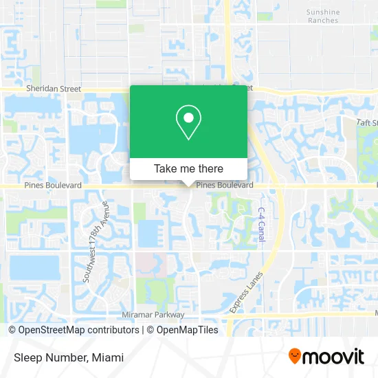
See Sleep Number, Miramar-Pembroke Pines, on the map
Public Transit to Sleep Number in Miramar-Pembroke Pines
Wondering how to get to Sleep Number in Miramar-Pembroke Pines? Moovit helps you find the best way to get to Sleep Number with step-by-step directions from the nearest public transit station.
Moovit provides free maps and live directions to help you navigate through your city. View schedules, routes, timetables, and find out how long does it take to get to Sleep Number in real time.
Looking for the nearest stop or station to Sleep Number? Check out this list of stops closest to your destination: Pines Boulevard/Northwest 160th Avenue - (Dykes Road).
Bus: 07, 28.
Want to see if there’s another route that gets you there at an earlier time? Moovit helps you find alternative routes or times. Get directions from and directions to Sleep Number easily from the Moovit App or Website.
We make riding to Sleep Number easy, which is why over 1.5 million users, including users in Miramar-Pembroke Pines, trust Moovit as the best app for public transit. You don’t need to download an individual bus app or train app, Moovit is your all-in-one transit app that helps you find the best bus time or train time available.
For information on prices of bus, costs and ride fares to Sleep Number, please check the Moovit app.
Use the app to navigate to popular places including to the airport, hospital, stadium, grocery store, mall, coffee shop, school, college, and university.
Sleep Number Address: 16030 Pines Blvd street in Miramar-Pembroke Pines
- Crunch Fitness,
- Burlington,
- Publix,
- Presto! ATM,
- WESTERN UNION,
- Scenthound,
- Cafe of Life Chiropractic,
- Regions Bank,
- DJ Juan Luv,
- Corporate Compliance Services,
- Pro Nail Plus II,
- A One Noodle & Dumpling,
- Stretchlab,
- Ramen and Bowls (Pembroke Pines),
- Body20,
- WING STOP,
- Hawaii Fluid Art,
- Westfork Plaza & Paraiso Parc,
- Door Locksmith,
- Window Cleaning Pembroke Pines Fl
Places Near Sleep Number (Miramar-Pembroke Pines)
- Wynwood, Miami,
- Sawgrass mall ( FL ), Miami Beach,
- Miami-Dade County Courthouse, Miami,
- Sawgrass Mall, Miami,
- Keiser University Flagship Campus, West Palm Beach,
- Marlins Park, Miami,
- Bayside Marketplace, Miami,
- Aventura Mall, Miami Beach,
- Zoo Miami, Miami,
- Miami Design District, Miami,
- Hard Rock Stadium, Miami Gardens,
- Miami Freedom Park, Miami,
- Dolphin Mall Bus, Miami,
- Little Havana, Miami,
- Aventura Mall, Miami,
- Miami VA Hospital, Miami,
- Brickell City Centre, Miami,
- Dolphin Mall, Miami,
- Richard E. Gerstein Justice Building, Miami,
- Port of Miami Cruise Terminal, Miami
How to get to popular places in Miami with public transit
Get around Miramar-Pembroke Pines by public transit!
Traveling around Miramar-Pembroke Pines has never been so easy. See step by step directions as you travel to any attraction, street or major public transit station. View bus and train schedules, arrival times, service alerts and detailed routes on a map, so you know exactly how to get to anywhere in Miramar-Pembroke Pines.
When traveling to any destination around Miramar-Pembroke Pines use Moovit's Live Directions with Get Off Notifications to know exactly where and how far to walk, how long to wait for your line, and how many stops are left. Moovit will alert you when it's time to get off — no need to constantly re-check whether yours is the next stop.
Wondering how to use public transit in Miramar-Pembroke Pines or how to pay for public transit in Miramar-Pembroke Pines? Moovit public transit app can help you navigate your way with public transit easily, and at minimum cost. It includes public transit fees, ticket prices, and costs. Looking for a map of Miramar-Pembroke Pines public transit lines? Moovit public transit app shows all public transit maps in Miramar-Pembroke Pines with all Bus, Train, Light Rail and Ferry routes and stops on an interactive map.
Miami has 4 transit type(s), including: Bus, Train, Light Rail and Ferry, operated by several transit agencies, including Broward County Transit, Miami-Dade Transit, Metrorail, Palm Tran, Tri-Rail, Brightline, MARTY, City of Homestead Trolley, Key West Transit, Treasure Coast Connector, GoLine IRT, Amtrak, Greyhound-us, FlixBus-us and Aventura Express Shuttle Bus