How to get to Sleep Number by bus?
Click on the bus route to see step by step directions with maps, line arrival times and updated time schedules.
From Totowa, NJ, Totowa
80 minFrom American Dream, East Rutherford
59 minFrom King Spa & Sauna, Palisades Park
55 minFrom Lodi, NJ, Lodi
38 minFrom Fort Lee, NJ, Fort Lee
41 minFrom Englewood, NJ, Englewood
41 minFrom Carlstadt, NJ, Carlstadt
40 minFrom MetLife Stadium, East Rutherford
55 minFrom Clifton, NJ, Clifton
74 minFrom Paterson, NJ, Paterson
84 min
Bus stops near Sleep Number in Paramus
Train stations near Sleep Number in Paramus
Bus lines to Sleep Number in Paramus
- 171, New York Gw Bridge Bus Station Ikea & Garden State Plaza,VIEW
- 758, Paramus Park Mall,VIEW
- 163, Ridgewood Terminal Via Murray Hill Parkway,VIEW
- 175, New York Bergen Comm College & Garden State Plaza,VIEW
- 709, Paramus Garden St Plz,VIEW
- 770, Hackensack Bus Terminal,VIEW
- 162, Paramus Express Via Prospect Ave,VIEW
- 707, Paterson City Hall,VIEW
- 756, Englewood Clf,VIEW
What are the closest stations to Sleep Number?
The closest stations to Sleep Number are:
- Rt-4 875' E Of Garden State Pkwy is 738 yards away, 12 min walk.
- Plaza Way 206'W Of GS Plaza Blvd is 868 yards away, 12 min walk.
- Passaic St at Berdan St is 988 yards away, 14 min walk.
- Garden State Plaza is 1240 yards away, 17 min walk.
- Hackensack - Anderson St is 2982 yards away, 35 min walk.
- Broadway is 4878 yards away, 59 min walk.
Which bus lines stop near Sleep Number?
These bus lines stop near Sleep Number: 163, 171, 709.
What’s the nearest bus station to Sleep Number in Paramus?
The nearest bus stations to Sleep Number in Paramus are Rt-4 875' E Of Garden State Pkwy and Plaza Way 206'W Of GS Plaza Blvd. The closest one is a 12 min walk away.
What time is the first train to Sleep Number in Paramus?
The PJL is the first train that goes to Sleep Number in Paramus. It stops nearby at 5:35 AM.
What time is the last train to Sleep Number in Paramus?
The PJL is the last train that goes to Sleep Number in Paramus. It stops nearby at 1:12 AM.
What time is the first bus to Sleep Number in Paramus?
The 163 is the first bus that goes to Sleep Number in Paramus. It stops nearby at 4:20 AM.
What time is the last bus to Sleep Number in Paramus?
The 163 is the last bus that goes to Sleep Number in Paramus. It stops nearby at 2:04 AM.
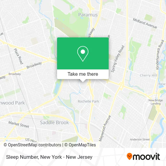
See Sleep Number, Paramus, on the map
Public Transit to Sleep Number in Paramus
Wondering how to get to Sleep Number in Paramus? Moovit helps you find the best way to get to Sleep Number with step-by-step directions from the nearest public transit station.
Moovit provides free maps and live directions to help you navigate through your city. View schedules, routes, timetables, and find out how long does it take to get to Sleep Number in real time.
Looking for the nearest stop or station to Sleep Number? Check out this list of stops closest to your destination: Rt-4 875' E Of Garden State Pkwy; Plaza Way 206'W Of GS Plaza Blvd; Passaic St at Berdan St; Garden State Plaza; Hackensack - Anderson St; Broadway.
Bus: 163, 171, 709, 758, 175, 770, 162.Train: PASC, BERG.
Want to see if there’s another route that gets you there at an earlier time? Moovit helps you find alternative routes or times. Get directions from and directions to Sleep Number easily from the Moovit App or Website.
We make riding to Sleep Number easy, which is why over 1.5 million users, including users in Paramus, trust Moovit as the best app for public transit. You don’t need to download an individual bus app or train app, Moovit is your all-in-one transit app that helps you find the best bus time or train time available.
For information on prices of bus, costs and ride fares to Sleep Number, please check the Moovit app.
Use the app to navigate to popular places including to the airport, hospital, stadium, grocery store, mall, coffee shop, school, college, and university.
Sleep Number Address: 1 Garden State Plz street in Paramus
- The Fix - Garden State Plaza,
- Converse Store,
- Skagen Denmark Garden State Plaza,
- Calzedonia,
- Auntie Anne's Pretzels Garden State Plaza,
- Tous Jewelry,
- Imax,
- Kendra Scott Design,
- Rituals,
- Baskin-Robbins,
- Abercrombie & Fitch,
- Aéropostale,
- Firehouse Subs Garden State Plaza,
- Crocs at Garden State Plaza,
- Lush Cosmetics Garden State Plaza,
- Wilson - Garden State Plaza,
- Aveda Store,
- Eyewellniss - Paramus,
- Payless Shoesource,
- Helzberg Diamonds
Places Near Sleep Number (Paramus)
- Hudson Yards, Manhattan,
- 26 Federal Plaza, Manhattan,
- Pier 83, Manhattan,
- Bellevue Hospital, Manhattan,
- 66 John Street, Manhattan,
- 1 Police Plaza, Manhattan,
- 911 Memorial, Manhattan,
- Mountainside Hospital, Glen Ridge,
- 3 Stone St, Manhattan,
- Rockefeller Center, Manhattan,
- Wall Street, Manhattan,
- 376 Hudson Street, Manhattan,
- 111 Centre New York City Supreme Court, Manhattan,
- SoHo, Manhattan,
- Queens Center Mall, Queens,
- qqqq, Manhattan,
- Katz's Deli, Manhattan,
- Chinatown, Manhattan,
- San Gennaro Feast, Manhattan,
- Times Square, Manhattan
How to get to popular places in New York - New Jersey with public transit
Get around Paramus by public transit!
Traveling around Paramus has never been so easy. See step by step directions as you travel to any attraction, street or major public transit station. View bus and train schedules, arrival times, service alerts and detailed routes on a map, so you know exactly how to get to anywhere in Paramus.
When traveling to any destination around Paramus use Moovit's Live Directions with Get Off Notifications to know exactly where and how far to walk, how long to wait for your line, and how many stops are left. Moovit will alert you when it's time to get off — no need to constantly re-check whether yours is the next stop.
Wondering how to use public transit in Paramus or how to pay for public transit in Paramus? Moovit public transit app can help you navigate your way with public transit easily, and at minimum cost. It includes public transit fees, ticket prices, and costs. Looking for a map of Paramus public transit lines? Moovit public transit app shows all public transit maps in Paramus with all Bus, Train, Subway, Light Rail, Ferry and Cable Car routes and stops on an interactive map.
New York - New Jersey has 6 transit type(s), including: Bus, Train, Subway, Light Rail, Ferry and Cable Car, operated by several transit agencies, including MTA Subway, Metro-North Railroad, LIRR, PATH, MTA New York City Transit - Express routes, MTA Bus, NJ Transit, NYC Ferry, NICE bus, Bee-Line Bus, NJ Transit Rail, Norwalk Transit District, Hartford Line, River Valley Transit and HART