How to get to Sleep Number by bus?
Click on the bus route to see step by step directions with maps, line arrival times and updated time schedules.
Bus stops near Sleep Number in James City County
What are the closest stations to Sleep Number?
The closest stations to Sleep Number are:
- Richmond Rd at Olde Towne Rd is 149 yards away, 3 min walk.
- Mooretown Rd at Ewell Rd 1 is 1437 yards away, 18 min walk.
Which bus line stops near Sleep Number?
2 (2 Richmond Rd)
What’s the nearest bus station to Sleep Number in James City County?
The nearest bus station to Sleep Number in James City County is Richmond Rd at Olde Towne Rd. It’s a 3 min walk away.
What time is the first bus to Sleep Number in James City County?
The 7 is the first bus that goes to Sleep Number in James City County. It stops nearby at 6:15 AM.
What time is the last bus to Sleep Number in James City County?
The 7 is the last bus that goes to Sleep Number in James City County. It stops nearby at 8:40 PM.
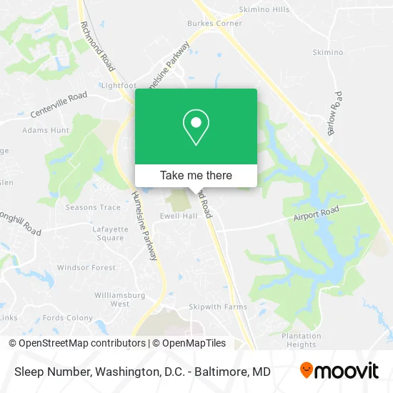
See Sleep Number, James City County, on the map
Public Transit to Sleep Number in James City County
Wondering how to get to Sleep Number in James City County? Moovit helps you find the best way to get to Sleep Number with step-by-step directions from the nearest public transit station.
Moovit provides free maps and live directions to help you navigate through your city. View schedules, routes, timetables, and find out how long does it take to get to Sleep Number in real time.
Looking for the nearest stop or station to Sleep Number? Check out this list of stops closest to your destination: Richmond Rd at Olde Towne Rd; Mooretown Rd at Ewell Rd 1.
Bus: 2, 7.
Want to see if there’s another route that gets you there at an earlier time? Moovit helps you find alternative routes or times. Get directions from and directions to Sleep Number easily from the Moovit App or Website.
We make riding to Sleep Number easy, which is why over 1.5 million users, including users in James City County, trust Moovit as the best app for public transit. You don’t need to download an individual bus app or train app, Moovit is your all-in-one transit app that helps you find the best bus time or train time available.
For information on prices of bus and train, costs and ride fares to Sleep Number, please check the Moovit app.
Use the app to navigate to popular places including to the airport, hospital, stadium, grocery store, mall, coffee shop, school, college, and university.
Sleep Number Address: 5707 Richmond Rd Williamsburg, VA 23188 street in James City County
- Banana Republic,
- Williamsburg Mattress Emporium,
- Turn the Page Bookshop,
- Elegant Design Quince,
- MCI Telecommunications,
- Izod Outlet,
- Nautica,
- Van Heusen,
- Escada Company Store,
- Michael Kors,
- Izod,
- Le Gourmet Chef,
- Williamsburg Prem Outl,
- Virginia Gourmet,
- Jones New York,
- Rocjford Footwear Depot,
- Sweet Baby Cakes,
- Bare Minerals,
- Boost Mobile,
- Go Calendars Games & Toys
Places Near Sleep Number (James City County)
- Capital One Arena, Washington,
- M&T Bank Stadium, Baltimore,
- National Theatre, Washington,
- PG Mall, Prince George's County,
- Amazon Hq2, Arlington County,
- The Anthem, Washington,
- Camden Yards, Baltimore,
- Museum Of The Bible, Washington,
- Basilica of the National Shrine, Washington,
- Sibley Memorial Hospital, Washington,
- Warner Theatre, Washington,
- Pennsylvania Ave NW (3rd st and pennsylvania), Washington,
- Washington DC VA Medical Center, Washington,
- Rock Creek Tennis Center, Washington,
- Washington National Cathedral, Washington,
- National Zoo, Washington,
- National Museum of African American History and Culture, Washington,
- Marriott Marquis Washington, DC, Washington,
- Westfield Montgomery Mall, Montgomery County,
- Georgetown, Washington
How to get to popular places in Washington, D.C. - Baltimore, MD with public transit
Get around James City County by public transit!
Traveling around James City County has never been so easy. See step by step directions as you travel to any attraction, street or major public transit station. View bus and train schedules, arrival times, service alerts and detailed routes on a map, so you know exactly how to get to anywhere in James City County.
When traveling to any destination around James City County use Moovit's Live Directions with Get Off Notifications to know exactly where and how far to walk, how long to wait for your line, and how many stops are left. Moovit will alert you when it's time to get off — no need to constantly re-check whether yours is the next stop.
Wondering how to use public transit in James City County or how to pay for public transit in James City County? Moovit public transit app can help you navigate your way with public transit easily, and at minimum cost. It includes public transit fees, ticket prices, and costs. Looking for a map of James City County public transit lines? Moovit public transit app shows all public transit maps in James City County with all Bus, Train, Metro, Light Rail and Ferry routes and stops on an interactive map.
Washington, D.C. - Baltimore, MD has 5 transit type(s), including: Bus, Train, Metro, Light Rail and Ferry, operated by several transit agencies, including WMATA, Montgomery County Ride On, Fairfax Connector, TheBus, PRTC, DASH - Alexandria, Arlington Transit (ART), RTA of Central Maryland, MDOT MTA, MDOT MTA Light RailLink, MDOT MTA Commuter Bus, MDOT MTA Local Bus, FXBGO!, Virginia Railway Express (VRE) and MARC