How to get to Slern by bus?
Click on the bus route to see step by step directions with maps, line arrival times and updated time schedules.
From GRN-Klinik Schwetzingen, Schwetzingen
93 minFrom Friedhof Käfertal, Käfertal
50 minFrom Universitätsklinikum Heidelberg-Notaufnahme, Neuenheim
113 minFrom Marie-Baum-Schule Heidelberg, Wieblingen
144 minFrom Globus Getränkecenter, Ludwigshafen-Oggersheim
83 minFrom Globus Getränkemarkt, Ludwigshafen-Oggersheim
84 minFrom Hans-Warsch-Platz,Ludwigshafen Oggersheim, Ludwigshafen-Oggersheim
59 minFrom Thoraxklinik Heidelberg, Neuenheim
116 minFrom Möbel Höffner, Schwetzingen
52 min
How to get to Slern by train?
Click on the train route to see step by step directions with maps, line arrival times and updated time schedules.
Light Rail stations near Slern in Innenstadt/Jungbusch
Bus stop near Slern in Innenstadt/Jungbusch
- Mannheim, Mensa am Schloss, 9 min walk,VIEW
Bus lines to Slern in Innenstadt/Jungbusch
What are the closest stations to Slern?
The closest stations to Slern are:
- Mannheim, Rathaus/Rem Bstg B is 148 meters away, 3 min walk.
- Mannheim, Paradeplatz is 205 meters away, 3 min walk.
- Mannheim, Mensa am Schloss is 641 meters away, 9 min walk.
Which train lines stop near Slern?
These train lines stop near Slern: RB35, RE60, S3, S6.
Which light rail lines stop near Slern?
These light rail lines stop near Slern: 1, 4, 4A, 5, RNV 5, RNV 6.
Which bus lines stop near Slern?
These bus lines stop near Slern: 53, 60, 710, 74, 76, RNV 65.
What’s the nearest light rail station to Slern in Innenstadt/Jungbusch?
The nearest light rail stations to Slern in Innenstadt/Jungbusch are Mannheim, Rathaus/Rem Bstg B and Mannheim, Paradeplatz. The closest one is a 3 min walk away.
What’s the nearest bus station to Slern in Innenstadt/Jungbusch?
The nearest bus station to Slern in Innenstadt/Jungbusch is Mannheim, Mensa am Schloss. It’s a 9 min walk away.
What time is the first light rail to Slern in Innenstadt/Jungbusch?
The RNV 1 is the first light rail that goes to Slern in Innenstadt/Jungbusch. It stops nearby at 3:00 AM.
What time is the last light rail to Slern in Innenstadt/Jungbusch?
The RNV 1 is the last light rail that goes to Slern in Innenstadt/Jungbusch. It stops nearby at 3:00 AM.
What time is the first bus to Slern in Innenstadt/Jungbusch?
The RNV 7 is the first bus that goes to Slern in Innenstadt/Jungbusch. It stops nearby at 4:28 AM.
What time is the last bus to Slern in Innenstadt/Jungbusch?
The RNV 60 is the last bus that goes to Slern in Innenstadt/Jungbusch. It stops nearby at 1:08 AM.
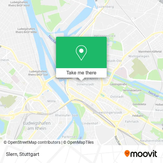
See Slern, Innenstadt/Jungbusch, on the map
Public Transit to Slern in Innenstadt/Jungbusch
Wondering how to get to Slern in Innenstadt/Jungbusch? Moovit helps you find the best way to get to Slern with step-by-step directions from the nearest public transit station.
Moovit provides free maps and live directions to help you navigate through your city. View schedules, routes, timetables, and find out how long does it take to get to Slern in real time.
Looking for the nearest stop or station to Slern? Check out this list of stops closest to your destination: Mannheim; Mannheim; Mannheim.
Train: RB35, RE60, S3, S6.Light Rail: 1, 4, 4A, 5, RNV 5, RNV 6.Bus: 53, 60, 710, 74, 76, RNV 65, RNV 60.
Want to see if there’s another route that gets you there at an earlier time? Moovit helps you find alternative routes or times. Get directions from and directions to Slern easily from the Moovit App or Website.
We make riding to Slern easy, which is why over 1.7 million users, including users in Innenstadt/Jungbusch, trust Moovit as the best app for public transit. You don’t need to download an individual bus app or train app, Moovit is your all-in-one transit app that helps you find the best bus time or train time available.
For information on prices of bus, light rail and train, costs and ride fares to Slern, please check the Moovit app.
Use the app to navigate to popular places including to the airport, hospital, stadium, grocery store, mall, coffee shop, school, college, and university.
Slern Address: E3 13 68159 Mannheim street in Innenstadt/Jungbusch
- Scarus-Software & Consulting Ulrich & Partner,
- Rechtsanwältin Meral Korkmaz,
- Gvv,
- Café Pelo,
- Westa Rudolf Dr. & Kollegen,
- Cafe City Treff,
- Nk-Arbeitsvermittlung Rolf Kuch,
- Nachtschwärmerboutique,
- Herbert Richter Schmerztherapie,
- Ak-Finanz Kapitalvermittlungs,
- Anwaltskanzlei Dr. Westa, Dr. Thiemann-Westa Und Merwarth,
- Dr. Thomas Honecker Augenarzt,
- Meral Korkmaz,
- Nk Rolf Kuch,
- Schwan-Apotheke,
- Dr. Peter Mattes,
- Aykut Güngör,
- Abax Gmbh,
- Zi Mannheim Psychosomatische Ambulanz,
- Minnie's Pub
Places Near Slern (Innenstadt/Jungbusch)
- Gleis 101/102 (tief), Stuttgart-Mitte,
- Klinikum Stuttgart - Katharinenhospital, Stuttgart-Mitte,
- Schleyerhalle, Bad Cannstatt,
- Waldfriedhof, Degerloch,
- Marmorsaal Im Weissenburgpark, Stuttgart-Süd,
- Gasometer Pforzheim, Pforzheim,
- FlixBus Haltestelle, Stuttgart,
- Pariser Platz Stuttgart, Stuttgart-Mitte,
- Im Wizemann (Halle), Bad Cannstatt,
- Mercedes-Benz Museum, Bad Cannstatt,
- Hanns-Martin-Schleyer-Halle, Bad Cannstatt,
- Geilhaus Haus 33a, Reutlingen-Betzingen,
- Mercedes-Benz Museum (Mercedes Museum Stuttgart), Bad Cannstatt,
- Hauptbahnhof Stuttgart, Stuttgart-Mitte,
- Hanns-Martin-Schleyer-Halle (Stuttgart Hans-Martin-Schleyerhalle), Bad Cannstatt,
- Porsche-Arena, Bad Cannstatt,
- Wilhelma (U-Bahn Wilhelma), Bad Cannstatt,
- SI-Centrum, Möhringen,
- Mettingen Eros-Center Puff Laufhaus, Esslingen Am Neckar,
- Porsche Museum, Zuffenhausen
How to get to popular places in Stuttgart with public transit
Get around Innenstadt/Jungbusch by public transit!
Traveling around Innenstadt/Jungbusch has never been so easy. See step by step directions as you travel to any attraction, street or major public transit station. View bus and train schedules, arrival times, service alerts and detailed routes on a map, so you know exactly how to get to anywhere in Innenstadt/Jungbusch.
When traveling to any destination around Innenstadt/Jungbusch use Moovit's Live Directions with Get Off Notifications to know exactly where and how far to walk, how long to wait for your line, and how many stops are left. Moovit will alert you when it's time to get off — no need to constantly re-check whether yours is the next stop.
Wondering how to use public transit in Innenstadt/Jungbusch or how to pay for public transit in Innenstadt/Jungbusch? Moovit public transit app can help you navigate your way with public transit easily, and at minimum cost. It includes public transit fees, ticket prices, and costs. Looking for a map of Innenstadt/Jungbusch public transit lines? Moovit public transit app shows all public transit maps in Innenstadt/Jungbusch with all Bus, Train, Subway, Light Rail, Ferry, S-Bahn and Funicular routes and stops on an interactive map.
Stuttgart has 7 transit type(s), including: Bus, Train, Subway, Light Rail, Ferry, S-Bahn and Funicular, operated by several transit agencies, including SSB - Stadtbahn, SSB, SSB - Seilbahn / Zacke, S-Bahn Stuttgart, Rhein-Neckar-Verkehr GmbH (rnv), Karlsruher Verkehrsverbund, DB AG, DB Regiobus BW, Arverio Baden-Württemberg GmbH, DB RegioNetz Verkehrs GmbH Westfrankenbahn, DB Regio AG Baden-Württemberg, Südwestdeutsche Verkehrs-AG, DB Regio AG Mitte Region Hessen, DB and Bodensee-Oberschwaben-Bahn