Directions to Slyde @ 23 (Staunton) with public transportation
The following transit lines have routes that pass near Slyde @ 23
 Bus: 250 CONNECTOR, BRCC SOUTH, BRCC NORTH, WEST / NORTH LOOP.
- Train: CARDINAL.
How to get to Slyde @ 23 by bus?
Click on the bus route to see step by step directions with maps, line arrival times and updated time schedules.
Bus stops near Slyde @ 23 in Staunton
Train station near Slyde @ 23 in Staunton
- Staunton Amtrak Station, 54 min walk,VIEW
Bus lines to Slyde @ 23 in Staunton
What are the closest stations to Slyde @ 23?
The closest stations to Slyde @ 23 are:
- Frederick St / N Central Ave is 81 yards away, 2 min walk.
- Central United Methodist Church is 322 yards away, 4 min walk.
- Staunton Hub / Lewis St is 416 yards away, 6 min walk.
- Staunton Amtrak Station is 4576 yards away, 54 min walk.
Which bus lines stop near Slyde @ 23?
These bus lines stop near Slyde @ 23: 250 CONNECTOR, BRCC SOUTH.
What’s the nearest bus station to Slyde @ 23 in Staunton?
The nearest bus station to Slyde @ 23 in Staunton is Frederick St / N Central Ave. It’s a 2 min walk away.
What time is the first bus to Slyde @ 23 in Staunton?
The WEST / NORTH LOOP is the first bus that goes to Slyde @ 23 in Staunton. It stops nearby at 6:30 AM.
What time is the last bus to Slyde @ 23 in Staunton?
The 250 CONNECTOR is the last bus that goes to Slyde @ 23 in Staunton. It stops nearby at 9:30 PM.
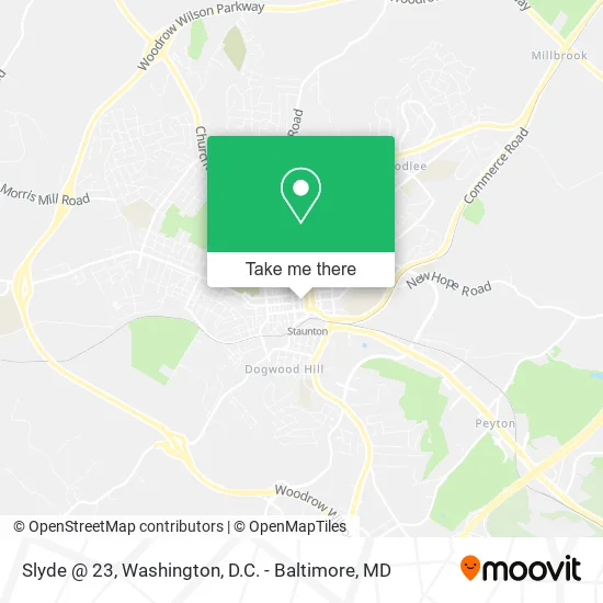
See Slyde @ 23, Staunton, on the map
Public Transit to Slyde @ 23 in Staunton
Wondering how to get to Slyde @ 23 in Staunton? Moovit helps you find the best way to get to Slyde @ 23 with step-by-step directions from the nearest public transit station.
Moovit provides free maps and live directions to help you navigate through your city. View schedules, routes, timetables, and find out how long does it take to get to Slyde @ 23 in real time.
Looking for the nearest stop or station to Slyde @ 23? Check out this list of stops closest to your destination: Frederick St / N Central Ave; Central United Methodist Church; Staunton Hub / Lewis St; Staunton Amtrak Station.
Bus: 250 CONNECTOR, BRCC SOUTH, BRCC NORTH, WEST / NORTH LOOP.Train: CARDINAL.
Want to see if there’s another route that gets you there at an earlier time? Moovit helps you find alternative routes or times. Get directions from and directions to Slyde @ 23 easily from the Moovit App or Website.
We make riding to Slyde @ 23 easy, which is why over 1.5 million users, including users in Staunton, trust Moovit as the best app for public transit. You don’t need to download an individual bus app or train app, Moovit is your all-in-one transit app that helps you find the best bus time or train time available.
For information on prices of bus, costs and ride fares to Slyde @ 23, please check the Moovit app.
Use the app to navigate to popular places including to the airport, hospital, stadium, grocery store, mall, coffee shop, school, college, and university.
Slyde @ 23 Address: 23 W Beverley St Staunton, VA 24401 street in Staunton
- Once upon A Time Clock Shop,
- The Artisans Loft,
- Staunton Antiques Center,
- Once upon A Time,
- Clock Tower Convenience Store,
- Clocktower Restaurant & Bar,
- Hl Lang Jewelers,
- McCaskey & Pyle, Attorneys-at-Law,
- The Foundry,
- Fretwell Bass,
- V-Anne Evans,
- Coart Gallery,
- Frontline Model Kits & Hobbies,
- Treasure-Box-Merchandise,
- Worthington Hardware,
- Warehouse Antiques & Collectibles,
- Ware House Miniatures,
- Staunton City Schools,
- Shenandoah Shakespeare Administrative Offices,
- The Space: A Counseling Center, LLC
Places Near Slyde @ 23 (Staunton)
- Georgetown, Washington,
- Basilica of the National Shrine, Washington,
- Washington National Cathedral, Washington,
- National Mall, Washington,
- National Zoo, Washington,
- Pennsylvania Ave NW (3rd st and pennsylvania), Washington,
- Rock Creek Tennis Center, Washington,
- Amazon Hq2, Arlington County,
- Marriott Marquis Washington, DC, Washington,
- Washington DC VA Medical Center, Washington,
- PG Mall, Prince George's County,
- M&T Bank Stadium, Baltimore,
- Warner Theatre, Washington,
- Sibley Memorial Hospital, Washington,
- The Anthem, Washington,
- Camden Yards, Baltimore,
- Museum Of The Bible, Washington,
- Westfield Montgomery Mall, Montgomery County,
- Capital One Arena, Washington,
- National Museum of African American History and Culture, Washington
How to get to popular places in Washington, D.C. - Baltimore, MD with public transit
Get around Staunton by public transit!
Traveling around Staunton has never been so easy. See step by step directions as you travel to any attraction, street or major public transit station. View bus and train schedules, arrival times, service alerts and detailed routes on a map, so you know exactly how to get to anywhere in Staunton.
When traveling to any destination around Staunton use Moovit's Live Directions with Get Off Notifications to know exactly where and how far to walk, how long to wait for your line, and how many stops are left. Moovit will alert you when it's time to get off — no need to constantly re-check whether yours is the next stop.
Wondering how to use public transit in Staunton or how to pay for public transit in Staunton? Moovit public transit app can help you navigate your way with public transit easily, and at minimum cost. It includes public transit fees, ticket prices, and costs. Looking for a map of Staunton public transit lines? Moovit public transit app shows all public transit maps in Staunton with all Bus, Train, Metro, Light Rail and Ferry routes and stops on an interactive map.
Washington, D.C. - Baltimore, MD has 5 transit type(s), including: Bus, Train, Metro, Light Rail and Ferry, operated by several transit agencies, including WMATA, Montgomery County Ride On, Fairfax Connector, TheBus, PRTC, DASH - Alexandria, Arlington Transit (ART), RTA of Central Maryland, MDOT MTA, MDOT MTA Light RailLink, MDOT MTA Commuter Bus, MDOT MTA Local Bus, FXBGO!, Virginia Railway Express (VRE) and MARC