How to get to Smartcae by bus?
Click on the bus route to see step by step directions with maps, line arrival times and updated time schedules.
From Verdi Theater, Florence
52 minFrom Faentina Street, Florence
89 minFrom Ponte a Ema, Bagno a Ripoli
70 minFrom Central Market Florence, Florence
44 minFrom Prosperius Villa Cherubini Institute, Florence
95 minFrom Carabinieri Non-Commissioned Officers School, Florence
65 minFrom Italian Red Cross - Anna Torrigiani Center, Florence
87 minFrom San Domenico Street, Florence
94 minFrom Camerata Street, Florence
87 minFrom Giano della Bella Street, Florence
49 min
Bus stops near Smartcae in Scandicci
Light Rail stations near Smartcae in Scandicci
Bus lines to Smartcae in Scandicci
- S3, Marconi School - Pettini School,VIEW
- 26, San Colombano/Badia A Settimo - Torregalli,VIEW
- 72, T1 Nenni - Lastra A Signa Station/Signa/Montelupo,VIEW
- 83, Torregalli - Signa/Porto Di Mezzo,VIEW
- 94, Le Bagnese/Lastra A Signa Station - Officine Galileo/M&R,VIEW
- 93, Batoni Square,VIEW
- 27, Vingone San Zanobi,VIEW
- 61, 78th Regiment,VIEW
- 63, San Vincenzo A Torri,VIEW
- 351 A, Europa,VIEW
- 15, T1 De Andre,VIEW
What are the closest stations to Smartcae?
The closest stations to Smartcae are:
- Lower Pisan Road is 284 meters away, 4 min walk.
- Pisana Respighi is 320 meters away, 5 min walk.
- Spontini is 393 meters away, 6 min walk.
- Ponchielli Donizetti is 524 meters away, 7 min walk.
- Codignola Street is 575 meters away, 8 min walk.
- Newton Bachelet is 740 meters away, 10 min walk.
- Villa Costanza is 1110 meters away, 15 min walk.
- Aldo Moro is 1250 meters away, 16 min walk.
Which bus lines stop near Smartcae?
These bus lines stop near Smartcae: 26, 83.
Which light rail line stops near Smartcae?
T1 (Villa Costanza)
What’s the nearest light rail station to Smartcae in Scandicci?
The nearest light rail station to Smartcae in Scandicci is Villa Costanza. It’s a 15 min walk away.
What’s the nearest bus station to Smartcae in Scandicci?
The nearest bus station to Smartcae in Scandicci is Lower Pisan Road. It’s a 4 min walk away.
What time is the first light rail to Smartcae in Scandicci?
The T2 is the first light rail that goes to Smartcae in Scandicci. It stops nearby at 4:33 AM.
What time is the last light rail to Smartcae in Scandicci?
The T2 is the last light rail that goes to Smartcae in Scandicci. It stops nearby at 1:04 AM.
What time is the first bus to Smartcae in Scandicci?
The 27 is the first bus that goes to Smartcae in Scandicci. It stops nearby at 6:24 AM.
What time is the last bus to Smartcae in Scandicci?
The 27 is the last bus that goes to Smartcae in Scandicci. It stops nearby at 10:36 PM.
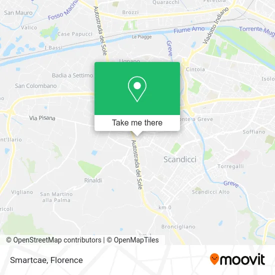
See Smartcae, Scandicci, on the map
Public Transit to Smartcae in Scandicci
Wondering how to get to Smartcae in Scandicci? Moovit helps you find the best way to get to Smartcae with step-by-step directions from the nearest public transit station.
Moovit provides free maps and live directions to help you navigate through your city. View schedules, routes, timetables, and find out how long does it take to get to Smartcae in real time.
Looking for the nearest stop or station to Smartcae? Check out this list of stops closest to your destination: Lower Pisan Road; Pisana Respighi; Spontini; Ponchielli Donizetti; Codignola Street; Newton Bachelet; Villa Costanza; Aldo Moro.
Bus: 26, 83, S3, 72, 94, 93, 27, 61, 63, 351 A, 15.Light Rail: T1.
Want to see if there’s another route that gets you there at an earlier time? Moovit helps you find alternative routes or times. Get directions from and directions to Smartcae easily from the Moovit App or Website.
We make riding to Smartcae easy, which is why over 1.5 million users, including users in Scandicci, trust Moovit as the best app for public transit. You don’t need to download an individual bus app or train app, Moovit is your all-in-one transit app that helps you find the best bus time or train time available.
For information on prices of bus and light rail, costs and ride fares to Smartcae, please check the Moovit app.
Use the app to navigate to popular places including to the airport, hospital, stadium, grocery store, mall, coffee shop, school, college, and university.
Smartcae Address: Via Ottorino Respighi, 4 50018 Scandicci street in Scandicci
- Unipolsai Insurance Division Unipol Lucarelli Luca,
- Straccali,
- British Passport,
- Tecnopeas by Osvaldo Villanelli & Co,
- Senatori Spa,
- Educational Services,
- Casellina Street / Ottorino Respighi Street,
- Atelier Bois Simplified Single-Person Limited Liability Company,
- Kyklos Multidisciplinary Center,
- Edil Zito,
- Gam Shinedetailing,
- Sicurdata,
- Giancarlo Leather Goods,
- Giusy Hair Salon by Giuseppa Tripolino,
- Ludovico Porfido,
- Accountant Alberico Porfido Studio,
- Capaldo Maurizio,
- Dr. Stefano Peggio,
- Casellina Sports Club,
- People's House of Casellina
Places Near Smartcae (Scandicci)
- Michelangelo Square, Florence,
- Visarno Arena, Florence,
- Santa Maria Nuova Hospital, Florence,
- Torregalli Hospital Scandicci *, Scandicci,
- Santa Maria Novella Station, Florence,
- Verdi Theater, Florence,
- Piero Palagi Hospital Facility-Florence, Florence,
- Visarno Hippodrome, Florence,
- Michelangelo Square, Florence,
- Asmana, Campi Bisenzio,
- Nelson Mandela Forum, Florence,
- IKEA Florence, Sesto Fiorentino,
- Cascine Park, Florence,
- Artemio Franchi Municipal Stadium, Florence,
- Campi Bisenzio, Campi Bisenzio,
- OOO, Florence,
- Field of Mars, Florence,
- I Gigli, Campi Bisenzio,
- Tobacco Manufacture, Florence,
- Mandela Forum (Nelson Mandela Forum), Florence
How to get to popular places in Florence with public transit
Get around Scandicci by public transit!
Traveling around Scandicci has never been so easy. See step by step directions as you travel to any attraction, street or major public transit station. View bus and train schedules, arrival times, service alerts and detailed routes on a map, so you know exactly how to get to anywhere in Scandicci.
When traveling to any destination around Scandicci use Moovit's Live Directions with Get Off Notifications to know exactly where and how far to walk, how long to wait for your line, and how many stops are left. Moovit will alert you when it's time to get off — no need to constantly re-check whether yours is the next stop.
Wondering how to use public transit in Scandicci or how to pay for public transit in Scandicci? Moovit public transit app can help you navigate your way with public transit easily, and at minimum cost. It includes public transit fees, ticket prices, and costs. Looking for a map of Scandicci public transit lines? Moovit public transit app shows all public transit maps in Scandicci with all Bus, Train, Light Rail, Ferry and Funicular routes and stops on an interactive map.
Florence has 5 transit type(s), including: Bus, Train, Light Rail, Ferry and Funicular, operated by several transit agencies, including Florence Urban - Tuscan Bus Lines, GEST, Livorno and Province - Tuscan Bus Lines, Arezzo, Florence and Provinces - Tuscan Bus Lines, Prato and Province - Tuscan Bus Lines, Lucca and Province - Tuscan Bus Lines, Massa, Carrara and Province - Tuscan Bus Lines, Pisa and Province - Tuscan Bus Lines, Grosseto, Siena and Provinces - Tuscan Bus Lines, Arezzo, Siena and Provinces - Tuscan Bus Lines, Florence and Province - Tuscan Bus Lines, Pistoia and Province - Tuscan Bus Lines, Siena and Province - Tuscan Bus Lines, Arezzo and Province - Tuscan Bus Lines and Trenitalia