Directions to Smith Elite Chiro (Baltimore) with public transportation
The following transit lines have routes that pass near Smith Elite Chiro
 Bus: 91, CITYLINK GREEN, CITYLINK PINK, CITYLINK SILVER, CITYLINK YELLOW.
- Train: MARC.
- Metro: METRO.
How to get to Smith Elite Chiro by bus?
Click on the bus route to see step by step directions with maps, line arrival times and updated time schedules.
From Sinai Hospital, Baltimore
51 minFrom University Of Maryland Baltimore (Umbc), Baltimore County
51 minFrom I-70 at Security Blvd Baltimore City Lot Park & Ride, Baltimore
50 minFrom Dundalk, Maryland, Baltimore County
51 minFrom I-695 @ Exit 17 (Security Blvd/MD 122), Baltimore County
47 minFrom Reisterstown Road Plaza, Baltimore
65 minFrom Eastern Ave (eastern avenue and dundalk av), Baltimore
34 minFrom MVA Glen Burnie, Anne Arundel County
39 minFrom Towson Town Center, Baltimore County
48 minFrom Guinness Open Gate Brewery & Barrel House, Baltimore County
72 min
How to get to Smith Elite Chiro by train?
Click on the train route to see step by step directions with maps, line arrival times and updated time schedules.
How to get to Smith Elite Chiro by metro?
Click on the metro route to see step by step directions with maps, line arrival times and updated time schedules.
Bus stops near Smith Elite Chiro in Baltimore
Light Rail stations near Smith Elite Chiro in Baltimore
- Cultural Center / State Center, 7 min walk,VIEW
Train station near Smith Elite Chiro in Baltimore
- Penn Station Marc Sb, 14 min walk,VIEW
Metro station near Smith Elite Chiro in Baltimore
- State Center Metro, 30 min walk,VIEW
Bus lines to Smith Elite Chiro in Baltimore
What are the closest stations to Smith Elite Chiro?
The closest stations to Smith Elite Chiro are:
- Saint Paul St & Madison St Sb is 23 yards away, 1 min walk.
- St Paul St & Madison St is 23 yards away, 1 min walk.
- Madison St & Charles St Wb Ns is 82 yards away, 2 min walk.
- Charles St & Read St Nb is 209 yards away, 3 min walk.
- Cultural Center / State Center is 528 yards away, 7 min walk.
- Penn Station Marc Sb is 1126 yards away, 14 min walk.
- State Center Metro is 2552 yards away, 30 min walk.
Which bus lines stop near Smith Elite Chiro?
These bus lines stop near Smith Elite Chiro: 91, CITYLINK GREEN, CITYLINK PINK, CITYLINK SILVER, CITYLINK YELLOW, PURPLE ROUTE.
Which train line stops near Smith Elite Chiro?
MARC (Inbound - Penn)
Which metro line stops near Smith Elite Chiro?
METRO (Towards John Hopkins)
What’s the nearest light rail station to Smith Elite Chiro in Baltimore?
The nearest light rail station to Smith Elite Chiro in Baltimore is Cultural Center / State Center. It’s a 7 min walk away.
What’s the nearest metro station to Smith Elite Chiro in Baltimore?
The nearest metro station to Smith Elite Chiro in Baltimore is State Center Metro. It’s a 30 min walk away.
What’s the nearest train station to Smith Elite Chiro in Baltimore?
The nearest train station to Smith Elite Chiro in Baltimore is Penn Station Marc Sb. It’s a 14 min walk away.
What’s the nearest bus station to Smith Elite Chiro in Baltimore?
The nearest bus stations to Smith Elite Chiro in Baltimore are Saint Paul St & Madison St Sb and St Paul St & Madison St. The closest one is a 1 min walk away.
What time is the first light rail to Smith Elite Chiro in Baltimore?
The LIGHT RAILLINK is the first light rail that goes to Smith Elite Chiro in Baltimore. It stops nearby at 3:50 AM.
What time is the last light rail to Smith Elite Chiro in Baltimore?
The LIGHT RAILLINK is the last light rail that goes to Smith Elite Chiro in Baltimore. It stops nearby at 1:26 AM.
What time is the first metro to Smith Elite Chiro in Baltimore?
The METRO is the first metro that goes to Smith Elite Chiro in Baltimore. It stops nearby at 5:07 AM.
What time is the last metro to Smith Elite Chiro in Baltimore?
The METRO is the last metro that goes to Smith Elite Chiro in Baltimore. It stops nearby at 12:22 AM.
What time is the first train to Smith Elite Chiro in Baltimore?
The MARC is the first train that goes to Smith Elite Chiro in Baltimore. It stops nearby at 4:30 AM.
What time is the last train to Smith Elite Chiro in Baltimore?
The MARC is the last train that goes to Smith Elite Chiro in Baltimore. It stops nearby at 8:45 PM.
What time is the first bus to Smith Elite Chiro in Baltimore?
The CITYLINK PINK is the first bus that goes to Smith Elite Chiro in Baltimore. It stops nearby at 3:02 AM.
What time is the last bus to Smith Elite Chiro in Baltimore?
The CITYLINK SILVER is the last bus that goes to Smith Elite Chiro in Baltimore. It stops nearby at 3:18 AM.
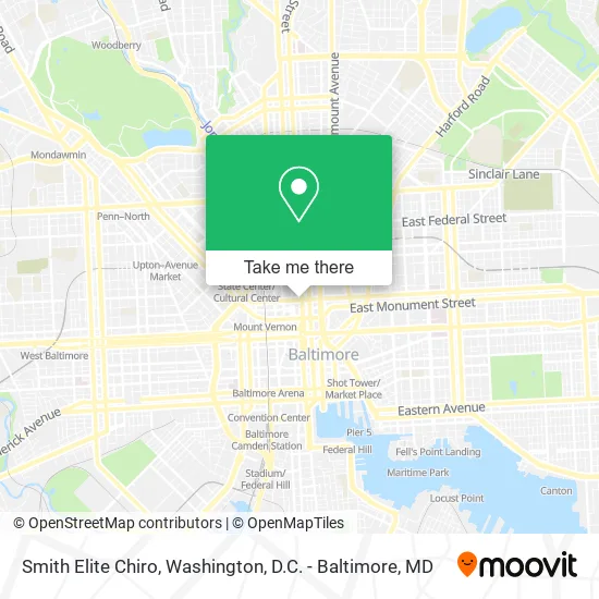
See Smith Elite Chiro, Baltimore, on the map
Public Transit to Smith Elite Chiro in Baltimore
Wondering how to get to Smith Elite Chiro in Baltimore? Moovit helps you find the best way to get to Smith Elite Chiro with step-by-step directions from the nearest public transit station.
Moovit provides free maps and live directions to help you navigate through your city. View schedules, routes, timetables, and find out how long does it take to get to Smith Elite Chiro in real time.
Looking for the nearest stop or station to Smith Elite Chiro? Check out this list of stops closest to your destination: Saint Paul St & Madison St Sb; St Paul St & Madison St; Madison St & Charles St Wb Ns; Charles St & Read St Nb; Cultural Center / State Center; Penn Station Marc Sb; State Center Metro.
Bus: 91, CITYLINK GREEN, CITYLINK PINK, CITYLINK SILVER, CITYLINK YELLOW, PURPLE ROUTE, 95, 103, 410.Train: MARC.Metro: METRO.
Want to see if there’s another route that gets you there at an earlier time? Moovit helps you find alternative routes or times. Get directions from and directions to Smith Elite Chiro easily from the Moovit App or Website.
We make riding to Smith Elite Chiro easy, which is why over 1.5 million users, including users in Baltimore, trust Moovit as the best app for public transit. You don’t need to download an individual bus app or train app, Moovit is your all-in-one transit app that helps you find the best bus time or train time available.
For information on prices of bus, metro and train, costs and ride fares to Smith Elite Chiro, please check the Moovit app.
Use the app to navigate to popular places including to the airport, hospital, stadium, grocery store, mall, coffee shop, school, college, and university.
Smith Elite Chiro Address: 58 E Madison St Baltimore, MD 21202 street in Baltimore
- Smoke 101,
- Chiropractic,
- Maryland Trial Lawyers Association,
- Consilience Financial,
- The Loyola School,
- Midtowne Hotel,
- El Patron,
- Michael Group,
- Alcohol Detox Hotline Baltimore, MD,
- Portage,
- Purely Clean Solutions,
- Baltimore Reads,
- Coral Wig,
- Jesuit Volunteers,
- Idfive,
- Donna's Mt Vernon,
- My Thai Go,
- Law Offices of Ryan Burke,
- Mymorale.Co,
- Maryland Capital
Places Near Smith Elite Chiro (Baltimore)
- National Mall, Washington,
- Camden Yards, Baltimore,
- Sibley Memorial Hospital, Washington,
- Warner Theatre, Washington,
- Marriott Marquis Washington, DC, Washington,
- National Zoo, Washington,
- Museum Of The Bible, Washington,
- Pennsylvania Ave NW (3rd st and pennsylvania), Washington,
- PG Mall, Prince George's County,
- National Museum of African American History and Culture, Washington,
- The Anthem, Washington,
- Georgetown, Washington,
- Washington National Cathedral, Washington,
- M&T Bank Stadium, Baltimore,
- Washington DC VA Medical Center, Washington,
- Basilica of the National Shrine, Washington,
- Westfield Montgomery Mall, Montgomery County,
- Rock Creek Tennis Center, Washington,
- Capital One Arena, Washington,
- Amazon Hq2, Arlington County
How to get to popular places in Washington, D.C. - Baltimore, MD with public transit
Get around Baltimore by public transit!
Traveling around Baltimore has never been so easy. See step by step directions as you travel to any attraction, street or major public transit station. View bus and train schedules, arrival times, service alerts and detailed routes on a map, so you know exactly how to get to anywhere in Baltimore.
When traveling to any destination around Baltimore use Moovit's Live Directions with Get Off Notifications to know exactly where and how far to walk, how long to wait for your line, and how many stops are left. Moovit will alert you when it's time to get off — no need to constantly re-check whether yours is the next stop.
Wondering how to use public transit in Baltimore or how to pay for public transit in Baltimore? Moovit public transit app can help you navigate your way with public transit easily, and at minimum cost. It includes public transit fees, ticket prices, and costs. Looking for a map of Baltimore public transit lines? Moovit public transit app shows all public transit maps in Baltimore with all Bus, Train, Metro, Light Rail and Ferry routes and stops on an interactive map.
Washington, D.C. - Baltimore, MD has 5 transit type(s), including: Bus, Train, Metro, Light Rail and Ferry, operated by several transit agencies, including WMATA, Montgomery County Ride On, Fairfax Connector, TheBus, PRTC, DASH - Alexandria, Arlington Transit (ART), RTA of Central Maryland, MDOT MTA, MDOT MTA Light RailLink, MDOT MTA Commuter Bus, MDOT MTA Local Bus, FXBGO!, Virginia Railway Express (VRE) and MARC