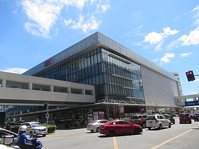
Smx Convention Center
-
-
-
-
-
-
-
-
-
-
Directions to Smx Convention Center stop (Parañaque) with public transit
The following transit lines have routes that pass near Smx Convention Center
 Bus: E, JEEP, P2P, UV, BUS.
- Train: LRT 1, MRT3.
How to get to Smx Convention Center stop by bus?
Click on the bus route to see step by step directions with maps, line arrival times and updated time schedules.
How to get to Smx Convention Center stop by train?
Click on the train route to see step by step directions with maps, line arrival times and updated time schedules.
Bus stops near Smx Convention Center stop in Parañaque
- Jose Diokno Blvd, Lungsod Ng Pasay, 10 min walk,
- Coral Way / Diosdado Macapagal Blvd Intersection, Lungsod Ng Pasay, Manila, 13 min walk,
- Mall Of Asia, 14 min walk,
- Epifanio De Los Santos Avenue, Lungsod Ng Pasay, 14 min walk,
Train stations near Smx Convention Center station in Parañaque
- Libertad, 36 min walk,
- Taft Ave Mrt, 36 min walk,
Bus lines to Smx Convention Center stop in Parañaque
- JEEP, BUENDIA LRT - SM MOA,
- JEEP, BUENDIA LRT TAFT - MALL OF ASIA,
- JEEP, Libertad - Malibay,
- JEEP, Pasay Rotonda - Signal Village,
- JEEP, SM MALL OF ASIA-MRT,
- BUS, Bagong Silang - NAIA via Maligaya Park, EDSA,
- BUS, Monumento NAIA via EDSA Coastal Rd,
- BUS, Baclaran - Minuyan via Commonwealth Ave,
- BUS, Baclaran SJDM via Commonwealth EDSA,
- BUS, Baclaran-Malanday via Edsa, McArthur,
- BUS, Domestic Grotto via EDSA,
- BUS, NAIA SM Fairview,
- BUS, Ayala Dasmarinas (Cavite) via Coastal Rd,
- BUS, Baclaran Novaliches via EDSA Quirino,
- BUS, NAIA - Malanday via EDSA,
- BUS, Baclaran-Navotas Terminal via EDSA,
- BUS, Malanday MIA via Pasay Rtda MOA Coastal Road,
- BUS, Baclaran SM Fairview via Lagro,
- BUS, Norzgry / Spalay-NAIA / Baclrn Via Comm Fairv Ed,
- BUS, Baclaran-BgSilang via Edsa Commonwealth,
What are the closest stations to Smx Convention Center?
The closest stations to Smx Convention Center are:
- Jose Diokno Blvd, Lungsod Ng Pasay is 687 meters away, 10 min walk.
- Coral Way / Diosdado Macapagal Blvd Intersection, Lungsod Ng Pasay, Manila is 1006 meters away, 13 min walk.
- Mall Of Asia is 1017 meters away, 14 min walk.
- Epifanio De Los Santos Avenue, Lungsod Ng Pasay is 1047 meters away, 14 min walk.
- Libertad is 2736 meters away, 36 min walk.
- Taft Ave Mrt is 2788 meters away, 36 min walk.
Which bus lines stop near Smx Convention Center?
These bus lines stop near Smx Convention Center: E, JEEP, P2P, UV.
Which train lines stop near Smx Convention Center?
These train lines stop near Smx Convention Center: LRT 1, MRT3.
What’s the nearest bus station to Smx Convention Center in Parañaque?
The nearest bus station to Smx Convention Center in Parañaque is Jose Diokno Blvd, Lungsod Ng Pasay. It’s a 10 min walk away.
What time is the first train to Smx Convention Center in Parañaque?
The LRT 1 is the first train that goes to Smx Convention Center in Parañaque. It stops nearby at 5:00 AM.
What time is the last train to Smx Convention Center in Parañaque?
The LRT 1 is the last train that goes to Smx Convention Center in Parañaque. It stops nearby at 10:49 PM.
What time is the first bus to Smx Convention Center in Parañaque?
The BUS is the first bus that goes to Smx Convention Center in Parañaque. It stops nearby at 3:22 AM.
What time is the last bus to Smx Convention Center in Parañaque?
The BUS is the last bus that goes to Smx Convention Center in Parañaque. It stops nearby at 4:23 AM.
See Smx Convention Center stop, Parañaque, on the map
Public transit to Smx Convention Center stop in Parañaque
Looking for directions to Smx Convention Center in Parañaque, Philippines?
Download the Moovit App to find the current schedule and step-by-step directions for Bus or Train routes that pass through Smx Convention Center.
Looking for the nearest stops closest to Smx Convention Center ? Check out this list of closest stops to your destination: Jose Diokno Blvd; Coral Way / Diosdado Macapagal Blvd Intersection; Mall Of Asia; Epifanio De Los Santos Avenue; Libertad; Taft Ave Mrt.
Bus: E, JEEP, P2P, UV, BUS, BUS, BUS, BUS, BUS.Train: LRT 1, MRT3.
We make riding on public transit to Smx Convention Center easy, which is why over 1.5 million users, including users in Parañaque trust Moovit as the best app for public transit.
Use the app to navigate to popular places including to the airport, hospital, stadium, grocery store, mall, coffee shop, school, college, and university.
The first line to this stop is P2P, at 5:13 AM, and the last line is P2P at 11:42 PM.
This stop serves P2P’s lines
Live Arrivals for Smx Convention Center stop
See real-time arrivals at Smx Convention Center stop, similar to an information board at stop itself. Check arrival times with live updates, delays, and service information. If you use this stop often or want to check arrival times in advance, we recommend saving this page.
- Jose Diokno Blvd, Lungsod Ng Pasay,
- Coral Way / Diosdado Macapagal Blvd Intersection, Lungsod Ng Pasay, Manila,
- Mall Of Asia,
- Epifanio De Los Santos Avenue, Lungsod Ng Pasay
Bus stops near Smx Convention Center stop
- Libertad,
- Taft Ave Mrt
Train stations near Smx Convention Center station
- Bocaue Public Market, Macarthur Highway, Bocaue, Bulacan,
- Baltazar / 5th Avenue West Intersection, Caloocan City,
- F Balagtas, Marikina City,
- Upper Mckinley Rd / N Rd, Taguig City, Manila,
- Arlegui, Manila,
- Visayas Avenue Wet And Dry Market, Visayas Avenue Quezon City,
- Commonwealth Avenue / Kalayaan A Intersection, Quezon City,
- Camarin Road, Sampaloc Intersection, Caloocan City,
- Eulogio Rodriguez Sr. Ave, Quezon City, Manila,
- Light Rail Transportation / New Antipolo, Quezon City,
- Mindanao Avenue, Quezon City,
- Batasan Road / Kaunlaran, Quezon City,
- J. Teodoro / 5th Ave West, Caloocan City, Manila,
- M H Del Pilar / Mendoza, Palasan Valenzuela City,
- Jose R. Reyes Memorial Medical Center, Rizal Avenue, Manila,
- Llano Road, Caloocan City,
- College Of St Anthony, Quirino Highway, City Of San Jose Del Monte,
- Jones Bridge / Riverside Dr Intersection, Manila,
- Airport Rd / Domestic Rd Intersection, Parañaque City, Manila,
- Montalban Highway Near San Jose Bridge, Rodriguez
Popular public transit stations in Parañaque
Get around Parañaque by public transit!
Traveling around Parañaque has never been so easy. See step by step directions as you travel to any attraction, street or major public transit station. View bus and train schedules, arrival times, service alerts and detailed routes on a map, so you know exactly how to get to anywhere in Parañaque.
When traveling to any destination around Parañaque use Moovit's Live Directions with Get Off Notifications to know exactly where and how far to walk, how long to wait for your line, and how many stops are left. Moovit will alert you when it's time to get off — no need to constantly re-check whether yours is the next stop.
Wondering how to use public transit in Parañaque or how to pay for public transit in Parañaque? Moovit public transit app can help you navigate your way with public transit easily, and at minimum cost. It includes public transit fees, ticket prices, and costs. Looking for a map of Parañaque public transit lines? Moovit public transit app shows all public transit maps in Parañaque with all Bus and Train routes and stops on an interactive map.
Manila has 2 transit type(s), including: Bus and Train, operated by several transit agencies, including MRTC, LRTA, PNR, LTFRB, BGC Bus, P2P and UV Express