Snyder Av & Swanson St stop - Monday schedule
| Line | Direction | Time |
|---|---|---|
| 79 | Columbus Commons | 5:27 AM |
| 7 | 33rd-Dauphin | 5:36 AM |
| 7 | 33rd-Dauphin | 6:00 AM |
| 79 | Columbus Commons | 6:00 AM |
| 79 | Columbus Commons | 6:16 AM |
| 7 | 33rd-Dauphin | 6:17 AM |
| 79 | Columbus Commons | 6:28 AM |
| 7 | 33rd-Dauphin | 6:32 AM |
| 79 | Columbus Commons | 6:40 AM |
| 7 | 33rd-Dauphin | 6:43 AM |
| 79 | Columbus Commons | 6:50 AM |
| 7 | 33rd-Dauphin | 6:56 AM |
| 79 | Columbus Commons | 7:00 AM |
| 7 | 33rd-Dauphin | 7:11 AM |
| 79 | Columbus Commons | 7:11 AM |
| 79 | Columbus Commons | 7:21 AM |
| 7 | 33rd-Dauphin | 7:26 AM |
| 79 | Columbus Commons | 7:31 AM |
| 79 | Columbus Commons | 7:41 AM |
| 7 | 33rd-Dauphin | 7:42 AM |
| 79 | Columbus Commons | 7:51 AM |
| 7 | 33rd-Dauphin | 7:57 AM |
| 79 | Columbus Commons | 8:01 AM |
| 79 | Columbus Commons | 8:12 AM |
| 7 | 33rd-Dauphin | 8:15 AM |
Directions to Snyder Av & Swanson St stop (Philadelphia) with public transit
The following transit lines have routes that pass near Snyder Av & Swanson St
 Bus: 7, 79, 25, 63.
- Metro: B1.
How to get to Snyder Av & Swanson St stop by bus?
Click on the bus route to see step by step directions with maps, line arrival times and updated time schedules.
How to get to Snyder Av & Swanson St stop by metro?
Click on the metro route to see step by step directions with maps, line arrival times and updated time schedules.
Bus stops near Snyder Av & Swanson St stop in Philadelphia
- Snyder Av & Swanson St, 1 min walk,
- Weccacoe Av & Snyder Av, 2 min walk,
Metro stations near Snyder Av & Swanson St station in Philadelphia
- Snyder, 20 min walk,
Bus lines to Snyder Av & Swanson St stop in Philadelphia
- 7, 33rd-Dauphin,
- 79, Columbus Commons,
- 25, Frankford Transit Center,
- 63, Overbrook Rail Station Via Produce Market,
What are the closest stations to Snyder Av & Swanson St?
The closest stations to Snyder Av & Swanson St are:
- Snyder Av & Swanson St stop is 30 yards away, 1 min walk.
- Weccacoe Av & Snyder Av stop is 117 yards away, 2 min walk.
- Snyder station is 1677 yards away, 20 min walk.
Which bus lines stop near Snyder Av & Swanson St?
These bus lines stop near Snyder Av & Swanson St: 7, 79.
Which metro line stops near Snyder Av & Swanson St?
B1 (NRG)
What’s the nearest metro station to Snyder Av & Swanson St in Philadelphia?
The nearest metro station to Snyder Av & Swanson St in Philadelphia is Snyder. It’s a 20 min walk away.
What’s the nearest bus station to Snyder Av & Swanson St in Philadelphia?
The nearest bus station to Snyder Av & Swanson St in Philadelphia is Snyder Av & Swanson St. It’s a 1 min walk away.
Snyder Av & Swanson St station
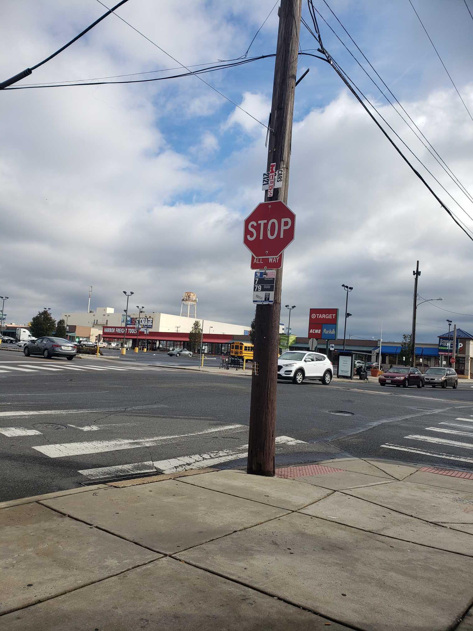 Taken by Anonymous
See Snyder Av & Swanson St stop, Philadelphia, on the map
Public transit to Snyder Av & Swanson St stop (ID: 24266) in Philadelphia
Looking for directions to Snyder Av & Swanson St in Philadelphia, United States?
Download the Moovit App to find the current schedule and step-by-step directions for Bus or Metro routes that pass through Snyder Av & Swanson St.
Looking for the nearest stops closest to Snyder Av & Swanson St ? Check out this list of closest stops to your destination: Snyder Av & Swanson St; Weccacoe Av & Snyder Av; Snyder.
Bus: 7, 79, 25, 63.Metro: B1.
We make riding on public transit to Snyder Av & Swanson St easy, which is why over 1.7 billion users, including users in Philadelphia trust Moovit as the best app for public transit.
Use the app to navigate to popular places including to the airport, hospital, stadium, grocery store, mall, coffee shop, school, college, and university.
Snyder Av & Swanson St stop’s code is 24266
The first line to this stop is 79, at 5:27 AM, and the last line is 79 at 4:28 AM.
This stop serves SEPTA’s lines
- Snyder Av & Swanson St,
- Weccacoe Av & Snyder Av
Bus stops near Snyder Av & Swanson St stop
- Snyder
Metro station near Snyder Av & Swanson St station
- 23rd St & Market St - Fs ,
- 33rd St & Diamond St,
- 63rd St & Lindbergh Blvd ,
- Mt Pleasant Av & Germantown Av ,
- Kensington Av & Allegheny Av ,
- Greyhound Terminal, 1001 Filbert St,
- State Rd & Sproul Rd - Fs,
- 7th St & Berks St ,
- Belfield Av & Penn St ,
- 36th St & Market St,
- 33rd St & Cecil B Moore Av Loop,
- Market St & 38th St,
- 19th St & Lombard St ,
- Haverford Av & 57th St,
- Knights Rd & Street Rd,
- 17th St & Lehigh Av,
- Arch St & 5th St,
- Old York Rd & Horsham Rd - Fs,
- Front St & Tioga St,
- Roosevelt Blvd & Broad St
Popular public transit stations in Philadelphia
Get around Philadelphia by public transit!
Traveling around Philadelphia has never been so easy. See step by step directions as you travel to any attraction, street or major public transit station. View bus and train schedules, arrival times, service alerts and detailed routes on a map, so you know exactly how to get to anywhere in Philadelphia.
When traveling to any destination around Philadelphia use Moovit's Live Directions with Get Off Notifications to know exactly where and how far to walk, how long to wait for your line, and how many stops are left. Moovit will alert you when it's time to get off — no need to constantly re-check whether yours is the next stop.
Wondering how to use public transit in Philadelphia or how to pay for public transit in Philadelphia? Moovit public transit app can help you navigate your way with public transit easily, and at minimum cost. It includes public transit fees, ticket prices, and costs. Looking for a map of Philadelphia public transit lines? Moovit public transit app shows all public transit maps in Philadelphia with all Bus, Train, Metro, Light Rail and Cable Car routes and stops on an interactive map.
Philadelphia has 5 transit type(s), including: Bus, Train, Metro, Light Rail and Cable Car, operated by several transit agencies, including SEPTA Subway, SEPTA Rail, SEPTA, SEPTA Trolley, NJ Transit Rail, NJ Transit, Port Authority Transit Corporation, Navy Yard, Penn Transit, Drexel University, Pottstown Area Rapid Transit (PART), Fullington Tours, Chescobus, Amtrak and Greyhound-us