Directions to Softball Field (Staunton) with public transportation
The following transit lines have routes that pass near Softball Field
 Bus: 250 CONNECTOR, BRCC SOUTH, WEST / NORTH LOOP, BRCC NORTH.
- Train: CARDINAL.
How to get to Softball Field by bus?
Click on the bus route to see step by step directions with maps, line arrival times and updated time schedules.
Bus stops near Softball Field in Staunton
Train station near Softball Field in Staunton
- Staunton Amtrak Station, 40 min walk,VIEW
Bus lines to Softball Field in Staunton
What are the closest stations to Softball Field?
The closest stations to Softball Field are:
- Frederick St / N Central Ave is 670 yards away, 9 min walk.
- Edgewood Rd / Dogwood Rd is 703 yards away, 9 min walk.
- Staunton Public Library is 727 yards away, 9 min walk.
- Staunton Amtrak Station is 3338 yards away, 40 min walk.
Which bus lines stop near Softball Field?
These bus lines stop near Softball Field: 250 CONNECTOR, BRCC SOUTH.
What’s the nearest bus station to Softball Field in Staunton?
The nearest bus stations to Softball Field in Staunton are Frederick St / N Central Ave, Edgewood Rd / Dogwood Rd and Staunton Public Library. The closest one is a 9 min walk away.
What time is the first bus to Softball Field in Staunton?
The WEST / NORTH LOOP is the first bus that goes to Softball Field in Staunton. It stops nearby at 6:30 AM.
What time is the last bus to Softball Field in Staunton?
The 250 CONNECTOR is the last bus that goes to Softball Field in Staunton. It stops nearby at 9:30 PM.
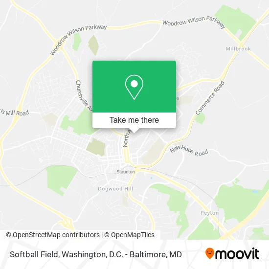
See Softball Field, Staunton, on the map
Public Transit to Softball Field in Staunton
Wondering how to get to Softball Field in Staunton? Moovit helps you find the best way to get to Softball Field with step-by-step directions from the nearest public transit station.
Moovit provides free maps and live directions to help you navigate through your city. View schedules, routes, timetables, and find out how long does it take to get to Softball Field in real time.
Looking for the nearest stop or station to Softball Field? Check out this list of stops closest to your destination: Frederick St / N Central Ave; Edgewood Rd / Dogwood Rd; Staunton Public Library; Staunton Amtrak Station.
Bus: 250 CONNECTOR, BRCC SOUTH, WEST / NORTH LOOP, BRCC NORTH.Train: CARDINAL.
Want to see if there’s another route that gets you there at an earlier time? Moovit helps you find alternative routes or times. Get directions from and directions to Softball Field easily from the Moovit App or Website.
We make riding to Softball Field easy, which is why over 1.5 million users, including users in Staunton, trust Moovit as the best app for public transit. You don’t need to download an individual bus app or train app, Moovit is your all-in-one transit app that helps you find the best bus time or train time available.
For information on prices of bus, costs and ride fares to Softball Field, please check the Moovit app.
Use the app to navigate to popular places including to the airport, hospital, stadium, grocery store, mall, coffee shop, school, college, and university.
Softball Field Address: Tullidge Dr Staunton, VA 24401 street in Staunton
- Physical Activities Center,
- Tennis Courts,
- Tullidge Residence Hall,
- Tullidge Lot,
- Mary Baldwin University Women's Soccer Camps,
- Online Lot,
- House of Prayer,
- Davis School,
- Prospect Street House,
- Online,
- Bertie Murphy Deming Fine Arts Center,
- Physical Plant,
- Hunt Dining Hall,
- Westmoreland Lot,
- Kable Residence Hall,
- Points Street Lot,
- Central Heating & Plumbing,
- Grounds Building,
- Marino's Lunch,
- Arch Rock Tea Room
Places Near Softball Field (Staunton)
- Pennsylvania Ave NW (3rd st and pennsylvania), Washington,
- National Museum of African American History and Culture, Washington,
- Museum Of The Bible, Washington,
- Capital One Arena, Washington,
- Washington DC VA Medical Center, Washington,
- Warner Theatre, Washington,
- National Zoo, Washington,
- Amazon Hq2, Arlington County,
- Basilica of the National Shrine, Washington,
- Georgetown, Washington,
- Rock Creek Tennis Center, Washington,
- Washington National Cathedral, Washington,
- M&T Bank Stadium, Baltimore,
- The Anthem, Washington,
- Sibley Memorial Hospital, Washington,
- PG Mall, Prince George's County,
- Camden Yards, Baltimore,
- National Theatre, Washington,
- Westfield Montgomery Mall, Montgomery County,
- Marriott Marquis Washington, DC, Washington
How to get to popular places in Washington, D.C. - Baltimore, MD with public transit
Get around Staunton by public transit!
Traveling around Staunton has never been so easy. See step by step directions as you travel to any attraction, street or major public transit station. View bus and train schedules, arrival times, service alerts and detailed routes on a map, so you know exactly how to get to anywhere in Staunton.
When traveling to any destination around Staunton use Moovit's Live Directions with Get Off Notifications to know exactly where and how far to walk, how long to wait for your line, and how many stops are left. Moovit will alert you when it's time to get off — no need to constantly re-check whether yours is the next stop.
Wondering how to use public transit in Staunton or how to pay for public transit in Staunton? Moovit public transit app can help you navigate your way with public transit easily, and at minimum cost. It includes public transit fees, ticket prices, and costs. Looking for a map of Staunton public transit lines? Moovit public transit app shows all public transit maps in Staunton with all Bus, Train, Metro, Light Rail and Ferry routes and stops on an interactive map.
Washington, D.C. - Baltimore, MD has 5 transit type(s), including: Bus, Train, Metro, Light Rail and Ferry, operated by several transit agencies, including WMATA, Montgomery County Ride On, Fairfax Connector, TheBus, PRTC, DASH - Alexandria, Arlington Transit (ART), RTA of Central Maryland, MDOT MTA, MDOT MTA Light RailLink, MDOT MTA Commuter Bus, MDOT MTA Local Bus, FXBGO!, Virginia Railway Express (VRE) and MARC