Directions to Sol Dance-Center (Queens) with public transportation
The following transit lines have routes that pass near Sol Dance-Center
 Bus: B32, Q101, Q103, Q32.
- Train: MONTAUK BRANCH, OYSTER BAY BRANCH, PORT JEFFERSON BRANCH.
- Subway: 7, 7X, G.
- Ferry: AS.
How to get to Sol Dance-Center by bus?
Click on the bus route to see step by step directions with maps, line arrival times and updated time schedules.
From Brook Ave, Bronx
98 minFrom Morris Ave, Bronx
77 minFrom Resorts World Shuttle Bus, Queens
52 minFrom The Shops at SkyView Center, Queens
67 minFrom Queens Center Mall, Queens
50 minFrom 30-56 Whitestone Expwy, Queens
82 minFrom Fulton Ave, Bronx
104 minFrom 28 Liberty, Manhattan
77 minFrom 51, Jersey City
101 min
How to get to Sol Dance-Center by train?
Click on the train route to see step by step directions with maps, line arrival times and updated time schedules.
How to get to Sol Dance-Center by subway?
Click on the subway route to see step by step directions with maps, line arrival times and updated time schedules.
Bus stops near Sol Dance-Center in Queens
Ferry station near Sol Dance-Center in Queens
- Long Island City, 7 min walk,VIEW
Subway stations near Sol Dance-Center in Queens
Train station near Sol Dance-Center in Queens
- Long Island City, 8 min walk,VIEW
Bus lines to Sol Dance-Center in Queens
What are the closest stations to Sol Dance-Center?
The closest stations to Sol Dance-Center are:
- Vernon Blvd/46 Rd is 238 yards away, 4 min walk.
- 11 St/47 Av is 467 yards away, 6 min walk.
- Long Island City is 496 yards away, 7 min walk.
- Borden Av/5 St is 538 yards away, 7 min walk.
- 21 St is 594 yards away, 8 min walk.
- Vernon Blvd-Jackson Av is 596 yards away, 8 min walk.
- Jackson Av/11 St is 743 yards away, 9 min walk.
Which bus lines stop near Sol Dance-Center?
These bus lines stop near Sol Dance-Center: B32, Q101, Q103, Q32.
Which train lines stop near Sol Dance-Center?
These train lines stop near Sol Dance-Center: MONTAUK BRANCH, OYSTER BAY BRANCH, PORT JEFFERSON BRANCH.
Which subway lines stop near Sol Dance-Center?
These subway lines stop near Sol Dance-Center: 7, 7X, G.
What’s the nearest subway station to Sol Dance-Center in Queens?
The nearest subway stations to Sol Dance-Center in Queens are 21 St and Vernon Blvd-Jackson Av. The closest one is a 8 min walk away.
What’s the nearest train station to Sol Dance-Center in Queens?
The nearest train station to Sol Dance-Center in Queens is Long Island City. It’s a 8 min walk away.
What’s the nearest bus station to Sol Dance-Center in Queens?
The nearest bus station to Sol Dance-Center in Queens is Vernon Blvd/46 Rd. It’s a 4 min walk away.
What’s the nearest ferry station to Sol Dance-Center in Queens?
The nearest ferry station to Sol Dance-Center in Queens is Long Island City. It’s a 7 min walk away.
What time is the first subway to Sol Dance-Center in Queens?
The 7 is the first subway that goes to Sol Dance-Center in Queens. It stops nearby at 3:00 AM.
What time is the last subway to Sol Dance-Center in Queens?
The 7 is the last subway that goes to Sol Dance-Center in Queens. It stops nearby at 3:07 AM.
What time is the first train to Sol Dance-Center in Queens?
The PORT JEFFERSON BRANCH is the first train that goes to Sol Dance-Center in Queens. It stops nearby at 6:40 AM.
What time is the last train to Sol Dance-Center in Queens?
The OYSTER BAY BRANCH is the last train that goes to Sol Dance-Center in Queens. It stops nearby at 6:40 PM.
What time is the first bus to Sol Dance-Center in Queens?
The Q101 is the first bus that goes to Sol Dance-Center in Queens. It stops nearby at 3:02 AM.
What time is the last bus to Sol Dance-Center in Queens?
The B62 is the last bus that goes to Sol Dance-Center in Queens. It stops nearby at 3:20 AM.
What time is the first ferry to Sol Dance-Center in Queens?
The AS is the first ferry that goes to Sol Dance-Center in Queens. It stops nearby at 6:23 AM.
What time is the last ferry to Sol Dance-Center in Queens?
The AS is the last ferry that goes to Sol Dance-Center in Queens. It stops nearby at 8:45 PM.
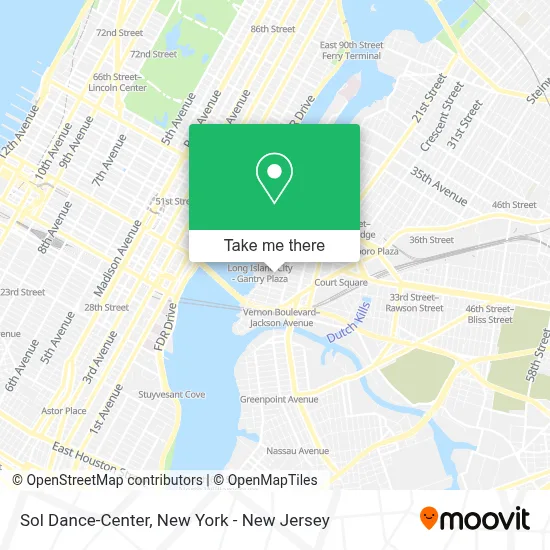
See Sol Dance-Center, Queens, on the map
Public Transit to Sol Dance-Center in Queens
Wondering how to get to Sol Dance-Center in Queens? Moovit helps you find the best way to get to Sol Dance-Center with step-by-step directions from the nearest public transit station.
Moovit provides free maps and live directions to help you navigate through your city. View schedules, routes, timetables, and find out how long does it take to get to Sol Dance-Center in real time.
Looking for the nearest stop or station to Sol Dance-Center? Check out this list of stops closest to your destination: Vernon Blvd/46 Rd; 11 St/47 Av; Long Island City; Borden Av/5 St; 21 St; Vernon Blvd-Jackson Av; Jackson Av/11 St.
Bus: B32, Q101, Q103, Q32.Train: MONTAUK BRANCH, OYSTER BAY BRANCH, PORT JEFFERSON BRANCH.Subway: 7, 7X, G.Ferry: AS.
Want to see if there’s another route that gets you there at an earlier time? Moovit helps you find alternative routes or times. Get directions from and directions to Sol Dance-Center easily from the Moovit App or Website.
We make riding to Sol Dance-Center easy, which is why over 1.5 million users, including users in Queens, trust Moovit as the best app for public transit. You don’t need to download an individual bus app or train app, Moovit is your all-in-one transit app that helps you find the best bus time or train time available.
For information on prices of subway, bus and train, costs and ride fares to Sol Dance-Center, please check the Moovit app.
Use the app to navigate to popular places including to the airport, hospital, stadium, grocery store, mall, coffee shop, school, college, and university.
Sol Dance-Center Address: 5-11 47th Ave street in Queens
- Queens Council on the Arts,
- Atm Duane Reade,
- Gantry Plaza State Park,
- 4705 center blvd. LIC,
- Chase Fire Products,
- Tiger J Taekwondo,
- Bridgeview School Of Fine Arts,
- Fedex,
- Athletic Field,
- Lic Lifestyle and Beauty,
- Byson Real Estate Co.,
- Bridgeview School Of Fine Arts,
- Western Union,
- Libertyx Bitcoin Atm,
- Dance Queens Fitness,
- Duane Reade #14390,
- Gantry Home and Hardware,
- Strength City,
- Avalon Riverview Dog Park,
- Dog Park
Places Near Sol Dance-Center (Queens)
- 911 Memorial, Manhattan,
- Bellevue Hospital, Manhattan,
- 3 Stone St, Manhattan,
- 376 Hudson Street, Manhattan,
- Rockefeller Center, Manhattan,
- 66 John Street, Manhattan,
- San Gennaro Feast, Manhattan,
- Times Square, Manhattan,
- Wall Street, Manhattan,
- qqqq, Manhattan,
- 1 Police Plaza, Manhattan,
- Mountainside Hospital, Glen Ridge,
- Chinatown, Manhattan,
- SoHo, Manhattan,
- Katz's Deli, Manhattan,
- Queens Center Mall, Queens,
- 26 Federal Plaza, Manhattan,
- 111 Centre New York City Supreme Court, Manhattan,
- Pier 83, Manhattan,
- Hudson Yards, Manhattan
How to get to popular places in New York - New Jersey with public transit
Get around Queens by public transit!
Traveling around Queens has never been so easy. See step by step directions as you travel to any attraction, street or major public transit station. View bus and train schedules, arrival times, service alerts and detailed routes on a map, so you know exactly how to get to anywhere in Queens.
When traveling to any destination around Queens use Moovit's Live Directions with Get Off Notifications to know exactly where and how far to walk, how long to wait for your line, and how many stops are left. Moovit will alert you when it's time to get off — no need to constantly re-check whether yours is the next stop.
Wondering how to use public transit in Queens or how to pay for public transit in Queens? Moovit public transit app can help you navigate your way with public transit easily, and at minimum cost. It includes public transit fees, ticket prices, and costs. Looking for a map of Queens public transit lines? Moovit public transit app shows all public transit maps in Queens with all Bus, Train, Subway, Light Rail, Ferry and Cable Car routes and stops on an interactive map.
New York - New Jersey has 6 transit type(s), including: Bus, Train, Subway, Light Rail, Ferry and Cable Car, operated by several transit agencies, including MTA Subway, Metro-North Railroad, LIRR, PATH, MTA New York City Transit - Express routes, MTA Bus, NJ Transit, NYC Ferry, NICE bus, Bee-Line Bus, NJ Transit Rail, Norwalk Transit District, Hartford Line, River Valley Transit and HART