Directions to Soldier Field (Chicago) with public transportation
The following transit lines have routes that pass near Soldier Field
 Bus: 146, 1, 3, 4, 12.
- Train: BNSF, ME, LAKESHORE, MONON.
- Chicago 'L': GREEN LINE, RED LINE, ORANGE LINE.
How to get to Soldier Field by bus?
Click on the bus route to see step by step directions with maps, line arrival times and updated time schedules.
How to get to Soldier Field by train?
Click on the train route to see step by step directions with maps, line arrival times and updated time schedules.
How to get to Soldier Field by Chicago 'L'?
Click on the Chicago 'L' route to see step by step directions with maps, line arrival times and updated time schedules.
Bus stops near Soldier Field in Chicago
- Michigan & 13th Street (South), 3 min walk,
- Indiana & 13th Street (South), 4 min walk,
- Soldier Field & Field Museum (East), 11 min walk,
- Michigan & 16th Street (South), 22 min walk,
Chicago 'L' station near Soldier Field in Chicago
- Roosevelt, 4 min walk,
Train station near Soldier Field in Chicago
- Museum Campus/11th St., 10 min walk,
Bus lines to Soldier Field in Chicago
- 1, Desplaines & Harrison Terminal (South),
- 3, Fairbanks & Huron (South),
- 4, State & Washington (North),
- 12, Central & Harrison Terminal (North),
- 130, Clinton & Washington (South),
- 146, Marine Drive & Wilson (North),
- X4, State & 95th Street (North),
What are the closest stations to Soldier Field?
The closest stations to Soldier Field are:
- Michigan & 13th Street (South) stop is 175 yards away, 3 min walk.
- Indiana & 13th Street (South) stop is 306 yards away, 4 min walk.
- Roosevelt station is 329 yards away, 4 min walk.
- Museum Campus/11th St. station is 816 yards away, 10 min walk.
- Soldier Field & Field Museum (East) stop is 933 yards away, 11 min walk.
- Michigan & 16th Street (South) stop is 1909 yards away, 22 min walk.
Which bus line stops near Soldier Field?
146 (Solidarity Dr & Planetarium (East))
Which train line stops near Soldier Field?
BNSF (Aurora (West))
Which Chicago 'L' lines stop near Soldier Field?
These Chicago 'L' lines stop near Soldier Field: GREEN LINE, RED LINE.
What’s the nearest Chicago 'L' station to Soldier Field in Chicago?
The nearest Chicago 'L' station to Soldier Field in Chicago is Roosevelt. It’s a 4 min walk away.
What’s the nearest train station to Soldier Field in Chicago?
The nearest train station to Soldier Field in Chicago is Museum Campus/11th St.. It’s a 10 min walk away.
What’s the nearest bus station to Soldier Field in Chicago?
The nearest bus station to Soldier Field in Chicago is Michigan & 13th Street (South). It’s a 3 min walk away.
What time is the first Chicago 'L' to Soldier Field in Chicago?
The RED LINE is the first Chicago 'L' that goes to Soldier Field in Chicago. It stops nearby at 3:10 AM.
What time is the last Chicago 'L' to Soldier Field in Chicago?
The RED LINE is the last Chicago 'L' that goes to Soldier Field in Chicago. It stops nearby at 3:25 AM.
What time is the first train to Soldier Field in Chicago?
The ME is the first train that goes to Soldier Field in Chicago. It stops nearby at 4:55 AM.
What time is the last train to Soldier Field in Chicago?
The ME is the last train that goes to Soldier Field in Chicago. It stops nearby at 12:57 AM.
What time is the first bus to Soldier Field in Chicago?
The 4 is the first bus that goes to Soldier Field in Chicago. It stops nearby at 3:18 AM.
What time is the last bus to Soldier Field in Chicago?
The 4 is the last bus that goes to Soldier Field in Chicago. It stops nearby at 3:19 AM.
See Soldier Field, Chicago, on the map
Public Transit to Soldier Field in Chicago
Wondering how to get to Soldier Field in Chicago? Moovit helps you find the best way to get to Soldier Field with step-by-step directions from the nearest public transit station.
Moovit provides free maps and live directions to help you navigate through your city. View schedules, routes, timetables, and find out how long does it take to get to Soldier Field in real time.
Looking for the nearest stop or station to Soldier Field? Check out this list of stops closest to your destination: Michigan & 13th Street (South); Indiana & 13th Street (South); Roosevelt; Museum Campus/11th St.; Soldier Field & Field Museum (East); Michigan & 16th Street (South).
Bus: 146, 1, 3, 4, 12, 130, X4.Train: BNSF, ME, LAKESHORE, MONON.Chicago 'L': GREEN LINE, RED LINE, ORANGE LINE.
Want to see if there’s another route that gets you there at an earlier time? Moovit helps you find alternative routes or times. Get directions from and directions to Soldier Field easily from the Moovit App or Website.
We make riding to Soldier Field easy, which is why over 1.7 billion users, including users in Chicago, trust Moovit as the best app for public transit. You don’t need to download an individual bus app or train app, Moovit is your all-in-one transit app that helps you find the best bus time or train time available.
For information on prices of bus, Chicago 'L' and train, costs and ride fares to Soldier Field, please check the Moovit app.
Use the app to navigate to popular places including to the airport, hospital, stadium, grocery store, mall, coffee shop, school, college, and university.
Soldier Field Address: South Special Olympics Drive street in Chicago
Popular routes to Soldier Field, Chicago
- Chicago Bears Pro Shop (South),
- Section 105,
- Soldier Field Chicgo,
- Soldier Field- Chicago Bears Football,
- Stadium Green at Soldier Field,
- Burnham Harbor,
- Golden Corral,
- Soldier Field Field Museum,
- Waldron Parking Deck,
- Burnham Harbor Dock D,
- McCormick Place Busway,
- The Field Museum,
- The Field Museum Main Store,
- Field Museum,
- Soldier Field Pick-Up/Drop-Off,
- Soldier Field-South Tailgate Lot,
- Shedd loading dock,
- Museum Campus,
- Tunnel Between Shed Aquarium And Field Museum,
- CTA Bus Stop - John G. Shedd Aquarium
Places Near Soldier Field (Chicago)
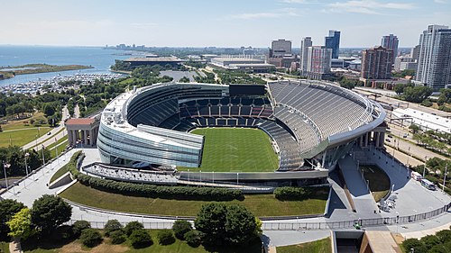
- Soldier Field, Chicago,
- Museum Of Science And Industry, Chicago,
- Lincoln Park Zoo, Chicago,
- Wrigley Field, Chicago,
- Navy Pier, Chicago,
- The Bean, Chicago,
- Daley Center (Richard J Daley Center), Chicago,
- Art Institute Of Chicago, Chicago,
- Grant Park, Chicago,
- O'Block, Chicago,
- Chinatown, Chicago,
- Brookfield Zoo, Brookfield,
- Northwestern Memorial Hospital, Chicago,
- Shedd Aquarium, Chicago,
- Willis Tower, Chicago,
- Field Museum, Chicago,
- Ogilvie Transportation Center, Chicago,
- Horseshoe Casino Shuttle, Chicago,
- United Center, Chicago,
- Salt Shed, Chicago
How to get to popular places in Chicago with public transit
Get around Chicago by public transit!
Traveling around Chicago has never been so easy. See step by step directions as you travel to any attraction, street or major public transit station. View bus and train schedules, arrival times, service alerts and detailed routes on a map, so you know exactly how to get to anywhere in Chicago.
When traveling to any destination around Chicago use Moovit's Live Directions with Get Off Notifications to know exactly where and how far to walk, how long to wait for your line, and how many stops are left. Moovit will alert you when it's time to get off — no need to constantly re-check whether yours is the next stop.
Wondering how to use public transit in Chicago or how to pay for public transit in Chicago? Moovit public transit app can help you navigate your way with public transit easily, and at minimum cost. It includes public transit fees, ticket prices, and costs. Looking for a map of Chicago public transit lines? Moovit public transit app shows all public transit maps in Chicago with all Bus, Train and Chicago 'L' routes and stops on an interactive map.
Chicago has 3 transit type(s), including: Bus, Train and Chicago 'L', operated by several transit agencies, including CTA 'L', Metra, Northern Indiana Commuter Transportation District, CTA, PACE, O'Hare International Airport Shuttle Bus, Gary Public Transit, Amtrak, River Valley Metro, Valpo Transit, DeKalb Public Transit, FlixBus-us, Greyhound-us, Van Galder (Coach USA) and Wisconsin Coach Lines