How to get to Solidcore by bus?
Click on the bus route to see step by step directions with maps, line arrival times and updated time schedules.
From Falls Church Marriott Fairview Park, Fairfax County
66 minFrom Intelligence Community Campus—Bethesda, Montgomery County
98 minFrom Lake Fairfax Park, Fairfax County
65 minFrom Defense Health Headquarters (DHHQ), Fairfax County
71 minFrom Inova employee Shuttle, Fairfax County
43 minFrom C&O Canal Towpath, Washington
124 minFrom The Westin Arlington Gateway, Arlington County
42 minFrom Walmart, Arlington County
40 minFrom British Embassy, Washington
91 minFrom Northern Virginia Community College - Annandale Campus, Fairfax County
65 min
How to get to Solidcore by metro?
Click on the metro route to see step by step directions with maps, line arrival times and updated time schedules.
Bus stops near Solidcore in Fairfax County
Metro station near Solidcore in Fairfax County
- Spring Hill, 22 min walk,VIEW
Bus lines to Solidcore in Fairfax County
What are the closest stations to Solidcore?
The closest stations to Solidcore are:
- Galleria Dr @ Tysons Blvd is 362 yards away, 5 min walk.
- Galleria Dr+Tysons Bl is 449 yards away, 6 min walk.
- Tysons Corner Metro Bay A is 540 yards away, 8 min walk.
- Tysons Corner Metro Station Departures is 568 yards away, 8 min walk.
- Spring Hill is 1885 yards away, 22 min walk.
Which bus lines stop near Solidcore?
These bus lines stop near Solidcore: 401, 423, 660, 798, A70.
Which metro line stops near Solidcore?
SILVER (Ashburn)
What’s the nearest metro station to Solidcore in Fairfax County?
The nearest metro station to Solidcore in Fairfax County is Spring Hill. It’s a 22 min walk away.
What’s the nearest bus station to Solidcore in Fairfax County?
The nearest bus station to Solidcore in Fairfax County is Galleria Dr @ Tysons Blvd. It’s a 5 min walk away.
What time is the first metro to Solidcore in Fairfax County?
The SILVER is the first metro that goes to Solidcore in Fairfax County. It stops nearby at 5:07 AM.
What time is the last metro to Solidcore in Fairfax County?
The SILVER is the last metro that goes to Solidcore in Fairfax County. It stops nearby at 12:43 AM.
What time is the first bus to Solidcore in Fairfax County?
The 494 is the first bus that goes to Solidcore in Fairfax County. It stops nearby at 5:24 AM.
What time is the last bus to Solidcore in Fairfax County?
The A70 is the last bus that goes to Solidcore in Fairfax County. It stops nearby at 12:48 AM.
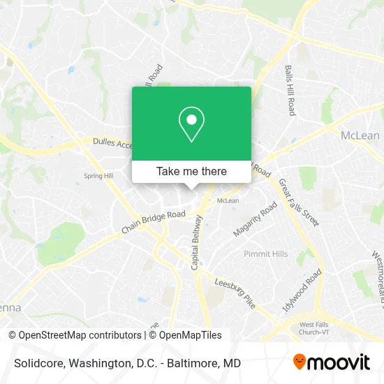
See Solidcore, Fairfax County, on the map
Public Transit to Solidcore in Fairfax County
Wondering how to get to Solidcore in Fairfax County? Moovit helps you find the best way to get to Solidcore with step-by-step directions from the nearest public transit station.
Moovit provides free maps and live directions to help you navigate through your city. View schedules, routes, timetables, and find out how long does it take to get to Solidcore in real time.
Looking for the nearest stop or station to Solidcore? Check out this list of stops closest to your destination: Galleria Dr @ Tysons Blvd; Galleria Dr+Tysons Bl; Tysons Corner Metro Bay A; Tysons Corner Metro Station Departures; Spring Hill.
Bus: 401, 423, 660, 798, A70, 494, 495, 463, 60.Metro: SILVER.
Want to see if there’s another route that gets you there at an earlier time? Moovit helps you find alternative routes or times. Get directions from and directions to Solidcore easily from the Moovit App or Website.
We make riding to Solidcore easy, which is why over 1.7 million users, including users in Fairfax County, trust Moovit as the best app for public transit. You don’t need to download an individual bus app or train app, Moovit is your all-in-one transit app that helps you find the best bus time or train time available.
For information on prices of bus and metro, costs and ride fares to Solidcore, please check the Moovit app.
Use the app to navigate to popular places including to the airport, hospital, stadium, grocery store, mall, coffee shop, school, college, and university.
Solidcore Address: 7911 Westpark Dr street in Fairfax County
- Ernst & Young LLP,
- Ernst & Young,
- Fogo de Chão Brazilian Steakhouse,
- Hilton McLean Tysons Corner,
- Mclean Hilton,
- Hilton McLean Tysons Corner (Hilton Hotel McLean),
- Tesla,
- Washington, DC,
- The Ritz-Carlton, Tysons Corner,
- Louis Vuitton McLean Tysons Galleria,
- 1750 Galleria at Tysons II,
- Capital One Tower,
- Tysons Galleria,
- Neiman Marcus,
- Capital One Fitness Center,
- Maggiano's,
- Tysons Corner Metro Station,
- Hilton Worldwide Global Headquarters,
- Saks Fifth Avenue,
- P.F. Chang's
Places Near Solidcore (Fairfax County)
- Pennsylvania Ave NW (3rd st and pennsylvania), Washington,
- National Museum of African American History and Culture, Washington,
- Marriott Marquis Washington, DC, Washington,
- PG Mall, Prince George's County,
- Westfield Montgomery Mall, Montgomery County,
- Museum Of The Bible, Washington,
- Warner Theatre, Washington,
- Washington DC VA Medical Center, Washington,
- Sibley Memorial Hospital, Washington,
- Georgetown, Washington,
- National Theatre, Washington,
- Washington National Cathedral, Washington,
- Capital One Arena, Washington,
- Camden Yards, Baltimore,
- Rock Creek Tennis Center, Washington,
- National Zoo, Washington,
- M&T Bank Stadium, Baltimore,
- Basilica of the National Shrine, Washington,
- Amazon Hq2, Arlington County,
- The Anthem, Washington
How to get to popular places in Washington, D.C. - Baltimore, MD with public transit
Get around Fairfax County by public transit!
Traveling around Fairfax County has never been so easy. See step by step directions as you travel to any attraction, street or major public transit station. View bus and train schedules, arrival times, service alerts and detailed routes on a map, so you know exactly how to get to anywhere in Fairfax County.
When traveling to any destination around Fairfax County use Moovit's Live Directions with Get Off Notifications to know exactly where and how far to walk, how long to wait for your line, and how many stops are left. Moovit will alert you when it's time to get off — no need to constantly re-check whether yours is the next stop.
Wondering how to use public transit in Fairfax County or how to pay for public transit in Fairfax County? Moovit public transit app can help you navigate your way with public transit easily, and at minimum cost. It includes public transit fees, ticket prices, and costs. Looking for a map of Fairfax County public transit lines? Moovit public transit app shows all public transit maps in Fairfax County with all Bus, Train, Metro, Light Rail and Ferry routes and stops on an interactive map.
Washington, D.C. - Baltimore, MD has 5 transit type(s), including: Bus, Train, Metro, Light Rail and Ferry, operated by several transit agencies, including WMATA, Montgomery County Ride On, Fairfax Connector, TheBus, PRTC, DASH - Alexandria, Arlington Transit (ART), RTA of Central Maryland, MDOT MTA, MDOT MTA Light RailLink, MDOT MTA Commuter Bus, MDOT MTA Local Bus, FXBGO!, Virginia Railway Express (VRE) and MARC