How to get to Sollers Point Southeastern Technical High by bus?
Click on the bus route to see step by step directions with maps, line arrival times and updated time schedules.
From Enoch Pratt Free Library - Central Library, Baltimore
66 minFrom Pigtown / Washington Village, Baltimore
62 minFrom National Aquarium, Baltimore
40 minFrom Morgan State University, Baltimore
78 minFrom Baltimore Greyhound Station, Baltimore
72 minFrom Giant Food Stores, Baltimore
69 minFrom Baltimore Marriott Inner Harbor at Camden Yards, Baltimore
47 minFrom Middle River, Maryland, Baltimore County
64 minFrom Topgolf, Baltimore
62 minFrom B&O Railroad Museum, Baltimore
51 min
Bus stop near Sollers Point Southeastern Technical High in Baltimore County
- Sollers Point Rd & Merritt Ave, 4 min walk,VIEW
Bus lines to Sollers Point Southeastern Technical High in Baltimore County
What are the closest stations to Sollers Point Southeastern Technical High?
The closest stations to Sollers Point Southeastern Technical High are:
- Sollers Point Rd & Merritt Ave is 336 yards away, 4 min walk.
Which bus lines stop near Sollers Point Southeastern Technical High?
These bus lines stop near Sollers Point Southeastern Technical High: 62, 65.
What’s the nearest bus station to Sollers Point Southeastern Technical High in Baltimore County?
The nearest bus station to Sollers Point Southeastern Technical High in Baltimore County is Sollers Point Rd & Merritt Ave. It’s a 4 min walk away.
What time is the first bus to Sollers Point Southeastern Technical High in Baltimore County?
The 65 is the first bus that goes to Sollers Point Southeastern Technical High in Baltimore County. It stops nearby at 3:05 AM.
What time is the last bus to Sollers Point Southeastern Technical High in Baltimore County?
The 65 is the last bus that goes to Sollers Point Southeastern Technical High in Baltimore County. It stops nearby at 3:07 AM.
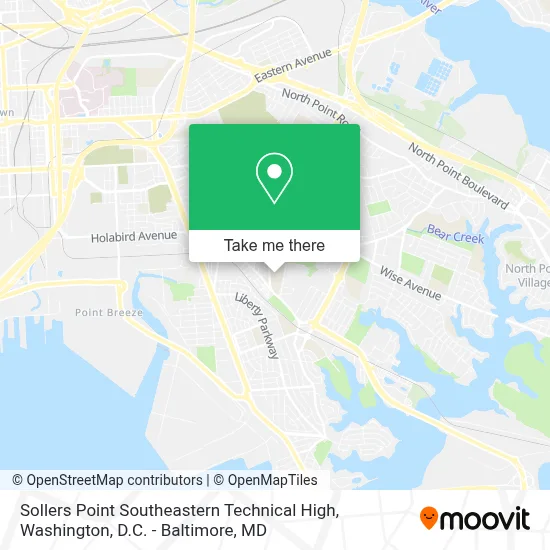
See Sollers Point Southeastern Technical High, Baltimore County, on the map
Public Transit to Sollers Point Southeastern Technical High in Baltimore County
Wondering how to get to Sollers Point Southeastern Technical High in Baltimore County? Moovit helps you find the best way to get to Sollers Point Southeastern Technical High with step-by-step directions from the nearest public transit station.
Moovit provides free maps and live directions to help you navigate through your city. View schedules, routes, timetables, and find out how long does it take to get to Sollers Point Southeastern Technical High in real time.
Looking for the nearest stop or station to Sollers Point Southeastern Technical High? Check out this list of stops closest to your destination: Sollers Point Rd & Merritt Ave.
Bus: 62, 65, 63, 163.
Want to see if there’s another route that gets you there at an earlier time? Moovit helps you find alternative routes or times. Get directions from and directions to Sollers Point Southeastern Technical High easily from the Moovit App or Website.
We make riding to Sollers Point Southeastern Technical High easy, which is why over 1.7 million users, including users in Baltimore County, trust Moovit as the best app for public transit. You don’t need to download an individual bus app or train app, Moovit is your all-in-one transit app that helps you find the best bus time or train time available.
For information on prices of bus and light rail, costs and ride fares to Sollers Point Southeastern Technical High, please check the Moovit app.
Use the app to navigate to popular places including to the airport, hospital, stadium, grocery store, mall, coffee shop, school, college, and university.
Sollers Point Southeastern Technical High Address: 1901 Delvale Ave street in Baltimore County
- Dundalk High School,
- CCBC Dundalk - Lot,
- Community College of Baltimore County-Dundalk (Community College of Balto City Dundalk Campus),
- Dundalk Middle School Recreation Area,
- Sparrows Point-Dundalk,
- MP Car Wash & Detailing,
- Dundalk and Baltimore,
- Dundalk, Maryland,
- Logan Elementary School,
- Fort Holabird Park,
- T-Mobile,
- Cimaglia Park at Fort Holabird,
- Credit Union 1,
- Merritt Blvd,
- Jimmy's Famous Seafood,
- UPS Access Point,
- Dundalk Marine Terminal,
- German Hill Rd and Merritt Blvd,
- Amazon Fulfillment Center-DMD5,
- Port Of Baltimore
Places Near Sollers Point Southeastern Technical High (Baltimore County)
- M&T Bank Stadium, Baltimore,
- Capital One Arena, Washington,
- National Zoo, Washington,
- Museum Of The Bible, Washington,
- Washington DC VA Medical Center, Washington,
- Pennsylvania Ave NW (3rd st and pennsylvania), Washington,
- Amazon Hq2, Arlington County,
- National Museum of African American History and Culture, Washington,
- Marriott Marquis Washington, DC, Washington,
- Rock Creek Tennis Center, Washington,
- PG Mall, Prince George's County,
- Westfield Montgomery Mall, Montgomery County,
- The Anthem, Washington,
- Basilica of the National Shrine, Washington,
- National Theatre, Washington,
- Warner Theatre, Washington,
- Sibley Memorial Hospital, Washington,
- Washington National Cathedral, Washington,
- Georgetown, Washington,
- Camden Yards, Baltimore
How to get to popular places in Washington, D.C. - Baltimore, MD with public transit
Get around Baltimore County by public transit!
Traveling around Baltimore County has never been so easy. See step by step directions as you travel to any attraction, street or major public transit station. View bus and train schedules, arrival times, service alerts and detailed routes on a map, so you know exactly how to get to anywhere in Baltimore County.
When traveling to any destination around Baltimore County use Moovit's Live Directions with Get Off Notifications to know exactly where and how far to walk, how long to wait for your line, and how many stops are left. Moovit will alert you when it's time to get off — no need to constantly re-check whether yours is the next stop.
Wondering how to use public transit in Baltimore County or how to pay for public transit in Baltimore County? Moovit public transit app can help you navigate your way with public transit easily, and at minimum cost. It includes public transit fees, ticket prices, and costs. Looking for a map of Baltimore County public transit lines? Moovit public transit app shows all public transit maps in Baltimore County with all Bus, Train, Metro, Light Rail and Ferry routes and stops on an interactive map.
Washington, D.C. - Baltimore, MD has 5 transit type(s), including: Bus, Train, Metro, Light Rail and Ferry, operated by several transit agencies, including WMATA, Montgomery County Ride On, Fairfax Connector, TheBus, PRTC, DASH - Alexandria, Arlington Transit (ART), RTA of Central Maryland, MDOT MTA, MDOT MTA Light RailLink, MDOT MTA Commuter Bus, MDOT MTA Local Bus, FXBGO!, Virginia Railway Express (VRE) and MARC