Directions to Solvang Kirke (København) with public transportation
The following transit lines have routes that pass near Solvang Kirke
 Bus: 33, 78, M1, M1, 8A.
- Train: 802, 803, 804, RE, IC.
- Metro: M1.
- Ferry: 991, 992.
How to get to Solvang Kirke by bus?
Click on the bus route to see step by step directions with maps, line arrival times and updated time schedules.
How to get to Solvang Kirke by train?
Click on the train route to see step by step directions with maps, line arrival times and updated time schedules.
How to get to Solvang Kirke by metro?
Click on the metro route to see step by step directions with maps, line arrival times and updated time schedules.
Bus stops near Solvang Kirke in København
- Irlandsvej (Englandsvej), 4 min walk,
- Sundbyvester Park (Irlandsvej), 5 min walk,
- Sundby St. (Metro), 8 min walk,
- Englandsvej (Vejlands Allé), 10 min walk,
Train station near Solvang Kirke in København
- Tårnby St., 22 min walk,
Ferry station near Solvang Kirke in København
- Bryggebroen (Islands Brygge), 47 min walk,
Bus lines to Solvang Kirke in København
- 33, Ørestad St.,
- 78, Femøren St.,
- M1, Vanløse St. (Metro),
- M1, Dr Byen St. (Metro),
- 8A, Valby St.,
- 34, Bella Center,
What are the closest stations to Solvang Kirke?
The closest stations to Solvang Kirke are:
- Irlandsvej (Englandsvej) is 249 meters away, 4 min walk.
- Sundbyvester Park (Irlandsvej) is 367 meters away, 5 min walk.
- Sundby St. (Metro) is 591 meters away, 8 min walk.
- Englandsvej (Vejlands Allé) is 759 meters away, 10 min walk.
- Tårnby St. is 1705 meters away, 22 min walk.
- Bryggebroen (Islands Brygge) is 3635 meters away, 47 min walk.
Which bus line stops near Solvang Kirke?
33 (Fra København)
Which train lines stop near Solvang Kirke?
These train lines stop near Solvang Kirke: 802, 803, 804, RE.
Which metro line stops near Solvang Kirke?
M1 (Vestamager St.)
What’s the nearest train station to Solvang Kirke in København?
The nearest train station to Solvang Kirke in København is Tårnby St.. It’s a 22 min walk away.
What’s the nearest bus station to Solvang Kirke in København?
The nearest bus station to Solvang Kirke in København is Irlandsvej (Englandsvej). It’s a 4 min walk away.
What time is the first metro to Solvang Kirke in København?
The M1 is the first metro that goes to Solvang Kirke in København. It stops nearby at 3:04 AM.
What time is the last metro to Solvang Kirke in København?
The M1 is the last metro that goes to Solvang Kirke in København. It stops nearby at 3:05 AM.
What time is the first train to Solvang Kirke in København?
The 802 is the first train that goes to Solvang Kirke in København. It stops nearby at 3:00 AM.
What time is the last train to Solvang Kirke in København?
The IC is the last train that goes to Solvang Kirke in København. It stops nearby at 3:10 AM.
What time is the first bus to Solvang Kirke in København?
The 8A is the first bus that goes to Solvang Kirke in København. It stops nearby at 3:00 AM.
What time is the last bus to Solvang Kirke in København?
The 8A is the last bus that goes to Solvang Kirke in København. It stops nearby at 2:54 AM.
What time is the first ferry to Solvang Kirke in København?
The 992 is the first ferry that goes to Solvang Kirke in København. It stops nearby at 10:22 AM.
What time is the last ferry to Solvang Kirke in København?
The 991 is the last ferry that goes to Solvang Kirke in København. It stops nearby at 9:13 PM.
See Solvang Kirke, København, on the map
Public Transit to Solvang Kirke in København
Wondering how to get to Solvang Kirke in København? Moovit helps you find the best way to get to Solvang Kirke with step-by-step directions from the nearest public transit station.
Moovit provides free maps and live directions to help you navigate through your city. View schedules, routes, timetables, and find out how long does it take to get to Solvang Kirke in real time.
Looking for the nearest stop or station to Solvang Kirke? Check out this list of stops closest to your destination: Irlandsvej (Englandsvej); Sundbyvester Park (Irlandsvej); Sundby St. (Metro); Englandsvej (Vejlands Allé); Tårnby St.; Bryggebroen (Islands Brygge).
Bus: 33, 78, M1, M1, 8A, 34.Train: 802, 803, 804, RE, IC, ICL.Metro: M1.Ferry: 991, 992.
Want to see if there’s another route that gets you there at an earlier time? Moovit helps you find alternative routes or times. Get directions from and directions to Solvang Kirke easily from the Moovit App or Website.
We make riding to Solvang Kirke easy, which is why over 1.5 million users, including users in København, trust Moovit as the best app for public transit. You don’t need to download an individual bus app or train app, Moovit is your all-in-one transit app that helps you find the best bus time or train time available.
For information on prices of bus, train and metro, costs and ride fares to Solvang Kirke, please check the Moovit app.
Use the app to navigate to popular places including to the airport, hospital, stadium, grocery store, mall, coffee shop, school, college, and university.
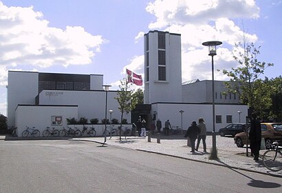
Solvang Kirke Address: Remisevej street in København
- Grand Impérissable Selskaber V Rasmus Kwasniak,
- Muhammad Asif Banaras,
- drivee,
- Dyvekeskolen,
- Elias Cykler,
- Bastiansminde Haveforeningen,
- Apoteket Sundby,
- Boligforeningen 3b Remisevænget Nord 3041,
- Botilbuddet Røde Mellemvej,
- Lo-Fa Holding Aps,
- Kinesisk Akupunktur Center,
- Remiseparken,
- Røde Mellemvej,
- Øens Spisested,
- Fremad Amager A/S,
- Boldklubben Fremad Amager,
- Baglokalet,
- Sundby Idrætspark,
- Urbanplanen,
- Børnehuset Lygtemagerstien
Places Near Solvang Kirke (København)
- Havnebus 993 (Nyhavn - Operaen),
- Bella Center, København,
- Carlsberg Byen, København,
- Field's, København,
- Reffen, København,
- Royal Arena, København,
- Bakken, København,
- Christiania, København,
- Seduction Girls, Rødovre,
- Refshaleøen, København,
- Fisketorvet, København,
- Operaen, København,
- Ikea, Århus,
- Eventyrpigerne, Sorø,
- Nyhavn, København,
- Bispebjerg Hospital, København,
- Den Sorte Diamant, København,
- Rigshospitalet, København,
- Dr Koncerthuset, København,
- Copenhagen Street Food - Reffen, København
How to get to popular places in Denmark with public transit
Get around København by public transit!
Traveling around København has never been so easy. See step by step directions as you travel to any attraction, street or major public transit station. View bus and train schedules, arrival times, service alerts and detailed routes on a map, so you know exactly how to get to anywhere in København.
When traveling to any destination around København use Moovit's Live Directions with Get Off Notifications to know exactly where and how far to walk, how long to wait for your line, and how many stops are left. Moovit will alert you when it's time to get off — no need to constantly re-check whether yours is the next stop.
Wondering how to use public transit in København or how to pay for public transit in København? Moovit public transit app can help you navigate your way with public transit easily, and at minimum cost. It includes public transit fees, ticket prices, and costs. Looking for a map of København public transit lines? Moovit public transit app shows all public transit maps in København with all Bus, Train, Metro, Light Rail and Ferry routes and stops on an interactive map.
Denmark has 5 transit type(s), including: Bus, Train, Metro, Light Rail and Ferry, operated by several transit agencies, including Metroselskabet, DSB S-tog, Lokaltog A/S, Midttrafik, Odense Letbane, DSB, NT, GoCollective, Skånetrafiken, Movia, FYNBUS, Sydtrafik, Bornholms Trafik, Citybus and Ærø Kommune