How to get to Soul Care Custom Jewelry by bus?
Click on the bus route to see step by step directions with maps, line arrival times and updated time schedules.
From Social Security Administration (Robert M. Ball Building), Baltimore County
123 minFrom I-695 @ Exit 17 (Security Blvd/MD 122), Baltimore County
103 minFrom Mva, Baltimore
44 minFrom Randallstown, MD, Baltimore County
125 minFrom Sinai Hospital, Baltimore
105 minFrom I-83 Exit 16 (Timonium Road), Baltimore County
152 minFrom Johns Hopkins Medicine at Green Spring Station, Baltimore County
132 minFrom Reisterstown Road Plaza, Baltimore
40 minFrom I-695 @ Exit 18 (Liberty Rd/MD 26), Baltimore County
103 min
Bus stop near Soul Care Custom Jewelry in Baltimore County
- 10802 Red Run Blvd Nb, 4 min walk,VIEW
Metro station near Soul Care Custom Jewelry in Baltimore County
- Owings Mills Metro, 53 min walk,VIEW
Bus lines to Soul Care Custom Jewelry in Baltimore County
- 89, Redland Court,VIEW
What are the closest stations to Soul Care Custom Jewelry?
The closest stations to Soul Care Custom Jewelry are:
- 10802 Red Run Blvd Nb is 326 yards away, 4 min walk.
- Owings Mills Metro is 4501 yards away, 53 min walk.
Which bus lines stop near Soul Care Custom Jewelry?
These bus lines stop near Soul Care Custom Jewelry: 87, 89.
What’s the nearest bus station to Soul Care Custom Jewelry in Baltimore County?
The nearest bus station to Soul Care Custom Jewelry in Baltimore County is 10802 Red Run Blvd Nb. It’s a 4 min walk away.
What time is the first metro to Soul Care Custom Jewelry in Baltimore County?
The METRO is the first metro that goes to Soul Care Custom Jewelry in Baltimore County. It stops nearby at 4:28 AM.
What time is the last metro to Soul Care Custom Jewelry in Baltimore County?
The METRO is the last metro that goes to Soul Care Custom Jewelry in Baltimore County. It stops nearby at 12:31 AM.
What time is the first bus to Soul Care Custom Jewelry in Baltimore County?
The 89 is the first bus that goes to Soul Care Custom Jewelry in Baltimore County. It stops nearby at 5:28 AM.
What time is the last bus to Soul Care Custom Jewelry in Baltimore County?
The 89 is the last bus that goes to Soul Care Custom Jewelry in Baltimore County. It stops nearby at 6:37 PM.
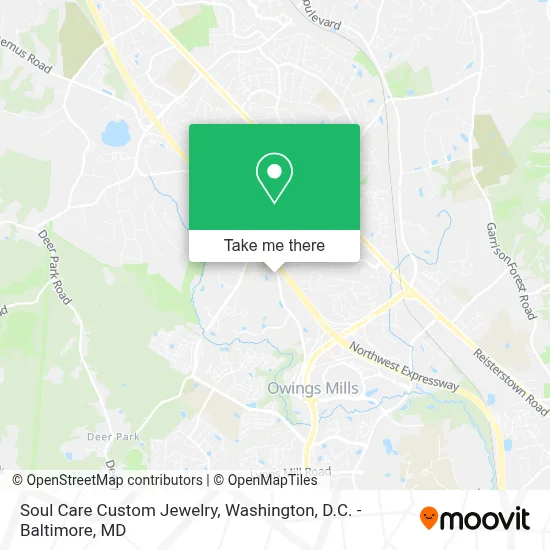
See Soul Care Custom Jewelry, Baltimore County, on the map
Public Transit to Soul Care Custom Jewelry in Baltimore County
Wondering how to get to Soul Care Custom Jewelry in Baltimore County? Moovit helps you find the best way to get to Soul Care Custom Jewelry with step-by-step directions from the nearest public transit station.
Moovit provides free maps and live directions to help you navigate through your city. View schedules, routes, timetables, and find out how long does it take to get to Soul Care Custom Jewelry in real time.
Looking for the nearest stop or station to Soul Care Custom Jewelry? Check out this list of stops closest to your destination: 10802 Red Run Blvd Nb; Owings Mills Metro.
Bus: 87, 89.Metro: METRO.
Want to see if there’s another route that gets you there at an earlier time? Moovit helps you find alternative routes or times. Get directions from and directions to Soul Care Custom Jewelry easily from the Moovit App or Website.
We make riding to Soul Care Custom Jewelry easy, which is why over 1.7 million users, including users in Baltimore County, trust Moovit as the best app for public transit. You don’t need to download an individual bus app or train app, Moovit is your all-in-one transit app that helps you find the best bus time or train time available.
For information on prices of bus, metro and light rail, costs and ride fares to Soul Care Custom Jewelry, please check the Moovit app.
Use the app to navigate to popular places including to the airport, hospital, stadium, grocery store, mall, coffee shop, school, college, and university.
Soul Care Custom Jewelry Address: 10821 Red Run Blvd street in Baltimore County
- Harbour School (Harbor School & Inno),
- Guntry Club of Maryland,
- Navy Federal Credit Union,
- Blink Charging,
- PP*Camille Nyman,
- All Staffing Inc,
- Vsu Training,
- Alecia Zarzecki-Groves, Bankers Life Agent,
- I-795 (Exit 4) @ Owings Mills Blvd (MD 940),
- Carefirst, BCBSMD,
- Blink Charging,
- CareFirst OM1,
- Domain Technology Partners,
- AMC Movie Theater,
- El Gran Pollo,
- Owings Mills, Maryland,
- Best Buy-Owings Mills,
- New Apna Bazar Zabiha Halal Meat & Fashion Boutique,
- Burlington,
- Baltimore Ravens Training Camp
Places Near Soul Care Custom Jewelry (Baltimore County)
- M&T Bank Stadium, Baltimore,
- Washington DC VA Medical Center, Washington,
- Capital One Arena, Washington,
- PG Mall, Prince George's County,
- Camden Yards, Baltimore,
- Marriott Marquis Washington, DC, Washington,
- The Anthem, Washington,
- Rock Creek Tennis Center, Washington,
- Georgetown, Washington,
- Museum Of The Bible, Washington,
- Westfield Montgomery Mall, Montgomery County,
- Warner Theatre, Washington,
- Pennsylvania Ave NW (3rd st and pennsylvania), Washington,
- Amazon Hq2, Arlington County,
- National Zoo, Washington,
- National Theatre, Washington,
- National Museum of African American History and Culture, Washington,
- Basilica of the National Shrine, Washington,
- Sibley Memorial Hospital, Washington,
- Washington National Cathedral, Washington
How to get to popular places in Washington, D.C. - Baltimore, MD with public transit
Get around Baltimore County by public transit!
Traveling around Baltimore County has never been so easy. See step by step directions as you travel to any attraction, street or major public transit station. View bus and train schedules, arrival times, service alerts and detailed routes on a map, so you know exactly how to get to anywhere in Baltimore County.
When traveling to any destination around Baltimore County use Moovit's Live Directions with Get Off Notifications to know exactly where and how far to walk, how long to wait for your line, and how many stops are left. Moovit will alert you when it's time to get off — no need to constantly re-check whether yours is the next stop.
Wondering how to use public transit in Baltimore County or how to pay for public transit in Baltimore County? Moovit public transit app can help you navigate your way with public transit easily, and at minimum cost. It includes public transit fees, ticket prices, and costs. Looking for a map of Baltimore County public transit lines? Moovit public transit app shows all public transit maps in Baltimore County with all Bus, Train, Metro, Light Rail and Ferry routes and stops on an interactive map.
Washington, D.C. - Baltimore, MD has 5 transit type(s), including: Bus, Train, Metro, Light Rail and Ferry, operated by several transit agencies, including WMATA, Montgomery County Ride On, Fairfax Connector, TheBus, PRTC, DASH - Alexandria, Arlington Transit (ART), RTA of Central Maryland, MDOT MTA, MDOT MTA Light RailLink, MDOT MTA Commuter Bus, MDOT MTA Local Bus, FXBGO!, Virginia Railway Express (VRE) and MARC