How to get to South Complex - Wendell Chino Building by bus?
Click on the bus route to see step by step directions with maps, line arrival times and updated time schedules.
Bus stops near South Complex - Wendell Chino Building in Santa Fe
Bus lines to South Complex - Wendell Chino Building in Santa Fe
What are the closest stations to South Complex - Wendell Chino Building?
The closest stations to South Complex - Wendell Chino Building are:
- Cerrillos @ Baca Ib is 50 yards away, 1 min walk.
- St. Francis @ Cordova Ib is 523 yards away, 7 min walk.
Which bus line stops near South Complex - Wendell Chino Building?
2 (Downtown Transit Center)
What’s the nearest bus station to South Complex - Wendell Chino Building in Santa Fe?
The nearest bus station to South Complex - Wendell Chino Building in Santa Fe is Cerrillos @ Baca Ib. It’s a 1 min walk away.
What time is the first bus to South Complex - Wendell Chino Building in Santa Fe?
The 2 is the first bus that goes to South Complex - Wendell Chino Building in Santa Fe. It stops nearby at 5:37 AM.
What time is the last bus to South Complex - Wendell Chino Building in Santa Fe?
The 2 is the last bus that goes to South Complex - Wendell Chino Building in Santa Fe. It stops nearby at 10:06 PM.
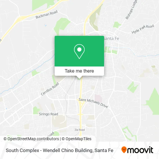
See South Complex - Wendell Chino Building, Santa Fe, on the map
Public Transit to South Complex - Wendell Chino Building in Santa Fe
Wondering how to get to South Complex - Wendell Chino Building in Santa Fe? Moovit helps you find the best way to get to South Complex - Wendell Chino Building with step-by-step directions from the nearest public transit station.
Moovit provides free maps and live directions to help you navigate through your city. View schedules, routes, timetables, and find out how long does it take to get to South Complex - Wendell Chino Building in real time.
Looking for the nearest stop or station to South Complex - Wendell Chino Building? Check out this list of stops closest to your destination: Cerrillos @ Baca Ib; St. Francis @ Cordova Ib.
Bus: 2, 4.
Want to see if there’s another route that gets you there at an earlier time? Moovit helps you find alternative routes or times. Get directions from and directions to South Complex - Wendell Chino Building easily from the Moovit App or Website.
We make riding to South Complex - Wendell Chino Building easy, which is why over 1.7 million users, including users in Santa Fe, trust Moovit as the best app for public transit. You don’t need to download an individual bus app or train app, Moovit is your all-in-one transit app that helps you find the best bus time or train time available.
For information on prices of bus, costs and ride fares to South Complex - Wendell Chino Building, please check the Moovit app.
Use the app to navigate to popular places including to the airport, hospital, stadium, grocery store, mall, coffee shop, school, college, and university.
South Complex - Wendell Chino Building Address: 1220 S St Francis Dr Santa Fe, NM 87505 street in Santa Fe
- New Mexico State Parks,
- New Mexico - State,
- Wendell Chino Building,
- Georgie's Mens Hair Cutting-Styling Salon,
- Santa Fe Civic Housing Authority,
- Ramirez Leroy Agency,
- We Buy Beat Up Old Homes,
- SF Pavement Marking,
- Progressive,
- Morena Skin & Beauty,
- Agape Insurance Services,
- Tierra Madre Botanicals,
- Ronald J Cowles Insurance,
- Social Security Numbers Credit,
- Studio Vaillancourt,
- Toni Drew LPC Resiliency Therapy,
- Sante Fe Homes (Santa Fe Homes),
- Inspectech-Structural Systems,
- Big Brothers Big Sisters Mountain Region,
- City of Santa Fe Senior Citizens Program
Places Near South Complex - Wendell Chino Building (Santa Fe)
- La Cienega, La Cienega,
- El Rey Court, Santa Fe,
- Museum Hill Santa Fe, Santa Fe,
- Presbyterian Santa Fe Medical Center, Santa Fe,
- De Vargas Mall, Santa Fe,
- Greyhound Bus Lines, Santa Fe,
- International Folk Art Market, Santa Fe,
- CHRISTUS St. Vincent, Santa Fe,
- Cathedral Basilica of St Francis of Assisi, Santa Fe,
- Zocalo, Santa Fe,
- Voupre, Santa Fe,
- Georgia O'Keeffe Museum, Santa Fe,
- Los Juanes, Santa Fe,
- Meow Wolf, Santa Fe,
- Glory Hole Glassworks, Santa Fe,
- Indian Market, Santa Fe,
- Santa Fe Botanical Garden, Santa Fe,
- Farolito Walk on Canyon Road, Santa Fe,
- Buffalo Thunder Resort & Casino, Santa Fe,
- Ten Thousand Waves, Santa Fe
How to get to popular places in Santa Fe with public transit
Get around Santa Fe by public transit!
Traveling around Santa Fe has never been so easy. See step by step directions as you travel to any attraction, street or major public transit station. View bus and train schedules, arrival times, service alerts and detailed routes on a map, so you know exactly how to get to anywhere in Santa Fe.
When traveling to any destination around Santa Fe use Moovit's Live Directions with Get Off Notifications to know exactly where and how far to walk, how long to wait for your line, and how many stops are left. Moovit will alert you when it's time to get off — no need to constantly re-check whether yours is the next stop.
Wondering how to use public transit in Santa Fe or how to pay for public transit in Santa Fe? Moovit public transit app can help you navigate your way with public transit easily, and at minimum cost. It includes public transit fees, ticket prices, and costs. Looking for a map of Santa Fe public transit lines? Moovit public transit app shows all public transit maps in Santa Fe with all bus routes and stops on an interactive map.
Santa Fe has 1 transit type(s), including: bus, operated by several transit agencies, including Santa Fe Trails