How to get to Southern Management by bus?
Click on the bus route to see step by step directions with maps, line arrival times and updated time schedules.
Bus stops near Southern Management in Roanoke
Bus lines to Southern Management in Roanoke
What are the closest stations to Southern Management?
The closest stations to Southern Management are:
- Melrose Eb at Fentress is 17 yards away, 1 min walk.
- Melrose Wb at Fentress is 43 yards away, 1 min walk.
- Hershberger Wb at Westside is 1272 yards away, 16 min walk.
- Westwood Nb at Salem Turnpike is 1841 yards away, 22 min walk.
Which bus line stops near Southern Management?
91 (Apperson Eb at Riverview)
What’s the nearest bus station to Southern Management in Roanoke?
The nearest bus stations to Southern Management in Roanoke are Melrose Eb at Fentress and Melrose Wb at Fentress. The closest one is a 1 min walk away.
What time is the first bus to Southern Management in Roanoke?
The 92 is the first bus that goes to Southern Management in Roanoke. It stops nearby at 5:48 AM.
What time is the last bus to Southern Management in Roanoke?
The 85 is the last bus that goes to Southern Management in Roanoke. It stops nearby at 8:37 PM.
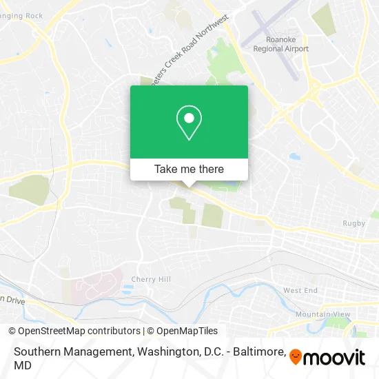
See Southern Management, Roanoke, on the map
Public Transit to Southern Management in Roanoke
Wondering how to get to Southern Management in Roanoke? Moovit helps you find the best way to get to Southern Management with step-by-step directions from the nearest public transit station.
Moovit provides free maps and live directions to help you navigate through your city. View schedules, routes, timetables, and find out how long does it take to get to Southern Management in real time.
Looking for the nearest stop or station to Southern Management? Check out this list of stops closest to your destination: Melrose Eb at Fentress; Melrose Wb at Fentress; Hershberger Wb at Westside; Westwood Nb at Salem Turnpike.
Bus: 91, 92, 85, 76.
Want to see if there’s another route that gets you there at an earlier time? Moovit helps you find alternative routes or times. Get directions from and directions to Southern Management easily from the Moovit App or Website.
We make riding to Southern Management easy, which is why over 1.5 million users, including users in Roanoke, trust Moovit as the best app for public transit. You don’t need to download an individual bus app or train app, Moovit is your all-in-one transit app that helps you find the best bus time or train time available.
For information on prices of bus and train, costs and ride fares to Southern Management, please check the Moovit app.
Use the app to navigate to popular places including to the airport, hospital, stadium, grocery store, mall, coffee shop, school, college, and university.
Southern Management Address: 3620 Melrose Ave NW Roanoke, VA 24017 street in Roanoke
- Mega Ministries,
- Melrose Hair & Beauty Supplies,
- God's House Baptist Ministry,
- Kuumba Community Health,
- WESTERN UNION,
- Flowers Baking Company,
- Roanoke Grocery Market,
- Two Penny's Beauty & Barber Salon,
- J & J Autoville,
- Sales Town,
- Melrose Stop Mart .,
- Official Image,
- Unbank Bitcoin ATM,
- ATM,
- Sky Mart,
- Washington Heights Grace Brethren Church,
- Caru Apartments,
- Mike's Car Care Rim Shop,
- Atm America,
- Shell
Places Near Southern Management (Roanoke)
- Westfield Montgomery Mall, Montgomery County,
- Washington National Cathedral, Washington,
- Georgetown, Washington,
- Museum Of The Bible, Washington,
- Washington DC VA Medical Center, Washington,
- M&T Bank Stadium, Baltimore,
- Rock Creek Tennis Center, Washington,
- National Mall, Washington,
- National Museum of African American History and Culture, Washington,
- Pennsylvania Ave NW (3rd st and pennsylvania), Washington,
- National Zoo, Washington,
- Warner Theatre, Washington,
- Camden Yards, Baltimore,
- Sibley Memorial Hospital, Washington,
- The Anthem, Washington,
- Amazon Hq2, Arlington County,
- Basilica of the National Shrine, Washington,
- Capital One Arena, Washington,
- PG Mall, Prince George's County,
- Marriott Marquis Washington, DC, Washington
How to get to popular places in Washington, D.C. - Baltimore, MD with public transit
Get around Roanoke by public transit!
Traveling around Roanoke has never been so easy. See step by step directions as you travel to any attraction, street or major public transit station. View bus and train schedules, arrival times, service alerts and detailed routes on a map, so you know exactly how to get to anywhere in Roanoke.
When traveling to any destination around Roanoke use Moovit's Live Directions with Get Off Notifications to know exactly where and how far to walk, how long to wait for your line, and how many stops are left. Moovit will alert you when it's time to get off — no need to constantly re-check whether yours is the next stop.
Wondering how to use public transit in Roanoke or how to pay for public transit in Roanoke? Moovit public transit app can help you navigate your way with public transit easily, and at minimum cost. It includes public transit fees, ticket prices, and costs. Looking for a map of Roanoke public transit lines? Moovit public transit app shows all public transit maps in Roanoke with all Bus, Train, Metro, Light Rail and Ferry routes and stops on an interactive map.
Washington, D.C. - Baltimore, MD has 5 transit type(s), including: Bus, Train, Metro, Light Rail and Ferry, operated by several transit agencies, including WMATA, Montgomery County Ride On, Fairfax Connector, TheBus, PRTC, DASH - Alexandria, Arlington Transit (ART), RTA of Central Maryland, MDOT MTA, MDOT MTA Light RailLink, MDOT MTA Commuter Bus, MDOT MTA Local Bus, FXBGO!, Virginia Railway Express (VRE) and MARC