Directions to Space Lab Systems (Manhattan) with public transportation
The following transit lines have routes that pass near Space Lab Systems
 Bus: M7, M79-SBS, M11, BXM2, M10.
- Train: BABYLON BRANCH, FAR ROCKAWAY BRANCH, PORT WASHINGTON BRANCH.
- Subway: 1, B, C, 2, 3.
How to get to Space Lab Systems by bus?
Click on the bus route to see step by step directions with maps, line arrival times and updated time schedules.
How to get to Space Lab Systems by train?
Click on the train route to see step by step directions with maps, line arrival times and updated time schedules.
How to get to Space Lab Systems by subway?
Click on the subway route to see step by step directions with maps, line arrival times and updated time schedules.
Bus stops near Space Lab Systems in Manhattan
Bus lines to Space Lab Systems in Manhattan
What are the closest stations to Space Lab Systems?
The closest stations to Space Lab Systems are:
- Columbus Av/W 80 St is 36 yards away, 1 min walk.
- W 81 St/Columbus Av is 143 yards away, 2 min walk.
- 72 St is 210 yards away, 3 min walk.
- Central Park West/W 81 St is 386 yards away, 5 min walk.
- 86 St is 680 yards away, 8 min walk.
Which bus lines stop near Space Lab Systems?
These bus lines stop near Space Lab Systems: M7, M79-SBS.
Which train lines stop near Space Lab Systems?
These train lines stop near Space Lab Systems: BABYLON BRANCH, FAR ROCKAWAY BRANCH, PORT WASHINGTON BRANCH.
Which subway lines stop near Space Lab Systems?
These subway lines stop near Space Lab Systems: 1, B, C.
What’s the nearest subway station to Space Lab Systems in Manhattan?
The nearest subway station to Space Lab Systems in Manhattan is 72 St. It’s a 3 min walk away.
What’s the nearest bus station to Space Lab Systems in Manhattan?
The nearest bus station to Space Lab Systems in Manhattan is Columbus Av/W 80 St. It’s a 1 min walk away.
What time is the first subway to Space Lab Systems in Manhattan?
The 1 is the first subway that goes to Space Lab Systems in Manhattan. It stops nearby at 3:00 AM.
What time is the last subway to Space Lab Systems in Manhattan?
The A is the last subway that goes to Space Lab Systems in Manhattan. It stops nearby at 4:06 AM.
What time is the first bus to Space Lab Systems in Manhattan?
The M7 is the first bus that goes to Space Lab Systems in Manhattan. It stops nearby at 3:00 AM.
What time is the last bus to Space Lab Systems in Manhattan?
The M7 is the last bus that goes to Space Lab Systems in Manhattan. It stops nearby at 3:01 AM.
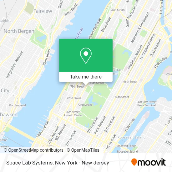
See Space Lab Systems, Manhattan, on the map
Public Transit to Space Lab Systems in Manhattan
Wondering how to get to Space Lab Systems in Manhattan? Moovit helps you find the best way to get to Space Lab Systems with step-by-step directions from the nearest public transit station.
Moovit provides free maps and live directions to help you navigate through your city. View schedules, routes, timetables, and find out how long does it take to get to Space Lab Systems in real time.
Looking for the nearest stop or station to Space Lab Systems? Check out this list of stops closest to your destination: Columbus Av/W 80 St; W 81 St/Columbus Av; 72 St; Central Park West/W 81 St; 86 St.
Bus: M7, M79-SBS, M11, BXM2, M10.Train: BABYLON BRANCH, FAR ROCKAWAY BRANCH, PORT WASHINGTON BRANCH.Subway: 1, B, C, 2, 3, A.
Want to see if there’s another route that gets you there at an earlier time? Moovit helps you find alternative routes or times. Get directions from and directions to Space Lab Systems easily from the Moovit App or Website.
We make riding to Space Lab Systems easy, which is why over 1.5 million users, including users in Manhattan, trust Moovit as the best app for public transit. You don’t need to download an individual bus app or train app, Moovit is your all-in-one transit app that helps you find the best bus time or train time available.
For information on prices of subway, bus and train, costs and ride fares to Space Lab Systems, please check the Moovit app.
Use the app to navigate to popular places including to the airport, hospital, stadium, grocery store, mall, coffee shop, school, college, and university.
Space Lab Systems Address: 100 W 80th St street in Manhattan
- Precision Sound Studios,
- Orleans,
- New York City Museums,
- New York | Upper West Side | Columbus Avenue,
- Columbus Ave., New York City,
- West 80th Street & Columbus Avenue,
- Central Park Suite,
- Rituals,
- Goldsmith & Company,
- Warby Parker,
- Belvedere Castle,
- The Ok Team at Brown Harris Stevens,
- Andrea Saenz - Nyc Real Estate,
- Alison Draper at Brown Harris Stevens,
- Debra Hoffman at Brown Harris Stevens,
- Linda Bernell at Halstead Manhattan,
- Abe Rosenberg at Halstead Real Estate,
- The Kerins Team,
- Olga Zoria Brown Harris Stevens,
- Anna Kahn at Brown Harris Stevens
Places Near Space Lab Systems (Manhattan)
- Wall Street, Manhattan,
- Chinatown, Manhattan,
- 66 John Street, Manhattan,
- San Gennaro Feast, Manhattan,
- Times Square, Manhattan,
- 376 Hudson Street, Manhattan,
- Pier 83, Manhattan,
- SoHo, Manhattan,
- 111 Centre New York City Supreme Court, Manhattan,
- Mountainside Hospital, Glen Ridge,
- 911 Memorial, Manhattan,
- Hudson Yards, Manhattan,
- 3 Stone St, Manhattan,
- qqqq, Manhattan,
- Bellevue Hospital, Manhattan,
- Queens Center Mall, Queens,
- 1 Police Plaza, Manhattan,
- 26 Federal Plaza, Manhattan,
- Katz's Deli, Manhattan,
- Rockefeller Center, Manhattan
How to get to popular places in New York - New Jersey with public transit
Get around Manhattan by public transit!
Traveling around Manhattan has never been so easy. See step by step directions as you travel to any attraction, street or major public transit station. View bus and train schedules, arrival times, service alerts and detailed routes on a map, so you know exactly how to get to anywhere in Manhattan.
When traveling to any destination around Manhattan use Moovit's Live Directions with Get Off Notifications to know exactly where and how far to walk, how long to wait for your line, and how many stops are left. Moovit will alert you when it's time to get off — no need to constantly re-check whether yours is the next stop.
Wondering how to use public transit in Manhattan or how to pay for public transit in Manhattan? Moovit public transit app can help you navigate your way with public transit easily, and at minimum cost. It includes public transit fees, ticket prices, and costs. Looking for a map of Manhattan public transit lines? Moovit public transit app shows all public transit maps in Manhattan with all Bus, Train, Subway, Light Rail, Ferry and Cable Car routes and stops on an interactive map.
New York - New Jersey has 6 transit type(s), including: Bus, Train, Subway, Light Rail, Ferry and Cable Car, operated by several transit agencies, including MTA Subway, Metro-North Railroad, LIRR, PATH, MTA New York City Transit - Express routes, MTA Bus, NJ Transit, NYC Ferry, NICE bus, Bee-Line Bus, NJ Transit Rail, Norwalk Transit District, Hartford Line, River Valley Transit and HART