How to get to Sparkling Clean Solution by bus?
Click on the bus route to see step by step directions with maps, line arrival times and updated time schedules.
From Sawgrass Mall, Miami
90 minFrom Tropicana Flea Market, Miami
55 minFrom Turnpike Exit @ Doral Blvd. (NW 41 Street), North Westside
147 minFrom Ebay Store, Miami
122 minFrom Tuuci, Hialeah
41 minFrom NW 37th Ave / NW 7th St, Miami
63 minFrom Florida Lottery District Office-Miami, Hialeah
47 minFrom Red Coach, Miami
70 minFrom Department of Children and Families, Miami
78 minFrom Macy's International Mall, Miami
64 min
How to get to Sparkling Clean Solution by train?
Click on the train route to see step by step directions with maps, line arrival times and updated time schedules.
Bus stops near Sparkling Clean Solution in Hialeah
Train station near Sparkling Clean Solution in Hialeah
- Okeechobee, 55 min walk,VIEW
Bus lines to Sparkling Clean Solution in Hialeah
What are the closest stations to Sparkling Clean Solution?
The closest stations to Sparkling Clean Solution are:
- W 49 St & W 4 Av is 723 yards away, 9 min walk.
- W 8 Av & W 44 Pl is 1380 yards away, 17 min walk.
- Okeechobee is 4621 yards away, 55 min walk.
Which bus lines stop near Sparkling Clean Solution?
These bus lines stop near Sparkling Clean Solution: 103, 37, HIAMAR.
Which train line stops near Sparkling Clean Solution?
GREEN (Dadeland South Stat.rail Northbound→Palmetto Station Rail Northbound)
What’s the nearest bus station to Sparkling Clean Solution in Hialeah?
The nearest bus station to Sparkling Clean Solution in Hialeah is W 49 St & W 4 Av. It’s a 9 min walk away.
What time is the first train to Sparkling Clean Solution in Hialeah?
The GREEN is the first train that goes to Sparkling Clean Solution in Hialeah. It stops nearby at 5:03 AM.
What time is the last train to Sparkling Clean Solution in Hialeah?
The GREEN is the last train that goes to Sparkling Clean Solution in Hialeah. It stops nearby at 12:56 AM.
What time is the first bus to Sparkling Clean Solution in Hialeah?
The 103 is the first bus that goes to Sparkling Clean Solution in Hialeah. It stops nearby at 5:04 AM.
What time is the last bus to Sparkling Clean Solution in Hialeah?
The 54 is the last bus that goes to Sparkling Clean Solution in Hialeah. It stops nearby at 12:02 AM.
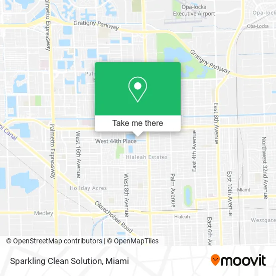
See Sparkling Clean Solution, Hialeah, on the map
Public Transit to Sparkling Clean Solution in Hialeah
Wondering how to get to Sparkling Clean Solution in Hialeah? Moovit helps you find the best way to get to Sparkling Clean Solution with step-by-step directions from the nearest public transit station.
Moovit provides free maps and live directions to help you navigate through your city. View schedules, routes, timetables, and find out how long does it take to get to Sparkling Clean Solution in real time.
Looking for the nearest stop or station to Sparkling Clean Solution? Check out this list of stops closest to your destination: W 49 St & W 4 Av; W 8 Av & W 44 Pl; Okeechobee.
Bus: 103, 37, HIAMAR, 54.Train: GREEN.
Want to see if there’s another route that gets you there at an earlier time? Moovit helps you find alternative routes or times. Get directions from and directions to Sparkling Clean Solution easily from the Moovit App or Website.
We make riding to Sparkling Clean Solution easy, which is why over 1.5 million users, including users in Hialeah, trust Moovit as the best app for public transit. You don’t need to download an individual bus app or train app, Moovit is your all-in-one transit app that helps you find the best bus time or train time available.
For information on prices of bus, train and light rail, costs and ride fares to Sparkling Clean Solution, please check the Moovit app.
Use the app to navigate to popular places including to the airport, hospital, stadium, grocery store, mall, coffee shop, school, college, and university.
Sparkling Clean Solution Address: 570 W 46th Pl Hialeah, FL 33012 street in Hialeah
- Rainbow,
- Burlington,
- Centerwell Retail Pharmacy,
- Burlington Coat Factory,
- Anabella's Beauty Salon,
- 911 Insurance,
- Asa College Hialeah Campus,
- Dollar Tree (Deals),
- Leonardo Falero,
- FedEx Office,
- Bella-Flor-Flowers,
- Lake Hialeah Henry,
- Paradise Plants,
- Citibank,
- Cabrera, Osvaldo Od: Osvaldo Cabrera, Od,
- Citibank,
- Sanchez Robert Pa,
- Love+Unltd Church,
- City of Hialeah Theatre,
- Little Havana Activities-Nutri
Places Near Sparkling Clean Solution (Hialeah)
- Richard E. Gerstein Justice Building, Miami,
- Miami-Dade County Courthouse, Miami,
- Wynwood, Miami,
- Zoo Miami, Miami,
- Miami VA Hospital, Miami,
- Sawgrass Mall, Miami,
- Port of Miami Cruise Terminal, Miami,
- Miami Design District, Miami,
- Keiser University Flagship Campus, West Palm Beach,
- Aventura Mall, Miami,
- Dolphin Mall Bus, Miami,
- Miami Freedom Park, Miami,
- Dolphin Mall, Miami,
- Hard Rock Stadium, Miami Gardens,
- Sawgrass mall ( FL ), Miami Beach,
- Marlins Park, Miami,
- Little Havana, Miami,
- Aventura Mall, Miami Beach,
- Bayside Marketplace, Miami,
- Brickell City Centre, Miami
How to get to popular places in Miami with public transit
Get around Hialeah by public transit!
Traveling around Hialeah has never been so easy. See step by step directions as you travel to any attraction, street or major public transit station. View bus and train schedules, arrival times, service alerts and detailed routes on a map, so you know exactly how to get to anywhere in Hialeah.
When traveling to any destination around Hialeah use Moovit's Live Directions with Get Off Notifications to know exactly where and how far to walk, how long to wait for your line, and how many stops are left. Moovit will alert you when it's time to get off — no need to constantly re-check whether yours is the next stop.
Wondering how to use public transit in Hialeah or how to pay for public transit in Hialeah? Moovit public transit app can help you navigate your way with public transit easily, and at minimum cost. It includes public transit fees, ticket prices, and costs. Looking for a map of Hialeah public transit lines? Moovit public transit app shows all public transit maps in Hialeah with all Bus, Train, Light Rail and Ferry routes and stops on an interactive map.
Miami has 4 transit type(s), including: Bus, Train, Light Rail and Ferry, operated by several transit agencies, including Broward County Transit, Miami-Dade Transit, Metrorail, Palm Tran, Tri-Rail, Brightline, MARTY, City of Homestead Trolley, Key West Transit, Treasure Coast Connector, GoLine IRT, Amtrak, Greyhound-us, FlixBus-us and Aventura Express Shuttle Bus