Directions to Sparks Telecom (Mandirituba) with public transportation
The following transit lines have routes that pass near Sparks Telecom
How to get to Sparks Telecom by bus?
Click on the bus route to see step by step directions with maps, line arrival times and updated time schedules.
From Terminal Fazenda Rio Grande, Fazenda Rio Grande
34 minFrom Rua Tenente Sandro Luiz Kampa 182, Fazenda Rio Grande
32 minFrom Hospital Nossa Senhora Aparecida, Fazenda Rio Grande
34 minFrom Mandirituba, Fazenda Rio Grande
17 minFrom Rua Vereador Domingos Benvenuto Moletta, São José Dos Pinhais
136 minFrom puteiro da katlin, Fazenda Rio Grande
43 minFrom Bairro Estados, Fazenda Rio Grande
46 minFrom hospital e maternidade nossa senhora Aparecida, Fazenda Rio Grande
35 minFrom Fazenda Rio Grande, Fazenda Rio Grande
29 minFrom Areia Branca dos Assis, Mandirituba
33 min
Bus stops near Sparks Telecom in Mandirituba
Bus lines to Sparks Telecom in Mandirituba
- G71 MANDIRITUBA / GUADALUPE, Terminal Rodoviário Mandirituba → Terminal Guadalupe,VIEW
- G72 AREIA BRANCA / GUADALUPE, Areia Branca → Terminal Guadalupe,VIEW
- G72 QUITANDINHA / GUADALUPE, Quitandinha → Terminal Guadalupe,VIEW
- F73 FAZENDA RIO GRANDE / AREIA BRANCA, Fazenda Rio Grande → Areia Branca,VIEW
- G11 QUITANDINHA / PINHEIRINHO, Rua da Cidadania Pinheirinho → Quitandinha,VIEW
- I21 PIÊN / FAZENDA RIO GRANDE (VIA AGUDOS DO SUL), Agudos do Sul → Fazenda Rio Grande,VIEW
What are the closest stations to Sparks Telecom?
The closest stations to Sparks Telecom are:
- Avenida Paraná, 488 is 27 meters away, 1 min walk.
- Rodovia Br 116 (Régis Bittencourt) - Elétrica Clemente is 436 meters away, 6 min walk.
Which bus lines stop near Sparks Telecom?
These bus lines stop near Sparks Telecom: F73 FAZENDA RIO GRANDE / AREIA BRANCA, G11 QUITANDINHA / PINHEIRINHO, G72 AREIA BRANCA / GUADALUPE.
What’s the nearest bus station to Sparks Telecom in Mandirituba?
The nearest bus station to Sparks Telecom in Mandirituba is Avenida Paraná, 488. It’s a 1 min walk away.
What time is the first bus to Sparks Telecom in Mandirituba?
The G72 AREIA BRANCA / GUADALUPE is the first bus that goes to Sparks Telecom in Mandirituba. It stops nearby at 5:03 AM.
What time is the last bus to Sparks Telecom in Mandirituba?
The G72 QUITANDINHA / GUADALUPE is the last bus that goes to Sparks Telecom in Mandirituba. It stops nearby at 12:18 AM.
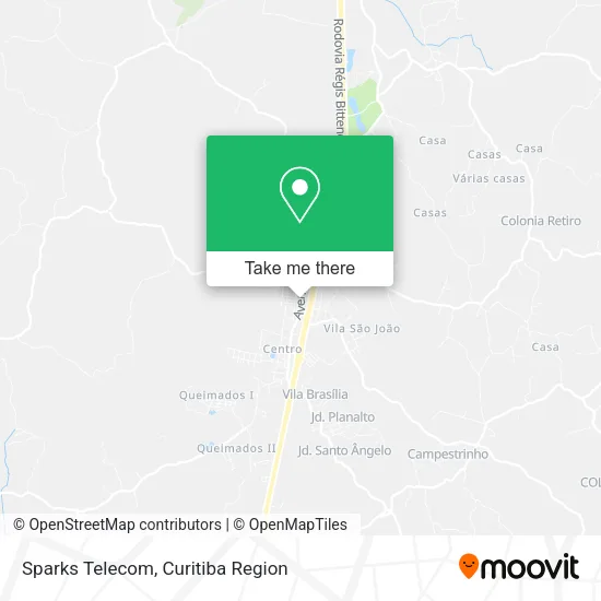
See Sparks Telecom, Mandirituba, on the map
Public Transit to Sparks Telecom in Mandirituba
Wondering how to get to Sparks Telecom in Mandirituba? Moovit helps you find the best way to get to Sparks Telecom with step-by-step directions from the nearest public transit station.
Moovit provides free maps and live directions to help you navigate through your city. View schedules, routes, timetables, and find out how long does it take to get to Sparks Telecom in real time.
Looking for the nearest stop or station to Sparks Telecom? Check out this list of stops closest to your destination: Avenida Paraná; Rodovia Br 116 (Régis Bittencourt) - Elétrica Clemente.
Bus: F73 FAZENDA RIO GRANDE / AREIA BRANCA, G11 QUITANDINHA / PINHEIRINHO, G72 AREIA BRANCA / GUADALUPE, G71 MANDIRITUBA / GUADALUPE, G72 QUITANDINHA / GUADALUPE, I21 PIÊN / FAZENDA RIO GRANDE (VIA AGUDOS DO SUL).
Want to see if there’s another route that gets you there at an earlier time? Moovit helps you find alternative routes or times. Get directions from and directions to Sparks Telecom easily from the Moovit App or Website.
We make riding to Sparks Telecom easy, which is why over 1.5 million users, including users in Mandirituba, trust Moovit as the best app for public transit. You don’t need to download an individual bus app or train app, Moovit is your all-in-one transit app that helps you find the best bus time or train time available.
For information on prices of bus, costs and ride fares to Sparks Telecom, please check the Moovit app.
Use the app to navigate to popular places including to the airport, hospital, stadium, grocery store, mall, coffee shop, school, college, and university.
Sparks Telecom Address: Avenida Paraná, 465 Mandirituba Mandirituba-PR 83800-000 street in Mandirituba
- Ruach Serviços de Engenharia de Projetos,
- Bicware Informática,
- Fdx Treinamento Gerencial,
- Rainbow,
- Cikel Logística e Serviços,
- Otto Hallgren Arquitetura e Construções,
- Edk Tecnologia,
- J. Ignacheski & Cia,
- Vento Sul Engenharia e Consultoria,
- Gringo's Burger,
- Donbros & Rizello,
- D.S.A,
- Km Empreiteira,
- Silva Pinturas,
- Marcio Antonio Lebioda & Cia.,
- Arteprint Comunicação Visual,
- Betinho Polimentos e Pinturas,
- Welter Representações Comerciais,
- L M Informatica,
- P J P Paineis & Cartazes
Places Near Sparks Telecom (Mandirituba)
- Hospital do Rocio, Campo,
- Hospital Angelina Caron, Campina Grande Do Sul,
- Hospital Da Cruz Vermelha, Batel,
- Rua General Mário Tourinho, Campina Do Siqueira,
- Hospital Madalena Sofia, Bairro Alto,
- Hospital Universitário Evangélico de Curitiba, Bigorrilho,
- Jardim Botânico de Curitiba PR, Centro,
- Hospital Nossa Senhora Das Graças, Mercês,
- Campo Largo, Campo,
- Shopping Estação, Rebouças,
- Hospital de Clínicas (HC - UFPR), Centro,
- Jockey Plaza Shopping Center, Tarumã,
- Arena Da Baixada - Curitiba,
- Hospital Erasto Gaertner, Jardim Das Américas,
- Shopping Palladium, Portão,
- Parque Barigui, Mercês,
- Rua Martim Afonso 558, Mercês,
- Park Shopping Barigüi, Mossunguê,
- Pontifícia Universidade Católica do Paraná (PUCPR), Prado Velho,
- Hhhhh, Fazendinha
How to get to popular places in Curitiba Region with public transit
Get around Mandirituba by public transit!
Traveling around Mandirituba has never been so easy. See step by step directions as you travel to any attraction, street or major public transit station. View bus and train schedules, arrival times, service alerts and detailed routes on a map, so you know exactly how to get to anywhere in Mandirituba.
When traveling to any destination around Mandirituba use Moovit's Live Directions with Get Off Notifications to know exactly where and how far to walk, how long to wait for your line, and how many stops are left. Moovit will alert you when it's time to get off — no need to constantly re-check whether yours is the next stop.
Wondering how to use public transit in Mandirituba or how to pay for public transit in Mandirituba? Moovit public transit app can help you navigate your way with public transit easily, and at minimum cost. It includes public transit fees, ticket prices, and costs. Looking for a map of Mandirituba public transit lines? Moovit public transit app shows all public transit maps in Mandirituba with all Bus and Cable Car routes and stops on an interactive map.
Curitiba Region has 2 transit type(s), including: Bus and Cable Car, operated by several transit agencies, including Sistema Integrado de Mobilidade (URBS), Sistema Integrado de Mobilidade (AMEP), URBS (Cartões bancários e Dinheiro), URBS (Cartões bancários / Cartão URBS), AMEP (Cartões bancários / Cartão MetroCard), AMEP (Cartões bancários / Cartão MetroCard / Dinheiro), Viação Colombo (Dinheiro), TRIAR (Cartão TRIAR / Dinheiro), Empresa Curitiba Cerro Azul (Dinheiro), Expresso Nossa Senhora da Penha (Dinheiro), Empresa Campo Alto Tijucas (Dinheiro), Auto Viação São José (Cartão VEM / Dinheiro), BRT S/A (Cartão VEM / Dinheiro), TransPiedade (Cartão Cidadão / Dinheiro) and Oceânica Sul (Cartão Transporte / Dinheiro)