Directions to Spector Chiropractic Offices (Baltimore) with public transportation
The following transit lines have routes that pass near Spector Chiropractic Offices
 Bus: 94, CHERRY ROUTE, CITYLINK SILVER, 67.
- Train: MARC.
- Metro: METRO.
- Ferry: HC3.
How to get to Spector Chiropractic Offices by bus?
Click on the bus route to see step by step directions with maps, line arrival times and updated time schedules.
From Pimlico Race Course, Baltimore
79 minFrom Mva, Baltimore
69 minFrom NSA Friendship Annex (FANX), Anne Arundel County
66 minFrom Walmart, Baltimore County
48 minFrom Hampden, Baltimore
35 minFrom Druid Hill Park, Baltimore
46 minFrom The Maryland Zoo In Baltimore, Baltimore
44 minFrom Guinness Open Gate Brewery & Barrel House, Baltimore County
64 minFrom Walmart, Baltimore County
65 minFrom I-695 @ Exit 17 (Security Blvd/MD 122), Baltimore County
60 min
How to get to Spector Chiropractic Offices by metro?
Click on the metro route to see step by step directions with maps, line arrival times and updated time schedules.
Bus stops near Spector Chiropractic Offices in Baltimore
Ferry station near Spector Chiropractic Offices in Baltimore
- Pier Five, 17 min walk,VIEW
Light Rail stations near Spector Chiropractic Offices in Baltimore
- Hamburg Street, 19 min walk,VIEW
Train station near Spector Chiropractic Offices in Baltimore
- Camden Station Marc, 25 min walk,VIEW
Bus lines to Spector Chiropractic Offices in Baltimore
What are the closest stations to Spector Chiropractic Offices?
The closest stations to Spector Chiropractic Offices are:
- Light St & Fort Ave Sb is 108 yards away, 2 min walk.
- Light St & Ostend St is 139 yards away, 2 min walk.
- Fort Ave & Light St is 153 yards away, 2 min walk.
- Pier Five is 1405 yards away, 17 min walk.
- Hamburg Street is 1584 yards away, 19 min walk.
- Camden Station Marc is 2057 yards away, 25 min walk.
Which bus lines stop near Spector Chiropractic Offices?
These bus lines stop near Spector Chiropractic Offices: 94, CHERRY ROUTE, CITYLINK SILVER.
Which metro line stops near Spector Chiropractic Offices?
METRO (Towards John Hopkins)
What’s the nearest light rail station to Spector Chiropractic Offices in Baltimore?
The nearest light rail station to Spector Chiropractic Offices in Baltimore is Hamburg Street. It’s a 19 min walk away.
What’s the nearest train station to Spector Chiropractic Offices in Baltimore?
The nearest train station to Spector Chiropractic Offices in Baltimore is Camden Station Marc. It’s a 25 min walk away.
What’s the nearest bus station to Spector Chiropractic Offices in Baltimore?
The nearest bus stations to Spector Chiropractic Offices in Baltimore are Light St & Fort Ave Sb, Light St & Ostend St and Fort Ave & Light St. The closest one is a 2 min walk away.
What’s the nearest ferry station to Spector Chiropractic Offices in Baltimore?
The nearest ferry station to Spector Chiropractic Offices in Baltimore is Pier Five. It’s a 17 min walk away.
What time is the first light rail to Spector Chiropractic Offices in Baltimore?
The LIGHT RAILLINK is the first light rail that goes to Spector Chiropractic Offices in Baltimore. It stops nearby at 4:03 AM.
What time is the last light rail to Spector Chiropractic Offices in Baltimore?
The LIGHT RAILLINK is the last light rail that goes to Spector Chiropractic Offices in Baltimore. It stops nearby at 1:13 AM.
What time is the first train to Spector Chiropractic Offices in Baltimore?
The MARC is the first train that goes to Spector Chiropractic Offices in Baltimore. It stops nearby at 5:00 AM.
What time is the last train to Spector Chiropractic Offices in Baltimore?
The MARC is the last train that goes to Spector Chiropractic Offices in Baltimore. It stops nearby at 8:55 PM.
What time is the first bus to Spector Chiropractic Offices in Baltimore?
The 94 is the first bus that goes to Spector Chiropractic Offices in Baltimore. It stops nearby at 4:01 AM.
What time is the last bus to Spector Chiropractic Offices in Baltimore?
The CITYLINK SILVER is the last bus that goes to Spector Chiropractic Offices in Baltimore. It stops nearby at 3:28 AM.
What time is the first ferry to Spector Chiropractic Offices in Baltimore?
The HC3 is the first ferry that goes to Spector Chiropractic Offices in Baltimore. It stops nearby at 6:00 AM.
What time is the last ferry to Spector Chiropractic Offices in Baltimore?
The HC3 is the last ferry that goes to Spector Chiropractic Offices in Baltimore. It stops nearby at 8:07 PM.
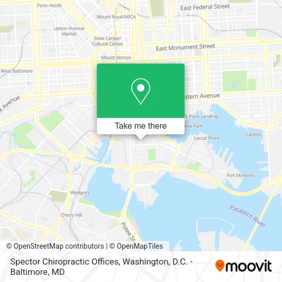
See Spector Chiropractic Offices, Baltimore, on the map
Public Transit to Spector Chiropractic Offices in Baltimore
Wondering how to get to Spector Chiropractic Offices in Baltimore? Moovit helps you find the best way to get to Spector Chiropractic Offices with step-by-step directions from the nearest public transit station.
Moovit provides free maps and live directions to help you navigate through your city. View schedules, routes, timetables, and find out how long does it take to get to Spector Chiropractic Offices in real time.
Looking for the nearest stop or station to Spector Chiropractic Offices? Check out this list of stops closest to your destination: Light St & Fort Ave Sb; Light St & Ostend St; Fort Ave & Light St; Pier Five; Hamburg Street; Camden Station Marc.
Bus: 94, CHERRY ROUTE, CITYLINK SILVER, 67.Train: MARC.Metro: METRO.Ferry: HC3.
Want to see if there’s another route that gets you there at an earlier time? Moovit helps you find alternative routes or times. Get directions from and directions to Spector Chiropractic Offices easily from the Moovit App or Website.
We make riding to Spector Chiropractic Offices easy, which is why over 1.5 million users, including users in Baltimore, trust Moovit as the best app for public transit. You don’t need to download an individual bus app or train app, Moovit is your all-in-one transit app that helps you find the best bus time or train time available.
For information on prices of bus, metro and light rail, costs and ride fares to Spector Chiropractic Offices, please check the Moovit app.
Use the app to navigate to popular places including to the airport, hospital, stadium, grocery store, mall, coffee shop, school, college, and university.
Spector Chiropractic Offices Address: 1425 Light St street in Baltimore
- Michael D Walls CPA,
- Hackstone Film Group,
- Octo Bar,
- Birckhead Lot,
- Freetjes,
- E Fort Ave Light St,
- Art Exposure,
- Carnival Cruise Lines,
- Stevens Autotransport and Welding,
- Hell's Kitchen Sandwich Lunch Combo,
- Enoch Pratt Free Library - Light Street Branch,
- Bell Locksmiths,
- EZ Connect Shuttle,
- Weichert Realtors Urban Lifestyles,
- Baltimore Immigration Memorial,
- Charles Shettle - Aflac,
- Tristar Investing,
- Divorce with A Plan,
- Sibs Food Boutique,
- Christina Giffin
Places Near Spector Chiropractic Offices (Baltimore)
- Georgetown, Washington,
- Warner Theatre, Washington,
- PG Mall, Prince George's County,
- M&T Bank Stadium, Baltimore,
- Amazon Hq2, Arlington County,
- Washington National Cathedral, Washington,
- Washington DC VA Medical Center, Washington,
- Basilica of the National Shrine, Washington,
- Capital One Arena, Washington,
- National Zoo, Washington,
- Westfield Montgomery Mall, Montgomery County,
- Camden Yards, Baltimore,
- National Mall, Washington,
- Marriott Marquis Washington, DC, Washington,
- National Museum of African American History and Culture, Washington,
- Pennsylvania Ave NW (3rd st and pennsylvania), Washington,
- The Anthem, Washington,
- Sibley Memorial Hospital, Washington,
- Museum Of The Bible, Washington,
- Rock Creek Tennis Center, Washington
How to get to popular places in Washington, D.C. - Baltimore, MD with public transit
Get around Baltimore by public transit!
Traveling around Baltimore has never been so easy. See step by step directions as you travel to any attraction, street or major public transit station. View bus and train schedules, arrival times, service alerts and detailed routes on a map, so you know exactly how to get to anywhere in Baltimore.
When traveling to any destination around Baltimore use Moovit's Live Directions with Get Off Notifications to know exactly where and how far to walk, how long to wait for your line, and how many stops are left. Moovit will alert you when it's time to get off — no need to constantly re-check whether yours is the next stop.
Wondering how to use public transit in Baltimore or how to pay for public transit in Baltimore? Moovit public transit app can help you navigate your way with public transit easily, and at minimum cost. It includes public transit fees, ticket prices, and costs. Looking for a map of Baltimore public transit lines? Moovit public transit app shows all public transit maps in Baltimore with all Bus, Train, Metro, Light Rail and Ferry routes and stops on an interactive map.
Washington, D.C. - Baltimore, MD has 5 transit type(s), including: Bus, Train, Metro, Light Rail and Ferry, operated by several transit agencies, including WMATA, Montgomery County Ride On, Fairfax Connector, TheBus, PRTC, DASH - Alexandria, Arlington Transit (ART), RTA of Central Maryland, MDOT MTA, MDOT MTA Light RailLink, MDOT MTA Commuter Bus, MDOT MTA Local Bus, FXBGO!, Virginia Railway Express (VRE) and MARC