Directions to Spectrum Balance And Neuro Science Center (East Grand Rapids) with public transportation
The following transit lines have routes that pass near Spectrum Balance And Neuro Science Center
 Bus: 6.
- Train: PERE MARQUETTE.
How to get to Spectrum Balance And Neuro Science Center by bus?
Click on the bus route to see step by step directions with maps, line arrival times and updated time schedules.
Bus stop near Spectrum Balance And Neuro Science Center in East Grand Rapids
- Wealthy/Laurel (Wb), 2 min walk,VIEW
Train station near Spectrum Balance And Neuro Science Center in East Grand Rapids
- Grand Rapids Vernon J. Ehlers Station, 56 min walk,VIEW
Bus lines to Spectrum Balance And Neuro Science Center in East Grand Rapids
- 6, Downtown/Rcs,VIEW
What are the closest stations to Spectrum Balance And Neuro Science Center?
The closest stations to Spectrum Balance And Neuro Science Center are:
- Wealthy/Laurel (Wb) is 60 yards away, 2 min walk.
- Grand Rapids Vernon J. Ehlers Station is 4756 yards away, 56 min walk.
Which bus line stops near Spectrum Balance And Neuro Science Center?
6 (Kentwood Station)
What’s the nearest bus station to Spectrum Balance And Neuro Science Center in East Grand Rapids?
The nearest bus station to Spectrum Balance And Neuro Science Center in East Grand Rapids is Wealthy/Laurel (Wb). It’s a 2 min walk away.
What time is the first train to Spectrum Balance And Neuro Science Center in East Grand Rapids?
The PERE MARQUETTE is the first train that goes to Spectrum Balance And Neuro Science Center in East Grand Rapids. It stops nearby at 6:00 AM.
What time is the last train to Spectrum Balance And Neuro Science Center in East Grand Rapids?
The PERE MARQUETTE is the last train that goes to Spectrum Balance And Neuro Science Center in East Grand Rapids. It stops nearby at 11:34 PM.
What time is the first bus to Spectrum Balance And Neuro Science Center in East Grand Rapids?
The 6 is the first bus that goes to Spectrum Balance And Neuro Science Center in East Grand Rapids. It stops nearby at 5:16 AM.
What time is the last bus to Spectrum Balance And Neuro Science Center in East Grand Rapids?
The 6 is the last bus that goes to Spectrum Balance And Neuro Science Center in East Grand Rapids. It stops nearby at 11:37 PM.
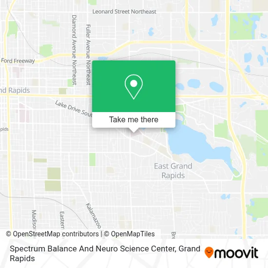
See Spectrum Balance And Neuro Science Center, East Grand Rapids, on the map
Public Transit to Spectrum Balance And Neuro Science Center in East Grand Rapids
Wondering how to get to Spectrum Balance And Neuro Science Center in East Grand Rapids? Moovit helps you find the best way to get to Spectrum Balance And Neuro Science Center with step-by-step directions from the nearest public transit station.
Moovit provides free maps and live directions to help you navigate through your city. View schedules, routes, timetables, and find out how long does it take to get to Spectrum Balance And Neuro Science Center in real time.
Looking for the nearest stop or station to Spectrum Balance And Neuro Science Center? Check out this list of stops closest to your destination: Wealthy/Laurel (Wb); Grand Rapids Vernon J. Ehlers Station.
Bus: 6.Train: PERE MARQUETTE.
Want to see if there’s another route that gets you there at an earlier time? Moovit helps you find alternative routes or times. Get directions from and directions to Spectrum Balance And Neuro Science Center easily from the Moovit App or Website.
We make riding to Spectrum Balance And Neuro Science Center easy, which is why over 1.5 million users, including users in East Grand Rapids, trust Moovit as the best app for public transit. You don’t need to download an individual bus app or train app, Moovit is your all-in-one transit app that helps you find the best bus time or train time available.
For information on prices of bus, costs and ride fares to Spectrum Balance And Neuro Science Center, please check the Moovit app.
Use the app to navigate to popular places including to the airport, hospital, stadium, grocery store, mall, coffee shop, school, college, and university.
Location: East Grand Rapids, Grand Rapids
- Spectrum Health-Blodgett Hospital,
- Blodgett Hospital,
- Blodgett Hospital Endoscopy,
- Gaslight Village,
- Mind Body Baby,
- Aquinas College Lacrosse Field,
- East Grand Rapids High School,
- Kent District Library - East Grand Rapids Branch,
- Reeds Lake,
- Martin Luther King Park,
- The Salvation Army,
- Meadowvale Dr SE,
- Grand Rapids Community College-Sneden Hall Room 203,
- Reeds Lake Blvd SE,
- Michigan and Maryland,
- Property Tax Consultants,
- Manhattan Rd SE,
- Michigan & Fuller,
- Cascade Community Association Park,
- Manhattan Ln SE
Places Near Spectrum Balance And Neuro Science Center (East Grand Rapids)
- Hudsonville,
- Kent County Courthouse, Grand Rapids,
- Byron Center,
- John Ball Zoo, Grand Rapids,
- Metro Cascade,
- Spectrum Health Butterworth Hospital, Grand Rapids,
- Frederik Meijer Gardens, Grand Rapids,
- Grand Rapids Community College, Grand Rapids,
- Van Andel Arena, Grand Rapids,
- University of Michigan Health Metro Health Hospital, Wyoming,
- Blodgett Hospital, East Grand Rapids,
- Union High School, Grand Rapids,
- Spectrum Health-Blodgett Hospital, East Grand Rapids,
- YMCA - David D. Hunting, Grand Rapids,
- Grandville, MI, Grandville,
- Lemmen-Holton Cancer Pavilion, Grand Rapids,
- Woodland Mall, Kentwood,
- Pine Rest Mental Health, Grand Rapids,
- Helel DeVos Children's Hospital Food Court, Grand Rapids,
- Butterworth Hospital Internal Radiology, Grand Rapids
How to get to popular places in Grand Rapids with public transit
Get around East Grand Rapids by public transit!
Traveling around East Grand Rapids has never been so easy. See step by step directions as you travel to any attraction, street or major public transit station. View bus and train schedules, arrival times, service alerts and detailed routes on a map, so you know exactly how to get to anywhere in East Grand Rapids.
When traveling to any destination around East Grand Rapids use Moovit's Live Directions with Get Off Notifications to know exactly where and how far to walk, how long to wait for your line, and how many stops are left. Moovit will alert you when it's time to get off — no need to constantly re-check whether yours is the next stop.
Wondering how to use public transit in East Grand Rapids or how to pay for public transit in East Grand Rapids? Moovit public transit app can help you navigate your way with public transit easily, and at minimum cost. It includes public transit fees, ticket prices, and costs. Looking for a map of East Grand Rapids public transit lines? Moovit public transit app shows all public transit maps in East Grand Rapids with all Bus and Train routes and stops on an interactive map.
Grand Rapids has 2 transit type(s), including: Bus and Train, operated by several transit agencies, including The Rapid, Amtrak and FlixBus-us