Directions to Spectrum Lab (Harrisonburg) with public transportation
The following transit lines have routes that pass near Spectrum Lab
 Bus: SHOP, BLUE, GOLD, GOLD, JMU SUMMER GOLD.
Bus stops near Spectrum Lab in Harrisonburg
Bus lines to Spectrum Lab in Harrisonburg
- Erika Shelburne,
- Blue Ridge Pain Treatment Center,
- Naspac VA,
- Mountain Ridge Pediatrics,
- Valley Plastic Surgery,
- McCain Whole Health Care,
- Sentara Medical Transport,
- Harrisonburg Dermatology,
- Valley Ent Head & Neck Surgery,
- Megan Imholt,
- Jamie Hutton MD Faap,
- Alexiou Hearing and Sinus Center,
- Jerri Alexiou MD,
- Comfort Inn & Suites Harrisonburg,
- Dr. Jeffery Kesecker, DDS,
- Bb&T,
- Linda Sue Hughes - Truist Mortgage Loan Officer,
- Scott & Stringfellow,
- Truist Bank,
- ATM
Places Near Spectrum Lab (Harrisonburg)
- Camden Yards, Baltimore,
- Washington National Cathedral, Washington,
- National Zoo, Washington,
- Amazon Hq2, Arlington County,
- Marriott Marquis Washington, DC, Washington,
- M&T Bank Stadium, Baltimore,
- Rock Creek Tennis Center, Washington,
- Basilica of the National Shrine, Washington,
- National Mall, Washington,
- Museum Of The Bible, Washington,
- Washington DC VA Medical Center, Washington,
- Pennsylvania Ave NW (3rd st and pennsylvania), Washington,
- Warner Theatre, Washington,
- Westfield Montgomery Mall, Montgomery County,
- National Museum of African American History and Culture, Washington,
- Capital One Arena, Washington,
- Georgetown, Washington,
- Sibley Memorial Hospital, Washington,
- PG Mall, Prince George's County,
- The Anthem, Washington
How to get to popular places in Washington, D.C. - Baltimore, MD with public transit
What are the closest stations to Spectrum Lab?
The closest stations to Spectrum Lab are:
- Lucy Dr. Across From Biolife is 267 yards away, 4 min walk.
- Neff Ave. @ Deyerle Ave. is 651 yards away, 8 min walk.
- University Blvd. Across From Medical Ave. is 1199 yards away, 15 min walk.
Which bus line stops near Spectrum Lab?
SHOP (Godwin Transit Center)
What’s the nearest bus station to Spectrum Lab in Harrisonburg?
The nearest bus station to Spectrum Lab in Harrisonburg is Lucy Dr. Across From Biolife. It’s a 4 min walk away.
What time is the first bus to Spectrum Lab in Harrisonburg?
The 1 is the first bus that goes to Spectrum Lab in Harrisonburg. It stops nearby at 6:42 AM.
What time is the last bus to Spectrum Lab in Harrisonburg?
The 1-B is the last bus that goes to Spectrum Lab in Harrisonburg. It stops nearby at 10:34 PM.
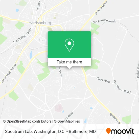
See Spectrum Lab, Harrisonburg, on the map
Public Transit to Spectrum Lab in Harrisonburg
Wondering how to get to Spectrum Lab in Harrisonburg? Moovit helps you find the best way to get to Spectrum Lab with step-by-step directions from the nearest public transit station.
Moovit provides free maps and live directions to help you navigate through your city. View schedules, routes, timetables, and find out how long does it take to get to Spectrum Lab in real time.
Looking for the nearest stop or station to Spectrum Lab? Check out this list of stops closest to your destination: Lucy Dr. Across From Biolife; Neff Ave. @ Deyerle Ave.; University Blvd. Across From Medical Ave..
Bus: SHOP, BLUE, GOLD, GOLD, JMU SUMMER GOLD, 1, 2, 2-B, EXT 2.
Want to see if there’s another route that gets you there at an earlier time? Moovit helps you find alternative routes or times. Get directions from and directions to Spectrum Lab easily from the Moovit App or Website.
We make riding to Spectrum Lab easy, which is why over 1.5 million users, including users in Harrisonburg, trust Moovit as the best app for public transit. You don’t need to download an individual bus app or train app, Moovit is your all-in-one transit app that helps you find the best bus time or train time available.
For information on prices of bus and train, costs and ride fares to Spectrum Lab, please check the Moovit app.
Use the app to navigate to popular places including to the airport, hospital, stadium, grocery store, mall, coffee shop, school, college, and university.
Spectrum Lab Address: 2042 Pro Point Ln Harrisonburg, VA 22801 street in Harrisonburg
Get around Harrisonburg by public transit!
Traveling around Harrisonburg has never been so easy. See step by step directions as you travel to any attraction, street or major public transit station. View bus and train schedules, arrival times, service alerts and detailed routes on a map, so you know exactly how to get to anywhere in Harrisonburg.
When traveling to any destination around Harrisonburg use Moovit's Live Directions with Get Off Notifications to know exactly where and how far to walk, how long to wait for your line, and how many stops are left. Moovit will alert you when it's time to get off — no need to constantly re-check whether yours is the next stop.
Wondering how to use public transit in Harrisonburg or how to pay for public transit in Harrisonburg? Moovit public transit app can help you navigate your way with public transit easily, and at minimum cost. It includes public transit fees, ticket prices, and costs. Looking for a map of Harrisonburg public transit lines? Moovit public transit app shows all public transit maps in Harrisonburg with all Bus, Train, Metro, Light Rail and Ferry routes and stops on an interactive map.
Washington, D.C. - Baltimore, MD has 5 transit type(s), including: Bus, Train, Metro, Light Rail and Ferry, operated by several transit agencies, including WMATA, Montgomery County Ride On, Fairfax Connector, TheBus, PRTC, DASH - Alexandria, Arlington Transit (ART), RTA of Central Maryland, MDOT MTA, MDOT MTA Light RailLink, MDOT MTA Commuter Bus, MDOT MTA Local Bus, FXBGO!, Virginia Railway Express (VRE) and MARC