Directions to Spin, Llc. (Baltimore) with public transportation
The following transit lines have routes that pass near Spin, Llc.
 Bus: 21, 94.
- Train: NORTHEAST REGIONAL.
- Metro: METRO.
How to get to Spin, Llc. by bus?
Click on the bus route to see step by step directions with maps, line arrival times and updated time schedules.
From University Of Maryland Baltimore (Umbc), Baltimore County
84 minFrom Towson, MD, Baltimore County
45 minFrom Patterson Park, Baltimore
45 minFrom I-695 @ Exit 27 (Dulaney Valley Road/MD 146), Baltimore County
69 minFrom Horseshoe Baltimore, Baltimore
56 minFrom Johns Hopkins Medicine at Green Spring Station, Baltimore County
40 minFrom I-695 @ Exit 18 (Liberty Rd/MD 26), Baltimore County
64 minFrom Topgolf, Baltimore
46 minFrom I-695 Exit 29 (Loch Raven Blvd (MD 542)/Cromwell Bridge Rd), Baltimore County
74 minFrom Maryland Science Center, Baltimore
35 min
How to get to Spin, Llc. by train?
Click on the train route to see step by step directions with maps, line arrival times and updated time schedules.
How to get to Spin, Llc. by metro?
Click on the metro route to see step by step directions with maps, line arrival times and updated time schedules.
Bus stops near Spin, Llc. in Baltimore
Light Rail stations near Spin, Llc. in Baltimore
- Woodberry, 27 min walk,VIEW
Metro station near Spin, Llc. in Baltimore
- Penn North Metro, 38 min walk,VIEW
What are the closest stations to Spin, Llc.?
The closest stations to Spin, Llc. are:
- 36th St & Falls Rd FS Eb is 80 yards away, 2 min walk.
- 33rd St & Chestnut Ave Wb is 545 yards away, 7 min walk.
- Woodberry is 2243 yards away, 27 min walk.
- Penn North Metro is 3248 yards away, 38 min walk.
Which bus lines stop near Spin, Llc.?
These bus lines stop near Spin, Llc.: 21, 94.
Which train line stops near Spin, Llc.?
NORTHEAST REGIONAL (Springfield)
Which metro line stops near Spin, Llc.?
METRO (Towards Owing Mills)
What’s the nearest light rail station to Spin, Llc. in Baltimore?
The nearest light rail station to Spin, Llc. in Baltimore is Woodberry. It’s a 27 min walk away.
What’s the nearest bus station to Spin, Llc. in Baltimore?
The nearest bus station to Spin, Llc. in Baltimore is 36th St & Falls Rd FS Eb. It’s a 2 min walk away.
What time is the first light rail to Spin, Llc. in Baltimore?
The LIGHT RAILLINK is the first light rail that goes to Spin, Llc. in Baltimore. It stops nearby at 3:42 AM.
What time is the last light rail to Spin, Llc. in Baltimore?
The LIGHT RAILLINK is the last light rail that goes to Spin, Llc. in Baltimore. It stops nearby at 1:30 AM.
What time is the first metro to Spin, Llc. in Baltimore?
The METRO is the first metro that goes to Spin, Llc. in Baltimore. It stops nearby at 5:01 AM.
What time is the last metro to Spin, Llc. in Baltimore?
The METRO is the last metro that goes to Spin, Llc. in Baltimore. It stops nearby at 12:18 AM.
What time is the first bus to Spin, Llc. in Baltimore?
The 94 is the first bus that goes to Spin, Llc. in Baltimore. It stops nearby at 3:59 AM.
What time is the last bus to Spin, Llc. in Baltimore?
The 94 is the last bus that goes to Spin, Llc. in Baltimore. It stops nearby at 2:46 AM.
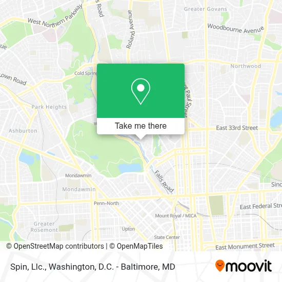
See Spin, Llc., Baltimore, on the map
Public Transit to Spin, Llc. in Baltimore
Wondering how to get to Spin, Llc. in Baltimore? Moovit helps you find the best way to get to Spin, Llc. with step-by-step directions from the nearest public transit station.
Moovit provides free maps and live directions to help you navigate through your city. View schedules, routes, timetables, and find out how long does it take to get to Spin, Llc. in real time.
Looking for the nearest stop or station to Spin, Llc.? Check out this list of stops closest to your destination: 36th St & Falls Rd FS Eb; 33rd St & Chestnut Ave Wb; Woodberry; Penn North Metro.
Bus: 21, 94.Train: NORTHEAST REGIONAL.Metro: METRO.
Want to see if there’s another route that gets you there at an earlier time? Moovit helps you find alternative routes or times. Get directions from and directions to Spin, Llc. easily from the Moovit App or Website.
We make riding to Spin, Llc. easy, which is why over 1.7 million users, including users in Baltimore, trust Moovit as the best app for public transit. You don’t need to download an individual bus app or train app, Moovit is your all-in-one transit app that helps you find the best bus time or train time available.
For information on prices of bus, train, light rail and metro, costs and ride fares to Spin, Llc., please check the Moovit app.
Use the app to navigate to popular places including to the airport, hospital, stadium, grocery store, mall, coffee shop, school, college, and university.
Spin, Llc. Address: 3100 Elm Ave street in Baltimore
- Qwrk Collective Environments,
- O2 Mold Testing Of Baltimore,
- Simpson Strong-Tie Company Inc.,
- Florence Crittenton Services,
- Vitalise Photography,
- Clipper Mill Rd MD-25,
- Ready Set Glow,
- Pyt Training,
- Studio G&M,
- Strategic Collaboration Network,
- Sportsambassadors,
- Typecast Press,
- Peter G. Dodge Foundation,
- Puptrait Pet Photography,
- Tashun Acupuncture,
- Kiddie Kulture by Nesha Llc,
- Blu Vision Photography,
- Cerebral Lounge,
- The Puptrait Studio,
- Baltimore Shiatsu And Acupuncture Center
Places Near Spin, Llc. (Baltimore)
- National Theatre, Washington,
- Pennsylvania Ave NW (3rd st and pennsylvania), Washington,
- Westfield Montgomery Mall, Montgomery County,
- Washington DC VA Medical Center, Washington,
- Sibley Memorial Hospital, Washington,
- Capital One Arena, Washington,
- National Museum of African American History and Culture, Washington,
- Camden Yards, Baltimore,
- Rock Creek Tennis Center, Washington,
- PG Mall, Prince George's County,
- Warner Theatre, Washington,
- Museum Of The Bible, Washington,
- Washington National Cathedral, Washington,
- M&T Bank Stadium, Baltimore,
- National Zoo, Washington,
- The Anthem, Washington,
- Georgetown, Washington,
- Marriott Marquis Washington, DC, Washington,
- Amazon Hq2, Arlington County,
- Basilica of the National Shrine, Washington
How to get to popular places in Washington, D.C. - Baltimore, MD with public transit
Get around Baltimore by public transit!
Traveling around Baltimore has never been so easy. See step by step directions as you travel to any attraction, street or major public transit station. View bus and train schedules, arrival times, service alerts and detailed routes on a map, so you know exactly how to get to anywhere in Baltimore.
When traveling to any destination around Baltimore use Moovit's Live Directions with Get Off Notifications to know exactly where and how far to walk, how long to wait for your line, and how many stops are left. Moovit will alert you when it's time to get off — no need to constantly re-check whether yours is the next stop.
Wondering how to use public transit in Baltimore or how to pay for public transit in Baltimore? Moovit public transit app can help you navigate your way with public transit easily, and at minimum cost. It includes public transit fees, ticket prices, and costs. Looking for a map of Baltimore public transit lines? Moovit public transit app shows all public transit maps in Baltimore with all Bus, Train, Metro, Light Rail and Ferry routes and stops on an interactive map.
Washington, D.C. - Baltimore, MD has 5 transit type(s), including: Bus, Train, Metro, Light Rail and Ferry, operated by several transit agencies, including WMATA, Montgomery County Ride On, Fairfax Connector, TheBus, PRTC, DASH - Alexandria, Arlington Transit (ART), RTA of Central Maryland, MDOT MTA, MDOT MTA Light RailLink, MDOT MTA Commuter Bus, MDOT MTA Local Bus, FXBGO!, Virginia Railway Express (VRE) and MARC