How to get to Spitting Image by bus?
Click on the bus route to see step by step directions with maps, line arrival times and updated time schedules.
How to get to Spitting Image by train?
Click on the train route to see step by step directions with maps, line arrival times and updated time schedules.
Train station near Spitting Image in Røyken
- Røyken Stasjon, 22 min walk,VIEW
Bus lines to Spitting Image in Røyken
What are the closest stations to Spitting Image?
The closest stations to Spitting Image are:
- Luftfartsverket is 156 meters away, 3 min walk.
- Grinidalen is 1173 meters away, 16 min walk.
- Røyken Stasjon is 1704 meters away, 22 min walk.
Which bus lines stop near Spitting Image?
These bus lines stop near Spitting Image: 260, 261.
Which train line stops near Spitting Image?
L1 (Spikkestad)
What’s the nearest train station to Spitting Image in Røyken?
The nearest train station to Spitting Image in Røyken is Røyken Stasjon. It’s a 22 min walk away.
What’s the nearest bus station to Spitting Image in Røyken?
The nearest bus station to Spitting Image in Røyken is Luftfartsverket. It’s a 3 min walk away.
What time is the first train to Spitting Image in Røyken?
The L1 is the first train that goes to Spitting Image in Røyken. It stops nearby at 6:16 AM.
What time is the last train to Spitting Image in Røyken?
The L1 is the last train that goes to Spitting Image in Røyken. It stops nearby at 1:10 AM.
What time is the first bus to Spitting Image in Røyken?
The 260 is the first bus that goes to Spitting Image in Røyken. It stops nearby at 6:42 AM.
What time is the last bus to Spitting Image in Røyken?
The 261 is the last bus that goes to Spitting Image in Røyken. It stops nearby at 1:01 AM.
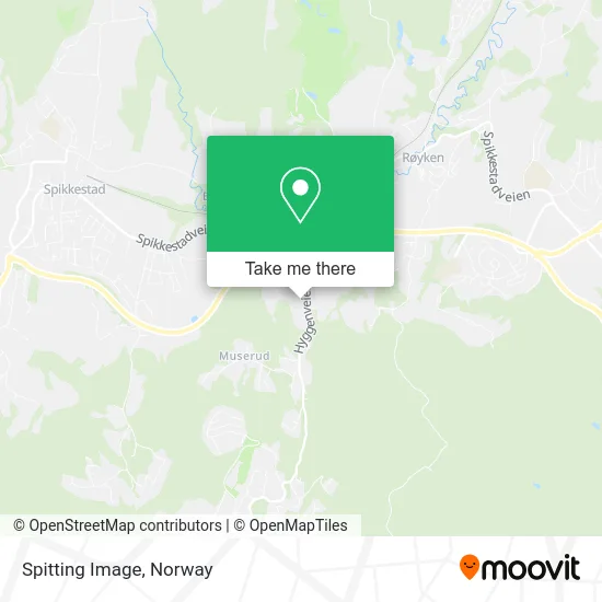
See Spitting Image, Røyken, on the map
Public Transit to Spitting Image in Røyken
Wondering how to get to Spitting Image in Røyken? Moovit helps you find the best way to get to Spitting Image with step-by-step directions from the nearest public transit station.
Moovit provides free maps and live directions to help you navigate through your city. View schedules, routes, timetables, and find out how long does it take to get to Spitting Image in real time.
Looking for the nearest stop or station to Spitting Image? Check out this list of stops closest to your destination: Luftfartsverket; Grinidalen; Røyken Stasjon.
Bus: 260, 261, 2033, 2072, 2034, 2081.Train: L1.
Want to see if there’s another route that gets you there at an earlier time? Moovit helps you find alternative routes or times. Get directions from and directions to Spitting Image easily from the Moovit App or Website.
We make riding to Spitting Image easy, which is why over 1.5 million users, including users in Røyken, trust Moovit as the best app for public transit. You don’t need to download an individual bus app or train app, Moovit is your all-in-one transit app that helps you find the best bus time or train time available.
For information on prices of bus, train and ferry, costs and ride fares to Spitting Image, please check the Moovit app.
Use the app to navigate to popular places including to the airport, hospital, stadium, grocery store, mall, coffee shop, school, college, and university.
Spitting Image Address: Hyggenveien 35 3440 Røyken street in Røyken
- Siktedukfabrikken,
- Omsorgspartner Ung AS,
- Edlandsporten AS,
- Presteskapet I Røyken,
- Auvi Industriområde,
- Reforcetech AS,
- Manifestsenteret Psykisk Lidelse og Rus,
- Oslo Kontrollsentral,
- Charlotte Wold Jørgensen,
- Bitehagen Barnehage,
- Jon Liestøl Dreieverksted,
- Bråset Bo- Og Omsorgssenter,
- Røykenbadet,
- Elisabeth Sæterdalen Hudpleier og Off Godkj Fotterapeut. - Elisabeth Sæterdalen Wiiger,
- Spikkestad Ungdomsskole,
- Røyken Barnebolig - Legevakt i Hurum og Røyken,
- Gunnar Eidhammer Psykiatrisk Sykepleie,
- Livsgnist Hilde Kollerud,
- Multiservice Svein Egil Pay,
- Klimateknikk.As
Places Near Spitting Image (Røyken)
- DFDS Seaways, Oslo,
- Ulriken, Bergen,
- Radiumhospitalet, Oslo,
- Lovisenberg Diakonale Sykehus, Oslo,
- Rikshospitalet (trikk), Oslo,
- IKEA, Bergen,
- Quality Hotel Edvard Grieg, Bergen,
- Color Line Terminal, Oslo,
- Vestby Outlet Store, Vestby,
- Jekta Storsenter, Tromsø,
- Drammen Sykehus, Drammen,
- Oslo S spor 19 (Trelastgata), Oslo,
- Bjerke Travbane, Oslo,
- Ullevål Stadion (T), Oslo,
- Tyholttårnet, Trondheim,
- Haukeland Universitetssjukehus, Bergen,
- Voldsløkka, Oslo,
- IKEA, Oslo,
- Nylandsbrua, Oslo,
- Ikea Leangen, Trondheim
How to get to popular places in Norway with public transit
Get around Røyken by public transit!
Traveling around Røyken has never been so easy. See step by step directions as you travel to any attraction, street or major public transit station. View bus and train schedules, arrival times, service alerts and detailed routes on a map, so you know exactly how to get to anywhere in Røyken.
When traveling to any destination around Røyken use Moovit's Live Directions with Get Off Notifications to know exactly where and how far to walk, how long to wait for your line, and how many stops are left. Moovit will alert you when it's time to get off — no need to constantly re-check whether yours is the next stop.
Wondering how to use public transit in Røyken or how to pay for public transit in Røyken? Moovit public transit app can help you navigate your way with public transit easily, and at minimum cost. It includes public transit fees, ticket prices, and costs. Looking for a map of Røyken public transit lines? Moovit public transit app shows all public transit maps in Røyken with all Bus, Train, Subway, Light Rail, Ferry and Cable Car routes and stops on an interactive map.
Norway has 6 transit type(s), including: Bus, Train, Subway, Light Rail, Ferry and Cable Car, operated by several transit agencies, including Ruter, Skyss, AtB, Flytoget, Vy Tåg, SJ, Go-Ahead Norge AS, SJ Nord, Vestfold Kollektivtrafikk as, Snelandia, Innlandstrafikk, FRAM, FlixBus, Kolumbus and Brakar