How to get to Spliff Nation by bus?
Click on the bus route to see step by step directions with maps, line arrival times and updated time schedules.
From Wheaton Mall, Montgomery County
65 minFrom Intelligence Community Campus—Bethesda, Montgomery County
41 minFrom Hampton Inn-Washington, Washington
42 minFrom Washington DC Temple, Montgomery County
74 minFrom Bolling AFB, Washington
141 minFrom VA Medical Center-Washington, Washington
55 minFrom DC to Rehoboth Beach, Washington
43 minFrom Washington Costco DC, Washington
84 minFrom Children's National - Main Hospital (Children's National Medical Center), Washington
57 minFrom Senate Hearing Room G50, Dirksen Building, Washington
56 min
How to get to Spliff Nation by metro?
Click on the metro route to see step by step directions with maps, line arrival times and updated time schedules.
From Wheaton Mall, Montgomery County
76 minFrom Hampton Inn-Washington, Washington
48 minFrom VA Medical Center-Washington, Washington
76 minFrom DC to Rehoboth Beach, Washington
46 minFrom Children's National - Main Hospital (Children's National Medical Center), Washington
77 minFrom Senate Hearing Room G50, Dirksen Building, Washington
53 min
Bus stops near Spliff Nation in Washington
Metro stations near Spliff Nation in Washington
Bus lines to Spliff Nation in Washington
What are the closest stations to Spliff Nation?
The closest stations to Spliff Nation are:
- Tunlaw Rd Nw+37 St NW is 174 yards away, 3 min walk.
- Wisconsin Av Nw+Calvert St NW is 289 yards away, 4 min walk.
- Rosslyn Metro Station is 2850 yards away, 34 min walk.
- Dupont Circle Metro Station is 3333 yards away, 40 min walk.
Which bus lines stop near Spliff Nation?
These bus lines stop near Spliff Nation: D80, D82, D96.
Which metro line stops near Spliff Nation?
RED (Shady Grove)
What’s the nearest bus station to Spliff Nation in Washington?
The nearest bus station to Spliff Nation in Washington is Tunlaw Rd Nw+37 St NW. It’s a 3 min walk away.
What time is the first metro to Spliff Nation in Washington?
The ORANGE is the first metro that goes to Spliff Nation in Washington. It stops nearby at 5:22 AM.
What time is the last metro to Spliff Nation in Washington?
The RED is the last metro that goes to Spliff Nation in Washington. It stops nearby at 12:17 AM.
What time is the first bus to Spliff Nation in Washington?
The D80 is the first bus that goes to Spliff Nation in Washington. It stops nearby at 3:11 AM.
What time is the last bus to Spliff Nation in Washington?
The D80 is the last bus that goes to Spliff Nation in Washington. It stops nearby at 3:16 AM.
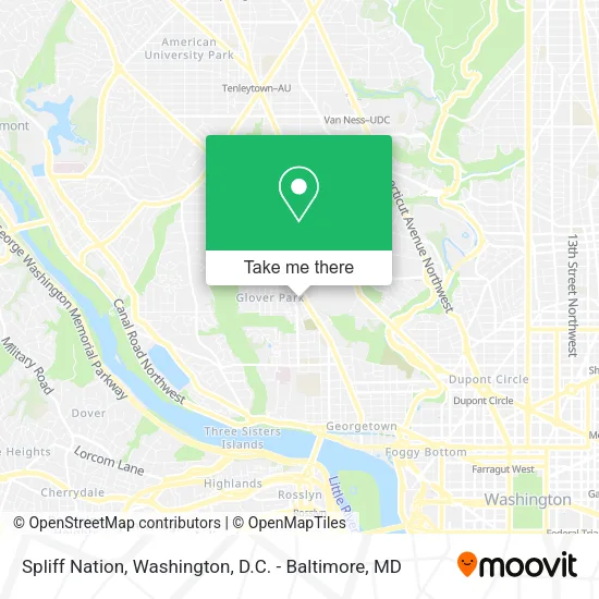
See Spliff Nation, Washington, on the map
Public Transit to Spliff Nation in Washington
Wondering how to get to Spliff Nation in Washington? Moovit helps you find the best way to get to Spliff Nation with step-by-step directions from the nearest public transit station.
Moovit provides free maps and live directions to help you navigate through your city. View schedules, routes, timetables, and find out how long does it take to get to Spliff Nation in real time.
Looking for the nearest stop or station to Spliff Nation? Check out this list of stops closest to your destination: Tunlaw Rd Nw+37 St NW; Wisconsin Av Nw+Calvert St NW; Rosslyn Metro Station; Dupont Circle Metro Station.
Bus: D80, D82, D96, C85.Metro: RED, BLUE, ORANGE, SILVER.
Want to see if there’s another route that gets you there at an earlier time? Moovit helps you find alternative routes or times. Get directions from and directions to Spliff Nation easily from the Moovit App or Website.
We make riding to Spliff Nation easy, which is why over 1.5 million users, including users in Washington, trust Moovit as the best app for public transit. You don’t need to download an individual bus app or train app, Moovit is your all-in-one transit app that helps you find the best bus time or train time available.
For information on prices of bus and metro, costs and ride fares to Spliff Nation, please check the Moovit app.
Use the app to navigate to popular places including to the airport, hospital, stadium, grocery store, mall, coffee shop, school, college, and university.
Spliff Nation Address: 2330 Wisconsin Ave NW Washington, DC 20007 street in Washington
- Dumplings & Beyond,
- Ferri.Beauty,
- Moge Tee,
- Cvs Pharmacy,
- Old Europe Restaurant,
- Marios Trattoria,
- Georgetown Plaza,
- Wingo's,
- Breadsoda DC,
- Embassy Gambia (Embassy of Gambia),
- Children's Health Center - Wisconsin Ave (Childrens Hospital),
- 31 Metrobus to Foggy Bottom Metro Station,
- Chinese Embassy Visa Section,
- Peoples Republic of Bangladesh,
- Georgetown University,
- Unity Center DC,
- Glover Park,
- Glover Park Hotel Georgetown,
- Bare Sugar & Wellness Studio,
- W St NW 37th St NW
Places Near Spliff Nation (Washington)
- National Zoo, Washington,
- Capital One Arena, Washington,
- Washington DC VA Medical Center, Washington,
- Sibley Memorial Hospital, Washington,
- The Anthem, Washington,
- PG Mall, Prince George's County,
- Amazon Hq2, Arlington County,
- Georgetown, Washington,
- Basilica of the National Shrine, Washington,
- Camden Yards, Baltimore,
- M&T Bank Stadium, Baltimore,
- Marriott Marquis Washington, DC, Washington,
- National Museum of African American History and Culture, Washington,
- Pennsylvania Ave NW (3rd st and pennsylvania), Washington,
- National Mall, Washington,
- Warner Theatre, Washington,
- Washington National Cathedral, Washington,
- Rock Creek Tennis Center, Washington,
- Westfield Montgomery Mall, Montgomery County,
- Museum Of The Bible, Washington
How to get to popular places in Washington, D.C. - Baltimore, MD with public transit
Get around Washington by public transit!
Traveling around Washington has never been so easy. See step by step directions as you travel to any attraction, street or major public transit station. View bus and train schedules, arrival times, service alerts and detailed routes on a map, so you know exactly how to get to anywhere in Washington.
When traveling to any destination around Washington use Moovit's Live Directions with Get Off Notifications to know exactly where and how far to walk, how long to wait for your line, and how many stops are left. Moovit will alert you when it's time to get off — no need to constantly re-check whether yours is the next stop.
Wondering how to use public transit in Washington or how to pay for public transit in Washington? Moovit public transit app can help you navigate your way with public transit easily, and at minimum cost. It includes public transit fees, ticket prices, and costs. Looking for a map of Washington public transit lines? Moovit public transit app shows all public transit maps in Washington with all Bus, Train, Metro, Light Rail and Ferry routes and stops on an interactive map.
Washington, D.C. - Baltimore, MD has 5 transit type(s), including: Bus, Train, Metro, Light Rail and Ferry, operated by several transit agencies, including WMATA, Montgomery County Ride On, Fairfax Connector, TheBus, PRTC, DASH - Alexandria, Arlington Transit (ART), RTA of Central Maryland, MDOT MTA, MDOT MTA Light RailLink, MDOT MTA Commuter Bus, MDOT MTA Local Bus, FXBGO!, Virginia Railway Express (VRE) and MARC