How to get to Spring Food Market by bus?
Click on the bus route to see step by step directions with maps, line arrival times and updated time schedules.
From Port of Baltimore - Cruise Maryland Terminal, Baltimore
67 minFrom Walmart, Baltimore County
64 minFrom I-695 @ Exit 27 (Dulaney Valley Road/MD 146), Baltimore County
47 minFrom Walmart Supercenter, Baltimore County
64 minFrom I-695 @ Exit 17 (Security Blvd/MD 122), Baltimore County
60 minFrom Baltimore Convention Center, Baltimore
35 minFrom Towson, MD, Baltimore County
35 minFrom Towson Town Center, Baltimore County
38 minFrom Canton, Baltimore
67 minFrom Pier Six Pavilion, Baltimore
42 min
How to get to Spring Food Market by metro?
Click on the metro route to see step by step directions with maps, line arrival times and updated time schedules.
Bus stops near Spring Food Market in Baltimore
Light Rail stations near Spring Food Market in Baltimore
- Cold Spring Lane, 26 min walk,VIEW
Metro station near Spring Food Market in Baltimore
- West Cold Spring Metro, 26 min walk,VIEW
Bus lines to Spring Food Market in Baltimore
What are the closest stations to Spring Food Market?
The closest stations to Spring Food Market are:
- Cold Spring Ln & Park Heights Ave FS Wb is 48 yards away, 1 min walk.
- Park Heights Ave & Cold Spring Ln Sb is 126 yards away, 2 min walk.
- Reisterstown Rd & Cold Spring Ln Sb is 140 yards away, 2 min walk.
- Cold Spring Lane is 2200 yards away, 26 min walk.
- West Cold Spring Metro is 2205 yards away, 26 min walk.
Which bus lines stop near Spring Food Market?
These bus lines stop near Spring Food Market: 28, 83, 85.
Which metro line stops near Spring Food Market?
METRO (Towards Owing Mills)
What’s the nearest light rail station to Spring Food Market in Baltimore?
The nearest light rail station to Spring Food Market in Baltimore is Cold Spring Lane. It’s a 26 min walk away.
What’s the nearest metro station to Spring Food Market in Baltimore?
The nearest metro station to Spring Food Market in Baltimore is West Cold Spring Metro. It’s a 26 min walk away.
What’s the nearest bus station to Spring Food Market in Baltimore?
The nearest bus station to Spring Food Market in Baltimore is Cold Spring Ln & Park Heights Ave FS Wb. It’s a 1 min walk away.
What time is the first light rail to Spring Food Market in Baltimore?
The LIGHT RAILLINK is the first light rail that goes to Spring Food Market in Baltimore. It stops nearby at 4:26 AM.
What time is the last light rail to Spring Food Market in Baltimore?
The LIGHT RAILLINK is the last light rail that goes to Spring Food Market in Baltimore. It stops nearby at 12:47 AM.
What time is the first metro to Spring Food Market in Baltimore?
The METRO is the first metro that goes to Spring Food Market in Baltimore. It stops nearby at 4:56 AM.
What time is the last metro to Spring Food Market in Baltimore?
The METRO is the last metro that goes to Spring Food Market in Baltimore. It stops nearby at 12:19 AM.
What time is the first bus to Spring Food Market in Baltimore?
The 83 is the first bus that goes to Spring Food Market in Baltimore. It stops nearby at 4:04 AM.
What time is the last bus to Spring Food Market in Baltimore?
The 85 is the last bus that goes to Spring Food Market in Baltimore. It stops nearby at 2:15 AM.
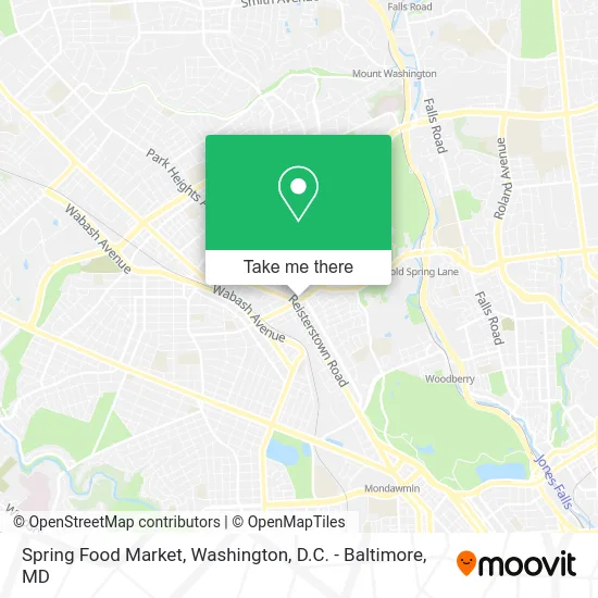
See Spring Food Market, Baltimore, on the map
Public Transit to Spring Food Market in Baltimore
Wondering how to get to Spring Food Market in Baltimore? Moovit helps you find the best way to get to Spring Food Market with step-by-step directions from the nearest public transit station.
Moovit provides free maps and live directions to help you navigate through your city. View schedules, routes, timetables, and find out how long does it take to get to Spring Food Market in real time.
Looking for the nearest stop or station to Spring Food Market? Check out this list of stops closest to your destination: Cold Spring Ln & Park Heights Ave FS Wb; Park Heights Ave & Cold Spring Ln Sb; Reisterstown Rd & Cold Spring Ln Sb; Cold Spring Lane; West Cold Spring Metro.
Bus: 28, 83, 85.Metro: METRO.
Want to see if there’s another route that gets you there at an earlier time? Moovit helps you find alternative routes or times. Get directions from and directions to Spring Food Market easily from the Moovit App or Website.
We make riding to Spring Food Market easy, which is why over 1.5 million users, including users in Baltimore, trust Moovit as the best app for public transit. You don’t need to download an individual bus app or train app, Moovit is your all-in-one transit app that helps you find the best bus time or train time available.
For information on prices of bus and metro, costs and ride fares to Spring Food Market, please check the Moovit app.
Use the app to navigate to popular places including to the airport, hospital, stadium, grocery store, mall, coffee shop, school, college, and university.
Spring Food Market Address: 2700 W Cold Spring Ln Baltimore, MD 21215 street in Baltimore
- Big Tymers Communications,
- Metro by T-Mobile,
- Amazon Locker-Fidele,
- King Crab ATL,
- Go Green Carpet Cleaners Carpet Cleaning,
- Libertyx Bitcoin ATM,
- Park Mini Mart,
- Mr D's Hookups,
- Park Heights Ave (cold spring lane and park heights),
- Park Heights Ave and Cold Spring,
- Park Heights W Cold Spring Ln,
- Baltimore Physical Therapy & Wellness,
- Icwc Catering Services,
- Dollar Shop,
- Ole Mexican Foods,
- Family Dollar,
- Baltimore Physical Therapy Pain Management,
- Park Heights Medical Clinic,
- Wylie Reisterstown Rd,
- ATM
Places Near Spring Food Market (Baltimore)
- Warner Theatre, Washington,
- Sibley Memorial Hospital, Washington,
- Rock Creek Tennis Center, Washington,
- Amazon Hq2, Arlington County,
- Westfield Montgomery Mall, Montgomery County,
- Washington National Cathedral, Washington,
- Pennsylvania Ave NW (3rd st and pennsylvania), Washington,
- Capital One Arena, Washington,
- Museum Of The Bible, Washington,
- National Theatre, Washington,
- PG Mall, Prince George's County,
- Basilica of the National Shrine, Washington,
- National Zoo, Washington,
- Marriott Marquis Washington, DC, Washington,
- Camden Yards, Baltimore,
- The Anthem, Washington,
- Washington DC VA Medical Center, Washington,
- M&T Bank Stadium, Baltimore,
- National Museum of African American History and Culture, Washington,
- Georgetown, Washington
How to get to popular places in Washington, D.C. - Baltimore, MD with public transit
Get around Baltimore by public transit!
Traveling around Baltimore has never been so easy. See step by step directions as you travel to any attraction, street or major public transit station. View bus and train schedules, arrival times, service alerts and detailed routes on a map, so you know exactly how to get to anywhere in Baltimore.
When traveling to any destination around Baltimore use Moovit's Live Directions with Get Off Notifications to know exactly where and how far to walk, how long to wait for your line, and how many stops are left. Moovit will alert you when it's time to get off — no need to constantly re-check whether yours is the next stop.
Wondering how to use public transit in Baltimore or how to pay for public transit in Baltimore? Moovit public transit app can help you navigate your way with public transit easily, and at minimum cost. It includes public transit fees, ticket prices, and costs. Looking for a map of Baltimore public transit lines? Moovit public transit app shows all public transit maps in Baltimore with all Bus, Train, Metro, Light Rail and Ferry routes and stops on an interactive map.
Washington, D.C. - Baltimore, MD has 5 transit type(s), including: Bus, Train, Metro, Light Rail and Ferry, operated by several transit agencies, including WMATA, Montgomery County Ride On, Fairfax Connector, TheBus, PRTC, DASH - Alexandria, Arlington Transit (ART), RTA of Central Maryland, MDOT MTA, MDOT MTA Light RailLink, MDOT MTA Commuter Bus, MDOT MTA Local Bus, FXBGO!, Virginia Railway Express (VRE) and MARC